Southwood, Indiana | |
---|---|
Coordinates: 39°24′11″N87°24′06″W / 39.40306°N 87.40167°W Coordinates: 39°24′11″N87°24′06″W / 39.40306°N 87.40167°W | |
Country | United States |
State | Indiana |
County | Vigo |
Township | Honey Creek |
Elevation | 495 ft (151 m) |
Time zone | UTC-5 (Eastern (EST)) |
• Summer (DST) | UTC-4 (EDT) |
ZIP code | 47802 |
Area code(s) | 812, 930 |
GNIS feature ID | 443897 |
Southwood is an unincorporated community in Honey Creek Township, Vigo County, in the U.S. state of Indiana. [2]
It is part of the Terre Haute metropolitan area.
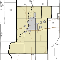
Southwood is located at 39°24′11″N87°24′06″W / 39.40306°N 87.40167°W at an elevation of 495 feet.
Centenary is an unincorporated community in Clinton Township, Vermillion County, in the U.S. state of Indiana.
Florida Township is one of thirteen townships in Parke County, Indiana, United States. As of the 2010 census, its population was 2,378 and it contained 1,073 housing units.
Liberty Township is one of thirteen townships in Parke County, Indiana, United States. As of the 2010 census, its population was 739 and it contained 324 housing units.
Cobb is an unincorporated community in northern Nevins Township, Vigo County, in the U.S. state of Indiana.
Hutton is an unincorporated community in northern Prairie Creek Township, Vigo County, in the U.S. state of Indiana.
Markles is an unincorporated community in southern Otter Creek Township, Vigo County, in the U.S. state of Indiana. Within the boundaries of Terre Haute, it is also part of the Terre Haute metropolitan area.
Pine Ridge is an unincorporated community in Fayette Township, Vigo County, in the U.S. state of Indiana. It is part of the Terre Haute metropolitan area.
Spring Hill is an unincorporated community in Honey Creek Township, Vigo County, in the U.S. state of Indiana.
Swalls is an unincorporated community in Lost Creek Township, Vigo County, in the U.S. state of Indiana. It is part of the Terre Haute metropolitan area.
Preston is an unincorporated community in Harrison Township, Vigo County, in the U.S. state of Indiana.
Benefiel Corner is an unincorporated community in Hamilton Township, Sullivan County, in the U.S. state of Indiana.
Grange Corner is an unincorporated community in Sugar Creek Township, Parke County, in the U.S. state of Indiana.
Jessup or Jessups Station is an unincorporated community in Florida Township, Parke County, in the U.S. state of Indiana.
Denmark is an unincorporated community in the southwest portion of Marion Township, Owen County, in the U.S. state of Indiana. It lies near the intersection of County Road 1400 West and County Road 150 South, which is a community about fifteen miles west of the city of Spencer, the county seat of Owen County. Its elevation is 722 feet, and it is located at 39°16′11″N87°1′33″W.
Hubbell is an unincorporated community in the southwestern corner of Jefferson Township, Owen County, in the U.S. state of Indiana. It lies near the intersection of County Road 750 South and Indiana Highway 157, which is a community nearly twenty miles southwest of the city of Spencer, the county seat. Its elevation is 528 feet, and it is located at 39°10′59″N87°0′44″W. This community is also known as Hubbells Station.
Syria is an unincorporated community in Paoli Township, Orange County, in the U.S. state of Indiana.
Smithville is an unincorporated community in the northwest corner of Marion Township, Owen County, in the U.S. state of Indiana. It lies near the intersection of County Road 200 North and County Road 1400 West, which is a community about fifteen miles west of the city of Spencer, the county seat. Its elevation is 591 feet, and it is located at 39°19′15″N87°1′33″W.
Needmore is an unincorporated community in Clinton Township, Vermillion County, in the U.S. state of Indiana.
Rosebud is an unincorporated community in Greer Township, Warrick County, in the U.S. state of Indiana.