Larimer Hill, Indiana

Last updated

Larimer Hill, Indiana
Map of Indiana highlighting Vigo County.svg
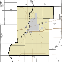
Vigo County's location in Indiana
Map of Vigo County Indiana Townships.svg
Red pog.svg
Larimer Hill
location in Vigo County, Indiana
Coordinates: 39°27′20″N87°28′19″W / 39.45556°N 87.47194°W / 39.45556; -87.47194
Country United States
State Indiana
County Vigo
Township Sugar Creek
Elevation
[1]
548 ft (167 m)
Time zone UTC-5 (Eastern (EST))
  Summer (DST) UTC-4 (EDT)
ZIP code
47885
Area code(s) 812, 930
GNIS feature ID 437632

Larimer Hill is an unincorporated community in Sugar Creek Township, Vigo County, in the U.S. state of Indiana. [2]

Contents

It is part of the Terre Haute metropolitan area.
History

The community was named after the Larimer family of settlers. [3]

Geography

Larimer Hill is located at 39°27′20″N87°28′19″W / 39.45556°N 87.47194°W / 39.45556; -87.47194 at an elevation of 548 feet.

Related Research Articles

<span class="mw-page-title-main">Hillsdale, Indiana</span> Unincorporated community in Indiana, United States

Hillsdale is an unincorporated community in Helt Township, Vermillion County, in the U.S. state of Indiana.

<span class="mw-page-title-main">Randall, Indiana</span> Ghost town in Indiana, United States

Randall is a former town in Helt Township, Vermillion County, in the U.S. state of Indiana. Randall is also 1.6 miles northwest of another extinct town: Toronto, on W County Road 700 S. The nearest extant community is the town of Dana, to the northeast.

<span class="mw-page-title-main">Jackson Hill, Indiana</span> Unincorporated community in Indiana, United States

Jackson Hill is an unincorporated community in Hamilton Township, Sullivan County, in the U.S. state of Indiana.

<span class="mw-page-title-main">Whitcomb Heights, Indiana</span> Unincorporated community in Indiana, United States

Whitcomb Heights is an unincorporated community in Sugar Creek Township, Vigo County, in the U.S. state of Indiana. It is officially part of West Terre Haute, Indiana. Whitcomb Heights is part of the Terre Haute metropolitan area.

<span class="mw-page-title-main">Ferguson Hill, Indiana</span> Unincorporated community in Indiana, United States

Ferguson Hill is an unincorporated community in Sugar Creek Township, Vigo County, in the U.S. state of Indiana.

<span class="mw-page-title-main">Glenn Ayr, Indiana</span> Unincorporated community in Indiana, United States

Glenn Ayr or Glenn Ayre is an unincorporated community in central Lost Creek Township, Vigo County, in the U.S. state of Indiana.

<span class="mw-page-title-main">Hutton, Indiana</span> Unincorporated community in Indiana, United States

Hutton is an unincorporated community in northern Prairie Creek Township, Vigo County, in the U.S. state of Indiana.

<span class="mw-page-title-main">Liggett, Indiana</span> Unincorporated community in Indiana, United States

Liggett is an unincorporated community in Sugar Creek Township, Vigo County, in the U.S. state of Indiana.

<span class="mw-page-title-main">Spring Hill, Vigo County, Indiana</span> Unincorporated community in Indiana, United States

Spring Hill is an unincorporated community in Honey Creek Township, Vigo County, in the U.S. state of Indiana.

<span class="mw-page-title-main">Benefiel Corner, Indiana</span> Unincorporated community in Indiana, United States

Benefiel Corner is an unincorporated community in Hamilton Township, Sullivan County, in the U.S. state of Indiana.

Cottage Hill is an unincorporated community in Posey Township, Clay County, Indiana. It is part of the Terre Haute Metropolitan Statistical Area.

Purdy Hill is an unincorporated community in Posey Township, Clay County, Indiana. It is part of the Terre Haute Metropolitan Statistical Area.

<span class="mw-page-title-main">Snow Hill, Parke County, Indiana</span> Unincorporated community in Indiana, United States

Snow Hill is an unincorporated community in Raccoon Township, Parke County, in the U.S. state of Indiana.

Denmark is an unincorporated community in the southwest portion of Marion Township, Owen County, in the U.S. state of Indiana. It lies near the intersection of County Road 1400 West and County Road 150 South, which is a community about fifteen miles west of the city of Spencer, the county seat of Owen County. Its elevation is 722 feet, and it is located at 39°16′11″N87°1′33″W.

Hubbell is an unincorporated community in the southwestern corner of Jefferson Township, Owen County, in the U.S. state of Indiana. It lies near the intersection of County Road 750 South and Indiana Highway 157, which is a community nearly twenty miles southwest of the city of Spencer, the county seat. Its elevation is 528 feet, and it is located at 39°10′59″N87°0′44″W. This community is also known as Hubbells Station.

Smithville is an unincorporated community in the northwest corner of Marion Township, Owen County, in the U.S. state of Indiana. It lies near the intersection of County Road 200 North and County Road 1400 West, which is a community about fifteen miles west of the city of Spencer, the county seat. Its elevation is 591 feet, and it is located at 39°19′15″N87°1′33″W.

<span class="mw-page-title-main">Piattsville, Indiana</span> Unincorporated community in Indiana, United States

Piattsville is an unincorporated community in Adams Township, Parke County, in the U.S. state of Indiana.

<span class="mw-page-title-main">Crompton Hill, Indiana</span> Unincorporated community in Indiana, United States

Crompton Hill is an unincorporated community in Clinton Township, Vermillion County, in the U.S. state of Indiana.

<span class="mw-page-title-main">Lusks Mills, Indiana</span> Unincorporated community in Indiana, United States

Lusks Mills is an unincorporated community in Sugar Creek Township, Parke County, in the U.S. state of Indiana.

<span class="mw-page-title-main">Gravel Hill, Indiana</span> Unincorporated community in Indiana, United States

Gravel Hill is an unincorporated community in Center Township, Benton County, in the U.S. state of Indiana.

References

  1. "US Board on Geographic Names". United States Geological Survey. October 25, 2007. Retrieved July 14, 2016.
  2. "Larimer Hill, Indiana". Geographic Names Information System . United States Geological Survey . Retrieved August 7, 2017.
  3. Baker, Ronald L. (October 1995). From Needmore to Prosperity: Hoosier Place Names in Folklore and History . Indiana University Press. p.  192. ISBN   978-0-253-32866-3. This village was named for a local family...