Sandcut, Indiana

Last updated

Sandcut, Indiana
Nickname: 
Meltonville
Map of Indiana highlighting Vigo County.svg
Vigo County's location in Indiana
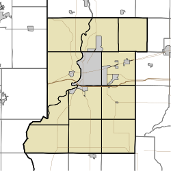
Map of Vigo County Indiana Townships.svg
Red pog.svg
Sandcut
location in Vigo County, Indiana
Coordinates: 39°33′53″N87°19′25″W / 39.56472°N 87.32361°W / 39.56472; -87.32361
Country United States
State Indiana
County Vigo
Township Otter Creek
Elevation
[1]
525 ft (160 m)
Time zone UTC-5 (Eastern (EST))
  Summer (DST) UTC-4 (EDT)
ZIP code
47805
Area code(s) 812, 930
GNIS feature ID 442993

Sandcut is an unincorporated community in Otter Creek Township, Vigo County, in the U.S. state of Indiana. [2] It is part of the Terre Haute metropolitan area. Little Gundy Creek flows on the southeastern side of Sandcut. Sandcut also has a volunteer fire department.
Contents

History

Sandcut was founded in 1927, and was so named because of its sandy soil. [3]

Geography

Sandcut is located at the intersection of Rio Grande Avenue and Rosedale Road, at 39°33′53″N87°19′25″W / 39.56472°N 87.32361°W / 39.56472; -87.32361 .

Related Research Articles

<span class="mw-page-title-main">Burnett, Indiana</span> Unincorporated community in Indiana, United States

Burnett is an unincorporated community in Otter Creek Township, Vigo County, in the U.S. state of Indiana.

<span class="mw-page-title-main">Bono, Vermillion County, Indiana</span> Unincorporated community in Indiana, United States

Bono is an unincorporated community in Helt Township, Vermillion County, in the U.S. state of Indiana.

<span class="mw-page-title-main">Barnhart Town, Indiana</span> Unincorporated community in Indiana, United States

Barnhart Town is an unincorporated community in Sugar Creek Township, Vigo County, in the U.S. state of Indiana.

<span class="mw-page-title-main">Gospel Grove, Indiana</span> Unincorporated community in Indiana, United States

Gospel Grove is an unincorporated community in central Lost Creek Township, Vigo County, in the U.S. state of Indiana.

<span class="mw-page-title-main">Hutton, Indiana</span> Unincorporated community in Indiana, United States

Hutton is an unincorporated community in northern Prairie Creek Township, Vigo County, in the U.S. state of Indiana.

<span class="mw-page-title-main">Liggett, Indiana</span> Unincorporated community in Indiana, United States

Liggett is an unincorporated community in Sugar Creek Township, Vigo County, in the U.S. state of Indiana.

<span class="mw-page-title-main">Marion Heights, Indiana</span> Unincorporated community in Indiana, United States

Marion Heights is an unincorporated community in northern Sugar Creek Township, Vigo County, in the U.S. state of Indiana.

<span class="mw-page-title-main">Markles, Indiana</span> Unincorporated community in Indiana, United States

Markles is an unincorporated community in southern Otter Creek Township, Vigo County, in the U.S. state of Indiana. Within the boundaries of Terre Haute, it is also part of the Terre Haute metropolitan area.

<span class="mw-page-title-main">Otter Creek Junction, Indiana</span> Unincorporated community in Indiana, United States

Otter Creek Junction is an unincorporated community in Otter Creek Township, Vigo County, in the U.S. state of Indiana.

<span class="mw-page-title-main">Southwood, Indiana</span> Unincorporated community in Indiana, United States

Southwood is an unincorporated community in Honey Creek Township, Vigo County, in the U.S. state of Indiana.

<span class="mw-page-title-main">Spring Hill, Vigo County, Indiana</span> Unincorporated community in Indiana, United States

Spring Hill is an unincorporated community in Honey Creek Township, Vigo County, in the U.S. state of Indiana.

<span class="mw-page-title-main">State Line, Vigo County, Indiana</span> Unincorporated community in Indiana, United States

State Line is an unincorporated community in western Sugar Creek Township, Vigo County, in the U.S. state of Indiana.

<span class="mw-page-title-main">Swalls, Indiana</span> Unincorporated community in Indiana, United States

Swalls is an unincorporated community in Lost Creek Township, Vigo County, in the U.S. state of Indiana. It is part of the Terre Haute metropolitan area.

<span class="mw-page-title-main">Woodgate, Indiana</span> Unincorporated community in Indiana, United States

Woodgate is an unincorporated community in central Honey Creek Township, Vigo County, in the U.S. state of Indiana.

<span class="mw-page-title-main">Tabertown, Indiana</span> Unincorporated community in Indiana, United States

Tabertown is an unincorporated community in Lost Creek Township, Vigo County, in the U.S. state of Indiana.

<span class="mw-page-title-main">Grange Corner, Parke County, Indiana</span> Unincorporated community in Indiana, United States

Grange Corner is an unincorporated community in Sugar Creek Township, Parke County, in the U.S. state of Indiana.

<span class="mw-page-title-main">Alma Lake, Indiana</span> Unincorporated community in Indiana, United States

Alma Lake is an unincorporated community in southeastern Jackson Township, Parke County, in the U.S. state of Indiana.

Denmark is an unincorporated community in the southwest portion of Marion Township, Owen County, in the U.S. state of Indiana. It lies near the intersection of County Road 1400 West and County Road 150 South, which is a community about fifteen miles west of the city of Spencer, the county seat of Owen County. Its elevation is 722 feet, and it is located at 39°16′11″N87°1′33″W.

Hubbell is an unincorporated community in the southwestern corner of Jefferson Township, Owen County, in the U.S. state of Indiana. It lies near the intersection of County Road 750 South and Indiana Highway 157, which is a community nearly twenty miles southwest of the city of Spencer, the county seat. Its elevation is 528 feet, and it is located at 39°10′59″N87°0′44″W. This community is also known as Hubbells Station.

<span class="mw-page-title-main">Sandytown, Indiana</span> Unincorporated community in Indiana, United States

Sandytown is an unincorporated community in Clinton Township, Vermillion County, in the U.S. state of Indiana.

References

  1. "US Board on Geographic Names". United States Geological Survey. October 25, 2007. Retrieved July 14, 2016.
  2. "Sandcut, Indiana". Geographic Names Information System . United States Geological Survey . Retrieved August 6, 2017.
  3. Baker, Ronald L. (October 1995). From Needmore to Prosperity: Hoosier Place Names in Folklore and History . Indiana University Press. p.  293. ISBN   978-0-253-32866-3. ...founded about 1927 and apparently named for sandy soil...