Harry Evans Covered Bridge

Last updated

Harry Evans Covered Bridge
HarryEvansCoveredBridge.jpg
Harry Evans Covered Bridge
Coordinates 39°39′43.62″N87°17′40.07″W / 39.6621167°N 87.2944639°W / 39.6621167; -87.2944639
CarriesC.R. 325W
CrossesRock Run (Indiana)
Locale Florida Township, Indiana, Parke, Indiana, United States
Official nameHarry Evans Covered Bridge
Named for Harry Evans
Maintained byParke County Commissioners
Parke County
WGCB # 14-61-10 [1]
Characteristics
Design Burr arch truss bridge [2]
MaterialConcrete (foundations)
Trough constructionWood
Total length81 ft (24.7 m) (includeds 8 ft (2.4 m) overhangs on each end)
Width16 ft (4.9 m)
Longest span65 ft (19.8 m)
No. of spans1
Load limit6 short tons (5.4 t; 12,000 lb)
Clearance above 13 ft (4.0 m)
Harry Evans Covered Bridge (#19)
Locator map of Parke County, Indiana.svg
Red pog.svg
Location of Harry Evans Covered Bridge
USA Indiana location map.svg
Red pog.svg
Location of Harry Evans Covered Bridge
Usa edcp location map.svg
Red pog.svg
Location of Harry Evans Covered Bridge
Built1908 (1908)
Built by Joseph A. Britton
Website Harry Evans Bridge
Part ofParke County Covered Bridges TR (ID64000193)
NRHP reference No. 78000392 [3]
Added to NRHPDecember 22, 1978
Location
Harry Evans Covered Bridge

The Harry Evans Covered Bridge is a single span Burr Arch Truss structure that crosses Rock Run built in 1908 by J.A. Britton 12 mi (0.80 km) north of Coxville, Indiana [4] USA.

Contents

History

The story goes that one of the former neighbors of the bridge was incensed over naming the bridge after a local resident, Harry Evans. He claimed that because Harry lived at the top of the hill that it was named after another Evans who lived in the valley. However, county records show that Harry Evans owned the land near the bridge. The land stayed in the Evans name until the 1960s. [5]

It was added to the National Register of Historic Places in 1978. [3] The hills near the bridge are riddled with numerous, and dangerous, old coal mines. [4]

See also

Related Research Articles

<span class="mw-page-title-main">Mansfield Covered Bridge</span> Bridge in Indiana, United States

The Mansfield Covered Bridge is a Double Burr Arch double span truss bridge located on Mansfield Road (historic) and Big Raccoon Creek in Mansfield southeast of Rockville in Parke County, Indiana. Built by Joseph J. Daniels in 1867 at a cost of $12,200. At 279 ft (85 m) it is the second longest covered bridge left in Parke County. This Historic Site rest on land provided by Indiana DNR, of Parke County, Indiana and is open to the public all year.

<span class="mw-page-title-main">Big Rocky Fork Covered Bridge</span> Place in Indiana listed on National Register of Historic Places

The Big Rocky Fork Covered Bridge is located 1 mile (1.6 km) southeast of Mansfield, Indiana, on County Road 720 and about 2 miles (3.2 km) east of State Road 59, in Parke County.

<span class="mw-page-title-main">Conley's Ford Covered Bridge</span> Bridge in Parke County, Indiana

Conley's Ford Covered Bridge was built in 1906 and crosses Big Raccoon Creek on County Road 550 East close to County Road 720 South, in Parke County, IN. The bridge is a single span Burr Arch Truss structure. The Conley's Ford Covered Bridge was built by J. Lawrence Van Fossen.

<span class="mw-page-title-main">Crooks Covered Bridge</span> Bridge in Parke County, Indiana

The Crooks Covered Bridge is a single span Burr Arch Truss structure that crosses Little Raccoon Creek built in 1855-1856 by Henry Wolf just southeast of Rockville, Indiana.
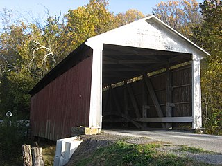
<span class="mw-page-title-main">Billie Creek Covered Bridge</span> Bridge in Parke County, Indiana

The Billie Creek Covered Bridge is a Burr Arch structure that was built by Joseph J. Daniels in 1895. J.L. Van Fossen supplied the sandstone that makes up the abutments cut from A.E. Fuel's nearby quarry.

<span class="mw-page-title-main">McAllister Covered Bridge</span> Registered Historic Place in Indiana, U.S.

The McAllister Covered Bridge is a Burr Arch structure that was built by Joseph A. Britton and Son in 1914. It is 144 feet (44 m) long, 16 feet (4.9 m) wide, and 14 feet (4.3 m) high. It is found in Adams Township, Parke County, Indiana, United States.

<span class="mw-page-title-main">Bowsher Ford Covered Bridge</span> Bridge in Parke County, Indiana

The Bowsher Ford Covered Bridge is a single span Burr Arch truss covered bridge structure that was built by J.A. Britton's son, Eugene Britton, in 1915.

<span class="mw-page-title-main">Catlin Covered Bridge</span> Bridge in Parke County, Indiana

The Catlin Covered Bridge is a single span Burr Arch truss covered bridge structure that was built by Clark McDaniel in 1907.

<span class="mw-page-title-main">Cox Ford Covered Bridge</span> Bridge in Indiana, United States

The Cox Ford Covered Bridge is a covered bridge that crosses Sugar Creek along the western edge of Turkey Run State Park, in Parke County, in the U.S. state of Indiana.

<span class="mw-page-title-main">Jackson Covered Bridge</span> Place in Indiana listed on National Register of Historic Places

The Jackson Covered Bridge also known as the Rockport Covered Bridge is located in the 'forgotten town' of Rockport, northwest of Bloomingdale, Parke County, Indiana, USA.

<span class="mw-page-title-main">Leatherwood Station Covered Bridge</span> Place in Indiana listed on National Register of Historic Places

The Leatherwood Station Covered Bridge is a single span double Burr Arch Truss covered bridge structure that was built by Joseph A. Britton & Son in 1899. Originally it had sandstone abutments but when it was moved to Billie Creek Village they were replaced with concrete abutments with sandstone showing.

<span class="mw-page-title-main">Marshall Covered Bridge</span> Bridge in Liberty, Indiana

The Marshall Covered Bridge is a single span Burr arch truss covered bridge structure that was built by Joseph A. Britton & Son in 1917. The bridge is 74 ft (23 m) long, 15 ft (4.6 m) wide, and 14 ft (4.3 m) high.

<span class="mw-page-title-main">Mecca Covered Bridge</span> Place in Indiana listed on National Register of Historic Places

The Mecca Covered Bridge crossing Big Raccoon Creek East of Mecca, Indiana is a single span Burr Arch Truss covered bridge structure that was built by J. J. Daniels in 1873. The bridge is 176 feet (54 m) long, 17 feet (5.2 m) wide, and 12.5 feet (3.8 m) high.
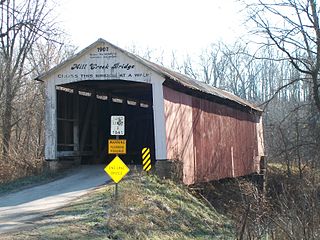
<span class="mw-page-title-main">Mill Creek Covered Bridge</span> Place in Indiana listed on National Register of Historic Places

The Mill Creek Covered Bridge also known as "Thompson's Ford Covered Bridge," "Tow Path Covered Bridge," or "Earl Ray Covered Bridge" crosses Wabash Mill Creek (historic) southwest of Tangier, Indiana. It is a single span Burr Arch Truss covered bridge structure that was built by D. M. Brown in 1907.
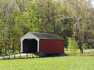
<span class="mw-page-title-main">Phillips Covered Bridge</span> Place in Indiana listed on National Register of Historic Places

The Phillips Covered Bridge is southeast of Montezuma, Indiana in Parke County, Indiana and crosses Rocky Run, also known as Big Pond Creek. Unlike the rest of the bridges of Parke County, it is a single span King Post bridge structure, having no arches, that was built by Joseph A. Britton in 1909.

<span class="mw-page-title-main">Rush Creek Covered Bridge</span> Place in Indiana listed on National Register of Historic Places

The Rush Creek Covered Bridge is south of Tangier, Indiana. The single span Burr Arch covered bridge structure was built by William Hendricks in 1904.

<span class="mw-page-title-main">Sanitorium Covered Bridge</span> Place in Indiana listed on National Register of Historic Places

The Sanitorium Covered Bridge is a bridged located east of Rockville, Indiana. The single-span Burr Arch covered bridge structure was built by Joseph A. Britton in 1913.

<span class="mw-page-title-main">Sim Smith Covered Bridge</span> Place in Indiana listed on National Register of Historic Places

The Sim Smith Covered Bridge is east of Montezuma, Indiana. The single span Burr Truss covered bridge structure was built by Joseph A. Britton in 1883. The bridge is 101 feet (31 m) long, 16 feet (4.9 m) wide, and 14 feet (4.3 m) high.

<span class="mw-page-title-main">Thorpe Ford Covered Bridge</span> Place in Indiana listed on National Register of Historic Places

The Thorpe Ford Covered Bridge is northeast of Rosedale, Indiana. The single span Burr Arch Truss covered bridge structure was built by Joseph A. Britton in 1912.
<span class="mw-page-title-main">Zacke Cox Covered Bridge</span> Place in Indiana listed on National Register of Historic Places

The Zacke Cox Covered Bridge is east of Mecca, Indiana. The single span Burr Arch Truss covered bridge structure was built by Joseph A. Britton in 1908.

References

  1. "The Harry Evans Bridge". Indiana Covered Bridge Society. Retrieved July 1, 2021.
  2. "Harry Evans Covered Bridge (#19)". Parke County Convention & Visitors Commission. Retrieved November 25, 2019.
  3. 1 2 "National Register Information System  Harry Evans Bridge (#19) (#78000392)". National Register of Historic Places . National Park Service. January 23, 2007. Retrieved November 25, 2019.
  4. 1 2 "Harry Evans Covered Bridge (#19)". coveredbridges.com. Parke County Incorporated /Parke County Convention and Visitors Commission. Retrieved November 25, 2019.
  5. "Indiana State Historic Architectural and Archaeological Research Database" (Searchable database). Department of Natural Resources, Division of Historic Preservation and Archaeology. Retrieved June 1, 2016.Note: This includes Charles Felkner (December 1977). "National Register of Historic Places Inventory Nomination Form: Parke County Covered Bridge Historic District" (PDF). Retrieved June 1, 2016., Site map, and accompanying photographs.