Wabash Township, Parke County, Indiana

Last updated

Wabash Township
Map highlighting Wabash Township, Parke County, Indiana.svg
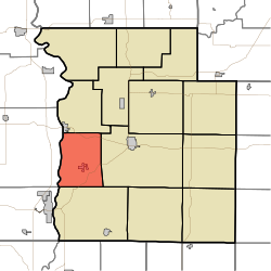
Location in Parke County
Coordinates: 39°43′56″N87°20′00″W / 39.73222°N 87.33333°W / 39.73222; -87.33333
Country Flag of the United States.svg  United States
State Flag of Indiana.svg  Indiana
County Parke
Government
  Type Indiana township
Area
  Total27.79 sq mi (72.0 km2)
  Land27.49 sq mi (71.2 km2)
  Water0.3 sq mi (0.8 km2)  1.08%
Elevation
[1]
620 ft (189 m)
Population
 (2010)
  Total818
  Density29.8/sq mi (11.5/km2)
Time zone UTC-5 (Eastern (EST))
  Summer (DST) UTC-4 (EDT)
ZIP codes
47860, 47862, 47872
Area code 765
GNIS feature ID 453966

Wabash Township is one of thirteen townships in Parke County, Indiana, United States. As of the 2010 census, its population was 818 and it contained 353 housing units. [2]

Contents

History

When General William Henry Harrison took an army from Vincennes to the Battle of Tippecanoe in late 1811, Zachariah Cicott served as a scout. Cicott was familiar with the area because of his time trading up and down the Wabash River starting circa 1801. The trail taken by Harrison's army passed through the area that later became Parke County on its way to and from the battle site in Tippecanoe County. The settlement of Armiesburg was so named because Harrison and his army crossed the Raccoon Creek and camped near there on their way to the battle. [3]

The Phillips Covered Bridge and Sim Smith Covered Bridge were listed on the National Register of Historic Places in 1978. [4]

Geography

According to the 2010 census, the township has a total area of 27.79 square miles (72.0 km2), of which 27.49 square miles (71.2 km2) (or 98.92%) is land and 0.3 square miles (0.78 km2) (or 1.08%) is water. [2]

Cities, towns, villages

Unincorporated towns

(This list is based on USGS data and may include former settlements.)

Cemeteries

The township contains these four cemeteries: Arabia, Armiesburg, Hixon and Watts.

Major highways

School districts

Political districts

Related Research Articles

<span class="mw-page-title-main">Tippecanoe County, Indiana</span> County in Indiana, United States

Tippecanoe County is located in the west-central portion of the U.S. state of Indiana about 22 miles east of the Illinois state line and less than 50 miles from the Chicago and the Indianapolis metro areas. As of the 2020 census, the population was 186,251. The county seat and largest city is Lafayette. It was created in 1826 from Wabash County portion of New Purchase and unorganized territory.

<span class="mw-page-title-main">Parke County, Indiana</span> County in Indiana, United States

Parke County lies in the western part of the U.S. state of Indiana along the Wabash River. The county was formed in 1821 out of a portion of Vigo County. According to the 2020 census, the population was 16,156. The county seat is Rockville.

<span class="mw-page-title-main">Mecca, Indiana</span> Town in Indiana, United States

Mecca is a town in Wabash Township, Parke County, in the U.S. state of Indiana. The population was 335 at the 2010 census.

<span class="mw-page-title-main">Montezuma, Indiana</span> Town in Indiana, United States

Montezuma is a town in Reserve Township, Parke County, in the U.S. state of Indiana. The population was 1,022 at the 2010 census. It is located approximately 66 miles west of the state capital Indianapolis.

<span class="mw-page-title-main">Battle Ground, Indiana</span> Town in Indiana, United States

Battle Ground is a town in Tippecanoe Township, Tippecanoe County in the U.S. state of Indiana. The population was 1,334 at the 2010 census. It is near the site of the Battle of Tippecanoe.

<span class="mw-page-title-main">Adams Township, Parke County, Indiana</span> Township in Indiana, United States

Adams Township is one of thirteen townships in Parke County, Indiana, United States. As of the 2010 census, its population was 5,825 and it contained 2,062 housing units.

<span class="mw-page-title-main">Helt Township, Vermillion County, Indiana</span> Township in Indiana, United States

Helt Township is one of five townships in Vermillion County, Indiana, United States. As of the 2010 census, its population was 2,610 and it contained 1,181 housing units.

<span class="mw-page-title-main">Vermillion Township, Vermillion County, Indiana</span> Township in Indiana, United States

Vermillion Township is one of five townships in Vermillion County, Indiana, United States. As of the 2010 census, its population was 924 and it contained 401 housing units.

<span class="mw-page-title-main">Florida Township, Parke County, Indiana</span> Township in Indiana, United States

Florida Township is one of thirteen townships in Parke County, Indiana, United States. As of the 2010 census, its population was 2,378 and it contained 1,073 housing units.

<span class="mw-page-title-main">Howard Township, Parke County, Indiana</span> Township in Indiana, United States

Howard Township is one of thirteen townships in Parke County, Indiana, United States. As of the 2010 census, its population was 341 and it contained 157 housing units. The township includes the western end of Shades State Park and the southeast quarter of Turkey Run State Park.

<span class="mw-page-title-main">Jackson Township, Parke County, Indiana</span> Township in Indiana, United States

Jackson Township is one of thirteen townships in Parke County, Indiana, United States. As of the 2010 census, its population was 737 and it contained 475 housing units.

<span class="mw-page-title-main">Penn Township, Parke County, Indiana</span> Township in Indiana, United States

Penn Township is one of thirteen townships in Parke County, Indiana, United States. As of the 2010 census, its population was 810 and it contained 368 housing units.

<span class="mw-page-title-main">Raccoon Township, Parke County, Indiana</span> Township in Indiana, United States

Raccoon Township is one of thirteen townships in Parke County, Indiana, United States. At the 2010 census, its population was 659 and it had 345 housing units.

<span class="mw-page-title-main">Reserve Township, Parke County, Indiana</span> Township in Indiana, United States

Reserve Township is one of thirteen townships in Parke County, Indiana, United States. As of the 2010 census, its population was 1,423 and it contained 675 housing units.

<span class="mw-page-title-main">Sugar Creek Township, Parke County, Indiana</span> Township in Indiana, United States

Sugar Creek Township is one of thirteen townships in Parke County, Indiana, United States. As of the 2010 census, its population was 322 and it contained 154 housing units. The township includes the north half of Turkey Run State Park.

<span class="mw-page-title-main">Round Grove Township, White County, Indiana</span> Township in Indiana, United States

Round Grove Township is one of twelve townships in White County, Indiana, United States. As of the 2010 census, its population was 259 and it contained 103 housing units.

<span class="mw-page-title-main">Deer Creek Township, Carroll County, Indiana</span> Township in Indiana, United States

Deer Creek Township is one of fourteen townships in Carroll County, Indiana. As of the 2010 census, its population was 4,571 and it contained 1,970 housing units.

<span class="mw-page-title-main">Tippecanoe Township, Tippecanoe County, Indiana</span> Township in Indiana, United States

Tippecanoe Township is one of thirteen townships in Tippecanoe County, Indiana, United States. As of the 2010 census, its population was 7,702 and it contained 3,085 housing units.

<span class="mw-page-title-main">Wayne Township, Tippecanoe County, Indiana</span> Township in Indiana, United States

Wayne Township is one of thirteen townships in Tippecanoe County, Indiana, United States. As of the 2010 census, its population was 1,580 and it contained 623 housing units.

<span class="mw-page-title-main">Armiesburg, Indiana</span> Unincorporated community in Indiana, United States

Armiesburg is an unincorporated community in Wabash Township, Parke County, in Indiana.

References

  1. "US Board on Geographic Names". United States Geological Survey. October 25, 2007. Retrieved May 9, 2017.
  2. 1 2 "Population, Housing Units, Area, and Density: 2010 - County -- County Subdivision and Place -- 2010 Census Summary File 1". United States Census. Archived from the original on February 12, 2020. Retrieved May 10, 2013.
  3. Bowen 1913, pp. 52–53, 221.
  4. "National Register Information System". National Register of Historic Places . National Park Service. July 9, 2010.

Bibliography