Colonels Island is a remote inhabited island in the U.S. state of Georgia. [1] [2] It was named for all the colonels who established plantations on it. [3]
Prior to the arrival of Europeans, the area was inhabited by members of the Guale culture.
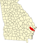
Part of Liberty County, Georgia, Colonels Island was home to Colonel Alexander Herron's plantation, called "Herron's Point". [3] Many of the plantations used to grow rice and indigo, which were two of the large cash crops that Georgia grew during the antebellum era. The island was originally known as Bermuda Island and reportedly had many people from Bermuda, but many died of malaria and the rest fled. [3]
Residents on the island travel via U.S. Route 84 to get on and off the island; the road terminates on Colonels Island.
Muscogee County is a county located on the central western border of the U.S. state of Georgia named after the Muscogee that originally inhabited the land with its western border with the state of Alabama that is formed by the Chattahoochee River. As of the 2020 census, the population was 206,922. Its county seat and only city is Columbus, with which it has been a consolidated city-county since the beginning of 1971.
McIntosh County is a county located in the U.S. state of Georgia. As of the 2020 census, the population was 10,975, a drop of 23.4 percent since the 2010 census. The county seat is Darien.
Liberty County is a county in the U.S. state of Georgia. As of the 2020 census, the population is 65,256. The county seat is Hinesville.
Glynn County is located in the southeastern part of the U.S. state of Georgia. As of the 2020 census, the population was 84,499. The county seat is Brunswick. Glynn County is part of the Brunswick, Georgia Metropolitan Statistical Area.
Chatham County is the easternmost county in the U.S. state of Georgia, on the state's Atlantic coast. The county seat and largest city is Savannah. One of the original counties of Georgia, Chatham County was created February 5, 1777, and is named after William Pitt, 1st Earl of Chatham.
Bulloch County is a county located in the southeastern part of the U.S. state of Georgia. As of the 2020 census, the population was 81,099, up from 70,217 in 2010. The county seat is Statesboro. With Evans County, Bulloch forms part of the Statesboro micropolitan statistical area, a component of the Savannah–Hinesville–Statesboro combined statistical area.
Statesboro is the most populous city in and the county seat of Bulloch County, Georgia, United States. Located in the southeastern part of the state, its population was 33,438 at the 2020 census. It is the principal city of the Statesboro micropolitan area, which had 81,099 residents, and is part of the Savannah–Hinesville–Statesboro combined statistical area.
Girard is a town in Burke County, Georgia, United States. The population was 184 in 2020. It is part of the Augusta, Georgia metropolitan area.
Isle of Hope is an unincorporated community and census-designated place (CDP) in Chatham County, Georgia, United States. It is part of the Savannah Metropolitan Statistical Area, and at the 2020 U.S. census its population was 2,357. The island is one of the most affluent communities in the state and is well known for its historic plantations and exclusive waterfront properties.
Tybee Island is a city and a barrier island in Chatham County, Georgia, 18 miles (29 km) east of Savannah. The name is used for both the city and the island, but geographically the two are not identical: only part of the island's territory lies within the city itself. The island is Georgia's easternmost point. The phrase "From Rabun Gap to Tybee Light", intended to illustrate Georgia's geographic diversity, contrasts the mountain pass near the state's northernmost point with the coastal barrier island's lighthouse.
Jonesboro is a city in and the county seat of Clayton County, Georgia, United States. The population was 4,235 in 2020.
Guyton is a city in Effingham County, Georgia, United States. The population was 2,289 at the 2020 census, up from 1,684 in 2010. Guyton is located 28 miles (45 km) northwest of downtown Savannah, and is part of the Savannah metropolitan statistical area.
Flemington is a city in Liberty County, Georgia, United States. It is a part of the Hinesville-Fort Stewart metropolitan statistical area. The population was 825 in 2020.
Gumbranch, alternatively spelled Gum Branch, is a city in Liberty County, Georgia, United States. It is a part of the Hinesville-Fort Stewart metropolitan statistical area. The population was 264 at the 2010 census, and 235 in 2020.
Midway is a city in Liberty County, Georgia, United States. It is a part of the Hinesville-Fort Stewart metropolitan statistical area. The population was 2,141 in 2020.
Walthourville is a city in Liberty County, Georgia, United States. When it was incorporated in 1974, it had a government entirely composed of women; and in 1978 it elected Carrie Kent, the first African-American woman mayor in Georgia history. Walthourville is a part of the Hinesville-Fort Stewart metropolitan statistical area (MSA). The population was 3,680 at the 2020 Census.
Darien is a city in and the county seat of McIntosh County, Georgia, United States. It lies on Georgia's coast at the mouth of the Altamaha River, approximately 50 miles south of Savannah, and is part of the Brunswick, Georgia metropolitan statistical area. It is the second-oldest planned city in Georgia and was originally called New Inverness. The population of Darien was 1,460 at the 2020 census, down from 1,975 in 2010.
Fayette is a city in Jefferson County, Mississippi, United States. The population was 1,614 at the 2010 census. It is the county seat of Jefferson County.
Bermuda, Islands of Bermuda, or The Somers Isles is an Atlantic archipelago, British Overseas Territory, and a former part of Virginia.
Georgia's 1st congressional district is a congressional district in the U.S. state of Georgia. It is currently represented by Republican Buddy Carter, though the district's boundaries were redrawn following the 2010 United States census, which granted an additional congressional seat to Georgia. The first election using the new district boundaries were the 2012 congressional elections.
31°42′40″N81°15′50″W / 31.71111°N 81.26389°W