Gumbranch, Georgia Gum Branch | |
|---|---|
 City Hall | |
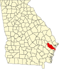
 Location in Liberty County and the state of Georgia | |
 Gumbranch, Georgia Location in the United States | |
| Coordinates: 31°50′20″N81°41′4″W / 31.83889°N 81.68444°W | |
| Country | United States |
| State | Georgia |
| County | Liberty |
| Area | |
• Total | 0.81 sq mi (2.09 km2) |
| • Land | 0.81 sq mi (2.09 km2) |
| • Water | 0.00 sq mi (0.00 km2) |
| Elevation | 79 ft (24 m) |
| Population (2020) | |
• Total | 235 |
| • Density | 291.20/sq mi (112.41/km2) |
| Time zone | UTC-5 (Eastern (EST)) |
| • Summer (DST) | UTC-4 (EDT) |
| ZIP code | 31313 |
| Area code | 912 |
| FIPS code | 13-35800 [2] |
| GNIS feature ID | 0331886 [3] |
Gumbranch, alternatively spelled Gum Branch, is a city in Liberty County, Georgia, United States. It is a part of the Hinesville-Fort Stewart metropolitan statistical area. The population was 264 at the 2010 census, [4] and 235 in 2020.