
Northumberland is a ceremonial county in North East England, on the border with Scotland. It is bordered by the North Sea to the east, Tyne and Wear and County Durham to the south, Cumbria to the west, and the Scottish Borders council area to the north. The town of Blyth is the largest settlement. Northumberland is the northernmost county in England.

Tynedale was a local government district in Northumberland, England. The district had a resident population of 58,808 according to the 2001 census. The main towns were Hexham, Haltwhistle and Prudhoe. The district contained part of Hadrian's Wall and the southern part of Northumberland National Park.

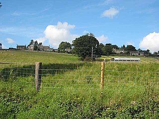
Stocksfield is a small village situated close to the River Tyne, about 14 miles (23 km) west of Newcastle upon Tyne in the southern part of Northumberland, England. There are several smaller communities within the parish of Stocksfield, including Branch End, New Ridley, Broomley, Hindley and the Painshawfield Estate. Other villages in Stocksfield's postal district include Bywell, Newton, Mickley, and Hedley on the Hill.
Anick is a village and former civil parish, now in the parish of Sandhoe, in Northumberland, England, situated to the north of Hexham. In 1881 the parish had a population of 153.

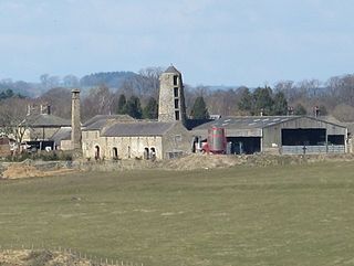
Barrasford is a village in Northumberland, England. It is situated to the north of Hexham, on the North Tyne. Barrasford is an ancient village that lies within the shadow of Haughton Castle. The village is notable for being the location of a Bronze Age burial site where the Reaverhill Dagger was excavated in 1964. Today Barrasford is noted for its quarry.

Berwick Hill is a village and former civil parish, now in the parish of Ponteland, in the county of Northumberland, England. It is situated to the north of Newcastle upon Tyne, near Ponteland. In 1951 the parish had a population of 41.

Bingfield is a village and former civil parish, now in the parish of Whittington, in Northumberland, in England. It is situated to the north of Corbridge, off the A68 road and includes some properties situated on the A68. In 1951 the parish had a population of 76.
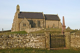
Chollerton is a village in Northumberland, England, on the A6079 road about six miles (10 km) to the north of Hexham, on the River North Tyne. Nearby villages include Low Brunton and Humshaugh. The village has a fine example of a mounting block standing at the churchyard gate.

Capheaton Hall, near Wallington, Northumberland, is an English country house, the seat of the Swinburne Baronets and a childhood home of the poet Algernon Swinburne. It counts among the principal gentry seats of Northumberland. It is a Grade I listed building.

Great Whittington is a village and former civil parish, now in the parish of Whittington, in Northumberland, England, 7 miles NE of Hexham. In 1951 the parish had a population of 158, in 2011 it had a population of 401.
Sandhoe is a hamlet and civil parish in Northumberland, England. It lies about 3 kilometres (2 mi) northwest of Corbridge and 3 kilometres south of Hadrian's Wall. The parish touches Acomb, Corbridge, Hexham and Wall.

Knarsdale, historically Knaresdale, is a village and former civil parish, now in the parish of Knaresdale with Kirkhaugh, in Northumberland, England about 5 miles (8 km) north of Alston. The village takes its name from the Knarr Burn: Knarr means 'rugged rock'. In 1951 the parish had a population of 289.
Thockrington is a village and former civil parish, now in the parish of Bavington, in Northumberland, England. The village lies about 10 miles (16 km) north of Hexham. In 1951 the parish had a population of 18.

Carrycoats is a former civil parish, now in the parish of Birtley, in the county of Northumberland, England. In 1951 the parish had a population of 34.

Newton is a village and former civil parish, now the parish of Bywell, in Northumberland, England. It is situated close to the A69 road, 3 miles (5 km) north of Stocksfield and 13 miles (21 km) west of Newcastle upon Tyne. In 1951 the parish had a population of 78. Bywell parish has a population of around 450 and Newton is its most populous settlement. Newton, Newton Hall and Stelling were three separate civil parishes from 1866 to 1 April 1955, when they were merged into the existing Bywell civil parish.

St Mary's Church is a Roman Catholic Parish church in Hexham, Northumberland. It was built from 1828 to 1830 in the Gothic Revival style. It is located on Battle Hill, opposite Hexham Park, close to the town centre. It is a Grade II* listed building.

Hallington is a hamlet and former civil parish about 9 miles from Hexham, now in the parish of Whittington, in the county of Northumberland, England. In 1951 the parish had a population of 75.

Whittonstall is a hilltop village in the civil parish of Shotley Low Quarter, in Northumberland, England.

