Comalcalco | |
|---|---|
| Motto: "La Perla de la Chontalpa" | |
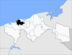 Location of the municipality in Tabasco. | |
| Country | |
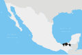
| State | Tabasco |
| Government | |
| • Type | Gregorio Efrain Espadas Méndez |
| Elevation | 5 and 13 m (1 ft) |
| Population (2020) | |
• Total | 214 877 |
| Time zone | UTC-6 (Zona Centro) |
Comalcalco is a municipality in the Mexican state of Tabasco. [1]
The municipal seat is the city of Comalcalco.