Jonuta | |
|---|---|
 | |
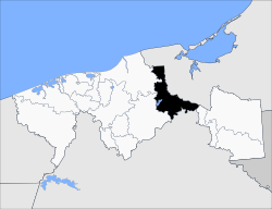 Location of Jonuta Municipality in Tabasco | |
| Coordinates: 18°05′N92°08′W / 18.083°N 92.133°W | |
| Country | |
| State | Tabasco |
| Government | |
| • Federal electoral district | Tabasco's 1st |
| Time zone | UTC-6 (Zona Centro) |
Jonuta is a municipality in the Mexican state of Tabasco. [1]
The municipal seat is the city of Jonuta.