Coolidge, Antigua and Barbuda

Last updated
Coolidge
Village/Community
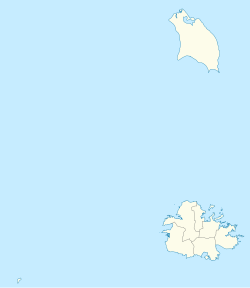
Antigua and Barbuda location map.svg
Red pog.svg
Coolidge
Location in Antigua and Barbuda
Coordinates: 17°08′52″N61°47′49″W / 17.14778°N 61.79694°W / 17.14778; -61.79694
Country Antigua and Barbuda
Island Antigua
Civil parish Saint George Parish
Government
  TypeVillage Council [1] (possibly dissolved) [2]
Area
  Total1.90 km2 (0.73 sq mi)
Population
 (2011)
  Total267
  Density140.53/km2 (364.0/sq mi)
Time zone UTC-4 (AST)

Coolidge is a village and community in Saint George Parish, Antigua and Barbuda.
Contents

Demographics

Coolidge has one enumeration district, ED 41900 Coolidge, the enumeration district is "high-income" and has an income weight of 3.18, the village had a population of 267 in 2011.

Census data

Source: [3]

Q48 EthnicCounts%
African descendent11342.46%
Caucasian/White72.78%
East Indian/India41.59%
Mixed (Black/White)134.76%
Mixed (Other)8431.35%
Hispanic62.38%
Syrian/Lebanese228.33%
Other165.95%
Don't know/Not stated10.40%
Total267100.00%
Q91 Business Earning (Earnings a business made)Counts%
1,000 to $1,999 EC per month416.67%
2,000 to $2,999 EC per month520.83%
3,000 to $4,999 EC per month625.00%
$5,000 EC and over per month1037.50%
Total25100.00%
NotApp :240
Missing :1
Employment statusCounts%
Employed14666.35%
Unemployed31.44%
Inactive7031.73%
Not stated10.48%
Total220100.00%
NotApp :47
Q71 Country of Citizenship 1Counts%
Antigua and Barbuda21279.37%
Other Asian and Middle Eastern countries83.17%
Dominica10.40%
Dominican Republic41.59%
Guyana31.19%
Jamaica83.17%
St. Lucia51.98%
Trinidad and Tobago20.79%
United Kingdom20.79%
USA113.97%
Other countries51.98%
Not Stated41.59%
Total267100.00%
Q71 Country of Citizenship 2 (Country of Second Citizenship)Counts%
Other Caribbean countries814.29%
Canada58.93%
Other Asian and Middle Eastern countries23.57%
Dominica35.36%
Guyana712.50%
Jamaica35.36%
St. Lucia11.79%
St. Vincent and the Grenadines11.79%
Trinidad and Tobago1016.07%
United Kingdom23.57%
USA1016.07%
Other countries610.71%
Total59100.00%
NotApp :207
Q117 MoneyOverseas (Money from relatives and friends overseas)Counts%
Under 100 EC$220100.00%
Total220100.00%
NotApp :47
Q55 Internet UseCounts%
Yes20677.38%
No4617.06%
Don't know/Not stated155.56%
Total267100.00%
Q49 ReligionCounts%
Adventist103.61%
Anglican5119.28%
Baptist62.41%
Evangelical10.40%
Jehovah Witness41.61%
Methodist124.42%
Moravian3011.24%
None/no religion166.02%
Pentecostal145.22%
Roman Catholic8632.53%
Weslyan Holiness62.41%
Other103.61%
Don't know/Not stated197.23%
Total264100.00%
NotApp :3
Q58. Country of birthCounts%
Africa10.40%
Other Latin or North American countries41.59%
Antigua and Barbuda16461.51%
Other Caribbean countries31.19%
Canada20.79%
Other Asian countries103.57%
Other European countries62.38%
Dominica31.19%
Dominican Republic51.98%
Guyana103.57%
Jamaica113.97%
Monsterrat10.40%
St. Kitts and Nevis10.40%
St. Lucia51.98%
St. Vincent and the Grenadines10.40%
Trinidad and Tobago83.17%
United Kingdom31.19%
USA186.75%
Not Stated103.57%
Total267100.00%

Related Research Articles

<span class="mw-page-title-main">Willikies</span> Town in Antigua, Antigua and Barbuda

Willikies is a small settlement in Saint Philip Parish, located in the eastern part of Antigua island in Antigua and Barbuda.

<span class="mw-page-title-main">Cedar Grove, Antigua and Barbuda</span> Village in Antigua, Antigua and Barbuda

Cedar Grove is a settlement in the far north of the island of Antigua. It is located to the east of the island's northernmost headlands, Boon Point. It is 6 kilometres (3.7 mi) northeast of the capital, St. John's.

<span class="mw-page-title-main">Liberta, Antigua and Barbuda</span> Village in Antigua, Antigua and Barbuda

Liberta is a town located in Saint Paul Parish, on the island of Antigua in Antigua and Barbuda. It had a population of 2,560 in 2001.

Piggotts, also known as St Mark's Village, is a small township in Saint George Parish on Antigua island in Antigua and Barbuda. It had a population of 1,478 in 2001.

Potters Village is a township located on Antigua in Antigua and Barbuda. It is located in the north of the island, to the east of the capital, St. John's and southwest of Piggotts.

<span class="mw-page-title-main">Five Islands, Antigua and Barbuda</span> Village in Antigua, Antigua and Barbuda

Five Islands Village is a village located on the northwest coast of Antigua, within Saint John Parish in Antigua and Barbuda.

<span class="mw-page-title-main">Buckleys</span> Town in Antigua, Antigua and Barbuda

Buckleys is a town in Saint John Parish, Antigua and Barbuda.

Bendals is a town in Saint John Parish, Antigua and Barbuda.

<span class="mw-page-title-main">Barbuda-North</span> Village and enumeration district in Barbuda, Antigua and Barbuda

Barbuda North is a village and enumeration district on the island of Barbuda.

<span class="mw-page-title-main">Glanvilles</span> Village in Antigua, Antigua and Barbuda

Glanvilles is a village in Saint Philip Parish, Antigua and Barbuda.

Montpelier is a small village in Saint Philip Parish, Antigua and Barbuda.

Collins is a village in Saint Philip Parish, Antigua and Barbuda.

Carlisle is a village in Saint George Parish, Antigua and Barbuda.

Crabs Hill is a village in Saint Mary Parish, Antigua and Barbuda.

Nut Grove is a village in Saint John Parish, Antigua and Barbuda.

Tomlinsons is a village in Saint John Parish, Antigua and Barbuda.

Branns Hamlet is a village in Saint John Parish, Antigua and Barbuda.

Emmanuel is a village in Saint John Parish, Antigua and Barbuda.

Crosbies is a village in Saint John Parish, Antigua and Barbuda.

Radio Range is a settlement in Saint John Parish, Antigua and Barbuda.

References

  1. http://laws.gov.ag/wp-content/uploads/2018/08/cap-466.pdf [ bare URL PDF ]
  2. "The political Neanderthal". 12 March 2020.
  3. "Antigua and Barbuda::Statistics Division/Redatam Webserver | Statistical Process and Dissemination Tool". redatam.org. Retrieved 2021-12-21.