Copake Hamlet, New York | |
---|---|
Coordinates: 42°6′11″N73°32′59″W / 42.10306°N 73.54972°W Coordinates: 42°6′11″N73°32′59″W / 42.10306°N 73.54972°W | |
Country | United States |
State | New York |
County | Columbia |
Town | Copake |
Area | |
• Total | 0.8 sq mi (2.1 km2) |
• Land | 0.8 sq mi (2.1 km2) |
• Water | 0 sq mi (0 km2) |
Elevation | 550 ft (170 m) |
Time zone | UTC-5 (Eastern (EST)) |
• Summer (DST) | UTC-4 (EDT) |
ZIP code | 12516 |
FIPS code | 36-18118 |
GNIS code | 0947408 |
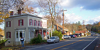
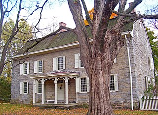
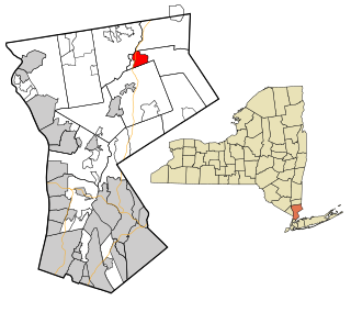
Copake Hamlet (or simply Copake) is a hamlet and census-designated place (CDP) in Columbia County, New York, United States. The hamlet is in the south-central part of the town of Copake. The CDP was designated after the 2010 census, so no population figure is yet available.
A census-designated place (CDP) is a concentration of population defined by the United States Census Bureau for statistical purposes only. CDPs have been used in each decennial census since 1980 as the counterparts of incorporated places, such as self-governing cities, towns, and villages, for the purposes of gathering and correlating statistical data. CDPs are populated areas that generally include one officially designated but currently unincorporated community, for which the CDP is named, plus surrounding inhabited countryside of varying dimensions and, occasionally, other, smaller unincorporated communities as well. CDPs include small rural communities, colonias located along the U.S. border with Mexico, and unincorporated resort and retirement communities and their environs.
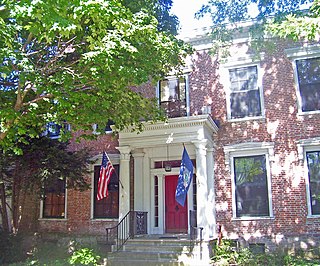
Columbia County is a county located in the U.S. state of New York. As of the 2010 census, the population was 63,096. The county seat is Hudson. The name comes from the Latin feminine form of the name of Christopher Columbus, which was at the time of the formation of the county a popular proposal for the name of the United States of America.
New York is a state in the Northeastern United States. New York was one of the original thirteen colonies that formed the United States. With an estimated 19.54 million residents in 2018, it is the fourth most populous state. In order to distinguish the state from the city with the same name, it is sometimes referred to as New York State.
The area was once known as Copake Flats. [1]
The Copake Memorial Clock was added to the National Register of Historic Places in 2012. [2]
Copake Memorial Clock, also known as the Copake Clock, is a historic freestanding clock located at Copake, Columbia County, New York. It was erected in 1944 as a memorial to those lost in World War II, and is a four sided pedestal-type, memorial chime clock. The metal object consisting of a base, plinth, and column topped by a copper and glass clock was manufactured by the O. C. McClintock Company of Minneapolis, Minnesota.
The National Register of Historic Places (NRHP) is the United States federal government's official list of districts, sites, buildings, structures and objects deemed worthy of preservation for their historical significance. A property listed in the National Register, or located within a National Register Historic District, may qualify for tax incentives derived from the total value of expenses incurred in preserving the property.
Copake is located in a flat valley along Bashbish Brook at the western foot of the Taconic Mountains, a range that runs along the New York-Massachusetts border. The hamlet of Copake Falls is 2 miles (3 km) to the northeast, and Copake Lake is 5 miles (8 km) via road to the northwest. New York State Route 22 passes about 0.5 miles (0.8 km) to the east of Copake Hamlet, leading north 5 miles (8 km) to Hillsdale and south 11 miles (18 km) to Millerton.
The Taconic Mountains or Taconic Range are a physiographic section of the larger New England province and part of the Appalachian Mountains, running along the eastern border of New York State and adjacent New England from northwest Connecticut to western Massachusetts, north to central western Vermont. The range includes notable summits such as Mount Equinox and Mount Greylock, the highest point in Massachusetts. Currently local residents, consistent with the prominent 19th century geologist, T. Nelson Dale, consider the Mount Greylock Massif as a subsidiary of the main Taconic Range to the west.
Copake Falls is a hamlet and census-designated place (CDP) in Columbia County, New York, United States. The hamlet, once known as Copake Iron Works, is in the eastern part of the town of Copake, 1.5 miles (2.4 km) west of the Massachusetts state line. The CDP was designated after the 2010 census, so no population figure is yet available.
Copake Lake is a community in southern Columbia County, New York, United States. The population was 823 at the 2010 census.
According to the United States Census Bureau, the Copake Hamlet CDP has a total area of 0.81 square miles (2.1 km2), all land. [3]
The United States Census Bureau is a principal agency of the U.S. Federal Statistical System, responsible for producing data about the American people and economy. The Census Bureau is part of the U.S. Department of Commerce and its director is appointed by the President of the United States.
Copake is a town in Columbia County, New York, United States. The population was 3,615 at the 2010 census. The town derives its name from a lake, which was known to the natives as Cook-pake, or Ack-kook-peek, meaning "Snake Pond".
Hillsdale is a small town in Columbia County, New York, near Hudson, New York and Great Barrington, Massachusetts. State Routes 22 and 23 intersect near the town center, which is listed on the National Register of Historic Places. The town has several restaurants and a general store, among other businesses. Hillsdale is known for its hilly landscape and is near Bash Bish Falls, Taconic State Park, and the Catamount ski area.
Gates is a town in Monroe County, New York. The town is named after General Horatio Gates. The population was 28,400 at the 2010 census. Gates and North Gates are census-designated places located within the town's boundaries.
Clark Mills is a hamlet in Oneida County, New York, United States. The population was 1,905 at the 2010 census.
Accord is a hamlet in Ulster County, New York, United States. The population was 562 at the 2010 census.
High Falls is a hamlet in Ulster County, New York, United States. The population was 627 at the 2010 census.
Highland is a hamlet in Ulster County, New York, United States. The population was 5,647 at the 2010 census. It is part of the New York City Combined Statistical area.
Pine Hill is a hamlet in the western part of the town of Shandaken in Ulster County, New York, United States. As of the 2010 census, the CDP had a total population of 275.
Stone Ridge is a hamlet in Ulster County, New York, United States. The population was 1,173 at the 2010 census.
Goldens Bridge is a hamlet in the town of Lewisboro in Westchester County, New York. The population was 1,630 at the 2010 census.
Paul Smiths is a hamlet and census-designated place (CDP) in the Town of Brighton in Franklin County, New York, United States. It is located on Lower Saint Regis Lake in the Adirondacks, 12 miles (19 km) northwest of Saranac Lake, located at 44°26' North 74°15' West. The population of the CDP was 671 at the 2010 census.
Downsville is a hamlet, census-designated place (CDP), and former village in the town of Colchester, Delaware County, New York, United States. The population was 617 at the 2010 census.
Oxbow is a hamlet and census-designated place (CDP) in the town of Antwerp, Jefferson County, New York, United States. As of the 2010 census it had a population of 108.
Witherbee is a hamlet and census-designated place (CDP) in the town of Moriah in Essex County, New York, United States. The population of the CDP was 347 at the 2010 census. Prior to 2010 the hamlet was part of the Mineville-Witherbee CDP.
Croom is an unincorporated community and census-designated place in Prince George's County, Maryland, United States. As of the 2010 census it had a population of 2,631. It largely consists of former tobacco farms and forests converting to Washington, DC bedroom subdivisions such as nearby Marlton. The main part of Patuxent River Park is in Croom.
Thousand Island Park is a hamlet and census-designated place (CDP) in the town of Orleans, Jefferson County, New York, United States, in the Thousand Islands region on the St. Lawrence River. The community includes the Thousand Island Park Historic District, listed on the National Register of Historic Places in 1982. As of the 2010 census, the population was 31 permanent residents, although there were 323 housing units, indicating a much greater seasonal population.
Taconic Shores is a residential development and census-designated place (CDP) in Columbia County, New York, United States. The hamlet is near the geographic center of the town of Copake and surrounds Robinson Pond, a water body on the Roeliff Jansen Kill. The CDP was designated after the 2010 census, so no population figure is yet available.
Ontario is a hamlet located in the Town of Ontario, Wayne County, New York, United States. The population was 2,160 at the 2010 census. Government offices for the Town of Ontario are located in the hamlet.