
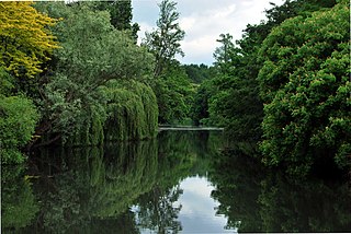
Lee Valley Regional Park is a 10,000-acre (40 km2) 26 miles (42 km) long linear park, much of it green spaces, running through the northeast of Greater London, Essex and Hertfordshire. The park follows the course of the River Lea (Lee) along the Lea Valley from Ware in Hertfordshire through Essex and the north east of Greater London, through the Queen Elizabeth Olympic Park to East India Docks Basin on the River Thames. The park is managed by Lee Valley Regional Park Authority and is made up of a diverse mix of countryside areas, urban green spaces, heritage sites, country parks, nature reserves and lakes and riverside trails, as well as leading sports centres covering an area of over 10,000 acres (40 km2). It is crossed by a number of roads and railways.
Syon Park is the garden of Syon House, the London home of the Duke of Northumberland in Isleworth in the London Borough of Hounslow. It was landscaped by Capability Brown in the 18th century, and it is Grade I listed by English Heritage under the Historic Buildings and Ancient Monuments Act 1953 for its special historic interest. The 56.6-hectare (140-acre) main gardens are a Site of Borough Importance for Nature Conservation, Grade I, and the flood meadows next to the River Thames are a biological Site of Special Scientific Interest (SSSI) and a Site of Metropolitan Importance for Nature Conservation.
Walthamstow Marshes, is a 36.7-hectare (91-acre) biological Site of Special Scientific Interest in Walthamstow in the London Borough of Waltham Forest. It was once an area of lammas land – common land used for growing crops and grazing cattle.

Ingrebourne Marshes are a 74.8 hectare biological Site of Special Scientific Interest in Hornchurch in the London Borough of Havering. Ingrebourne Valley Local Nature Reserve includes a small part of the SSSI west of the River Ingrebourne. The site is managed by the Essex Wildlife Trust

Sheepleas is a 99.9-hectare (247-acre) biological and geological Site of Special Scientific Interest east of Guildford in Surrey. It is a Geological Conservation Review site and a Local Nature Reserve. It is owned by Surrey County Council and managed by the Surrey Wildlife Trust.

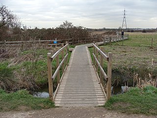
The River Lee Country Park is located in the Lee Valley Park and is managed by the Lee Valley Regional Park Authority. Covering 1,000 acres (400 ha) on either side of the River Lee Navigation between Waltham Abbey and Broxbourne, it is an area of lakes, watercourses, open spaces and three Sites of Special Scientific Interest (SSSI) linked by footpaths and cycle tracks.
The Turnford and Cheshunt Pits is a biological Site of Special Scientific Interest near Cheshunt in Hertfordshire and Essex and covers a total of 428.17 acres. It is part of the Lee Valley Special Protection Area.

The Cornmill Stream is a minor tributary of the River Lea in the English county of Essex.
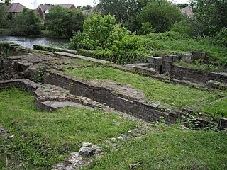
The Millhead Stream is a minor tributary of the River Lea in England. The stream flows north to south across the Waltham Abbey flood plain and through the site of the former Royal Gunpowder Mills.

Waltham Abbey SSSI is a 34.2-hectare (85-acre) biological Site of Special Scientific Interest which is located within the Waltham Abbey Royal Gunpowder Mills at Waltham Abbey in Essex.

Old Park Wood is a 16.7-hectare (41-acre) Site of Special Scientific Interest in Harefield in the London Borough of Hillingdon. The south-east part is an 8-hectare (20-acre) nature reserve owned and managed by the Hertfordshire and Middlesex Wildlife Trust.

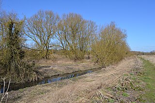
Sawbridgeworth Marsh is a 6.3-hectare (16-acre) biological Site of Special Scientific Interest (SSSI) near Sawbridgeworth in Hertfordshire, apart from a small area in the north which is in Essex. It is managed by the Essex Wildlife Trust. The planning authorities are East Hertfordshire District Council and Uttlesford District Council.
Thorley Wash or Thorley Flood Pound is a 17.3-hectare biological Site of Special Scientific Interest in Thorley, south of Bishop's Stortford in Hertfordshire. It was formerly a flood pound for the Stort Navigation, which was decommissioned in 2004 and converted to a more natural state. It was purchased by the Herts and Middlesex Wildlife Trust from the Environment Agency in 2011.

The Crouch and Roach Estuaries are a 1729 hectare biological Site of Special Scientific Interest (SSSI) at the mouth of the Crouch and Roach rivers in Essex. The Crouch part of the SSSI stretches from near Battlesbridge to Foulness Island, and the Roach from Rochford to the junction with the Crouch. Part of the site is in the Mid-Essex Coast Special Protection Area under the EC Directive on the Conservation of Wild Birds, and a Ramsar wetland site of international importance. It is also part of the Essex Estuaries Special Area of Conservation. An area of 65 hectares is managed by the Essex Wildlife Trust as the Lion Creek and Lower Raypits nature reserve and 8 hectares at Woodham Fen, both of which are managed by the Essex Wildlife Trust. A small area is also a geological SSSI, The Cliff, Burnham-on-Crouch.

Long Herdon Meadow is a 4.5-hectare (11-acre) biological Site of Special Scientific Interest south of Marsh Gibbon in Buckinghamshire. It is part of Upper Ray Meadows nature reserve, which is managed by the Berkshire, Buckinghamshire and Oxfordshire Wildlife Trust.

Pitsea Marsh is a 94.6-hectare (234-acre) Site of Special Scientific Interest in Pitsea in Essex. The southern half is the Wat Tyler Country Park, and the northern half is private land.

Glemsford Pits is a 37.5-hectare (93-acre) biological Site of Special Scientific Interest south of Glemsford in Suffolk. The River Stour, which forms the boundary between Suffolk and Essex, runs through the site, which is thus in both counties.

The Coppice, Kelvedon Hatch is a 9.4-hectare (23-acre) biological Site of Special Scientific Interest in Kelvedon Hatch in Essex.

Stonesfield Common, Bottoms and Banks is a 27.45-hectare (67.8-acre) biological Site of Special Scientific Interest (SSSI) south of Stonesfield in Oxfordshire.
