
The Darling Downs is a farming region on the western slopes of the Great Dividing Range in southern Queensland, Australia. The Downs are to the west of South East Queensland and are one of the major regions of Queensland. The name was generally applied to an area approximating to that of the Condamine River catchment upstream of Condamine township but is now applied to a wider region comprising the Southern Downs, Western Downs, Toowoomba and Goondiwindi local authority areas. The name Darling Downs was given in 1827 by Allan Cunningham, the first European explorer to reach the area and recognises the then Governor of New South Wales, Ralph Darling.
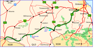
The Cunningham Highway is a 327-kilometre (203 mi) national highway located in south-eastern Queensland, Australia. The highway links the Darling Downs region with the urbanised outskirts of Ipswich via Cunninghams Gap.

Highfields is both a town and a locality in the Toowoomba Region, Queensland, Australia along the New England Highway. It is situated on the Great Dividing Range, slightly north of Mount Kynoch. It serves as a satellite suburb to the city of Toowoomba, accommodating many of Toowoomba businesses' employees. At the 2016 census, Highfields had a population of 8,131. The ABS also defines a larger growth area, named Highfields, that includes the suburb and several of those surrounding. At June 2015, the estimated urban population for the Highfields urban area was 18,771. It is the fastest growing area in Queensland and also one of the fastest in Australia.

The Gums is a rural town and locality in the Western Downs Region, Queensland, Australia.

Kingsthorpe is a rural town and locality in the Toowoomba Region, Queensland, Australia. In the 2016 census, Kingsthorpe had a population of 1,867 people.
Dulacca is a town and a locality in the Western Downs Region, Queensland, Australia.

The County of Bentinck is a county located on the southern boundary of the state of Queensland, Australia. Like all counties in Queensland, it is a non-functional administrative unit, that is used mainly for the purpose of registering land titles. The county was named in 1838 after William Cavendish-Bentinck, 3rd Duke of Portland, who served as Prime Minister of Great Britain twice, in 1783 and again between 1807 and 1809. Population centres within the County of Bentinck include the towns of Stanthorpe, Wallangarra, Glen Aplin, Applethorpe and Inglewood.

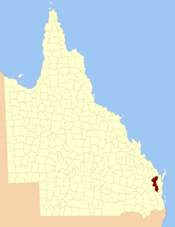
The County of Aubigny is a county in Queensland, Australia. Like all counties in Queensland, it is a non-functional administrative unit, that is used mainly for the purpose of registering land titles. The county lies between 151°E and 152°E longitude, and it covers the Toowoomba Region and the Dalby part of the Western Downs Region, The county was named by the Surveyor-General of New South Wales in 1850, possibly to honour the Earl of Arundel who had a long association with the name Aubigny. The area was officially named and bounded by the Governor in Council on 7 March 1901 under the Land Act 1897.
The County of Lennox is a county in Queensland, Australia. Like all counties in Queensland, it is a non-functional administrative unit, that is used mainly for the purpose of registering land titles.

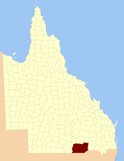
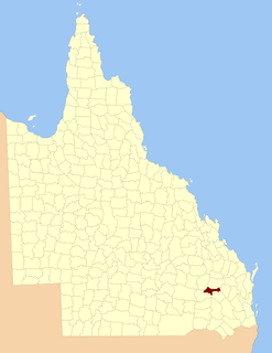
The County of Merivale is a county located on the southern boundary of the state of Queensland, Australia. Like all counties in Queensland, it is a non-functional administrative unit, that is used mainly for the purpose of registering land titles. The county was named in honour of Herman Merivale, the British permanent Under-Secretary of State for the Colonies. Its boundaries were declared and made subject to the Land Act 1897 on 7 March 1901. Population centres within the County of Merivale include the towns of Warwick, Allora and Killarney.
The County of Belmore is a county in Queensland, Australia, located west of the Darling Downs in the Shire of Balonne. Like all counties in Queensland, it is a non-functional administrative unit, that is used mainly for the purpose of registering land titles. It was officially named and bounded by the Governor in Council on 7 March 1901 under the Land Act 1897.
The County of Auburn is a county in the Darling Downs region of Queensland, Australia. Much of its area is within the Barakula State Forest. It was named and bounded by the Governor in Council on 7 March 1901 under the Land Act 1897.
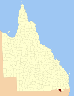
The County of Clive is a county in the southern Darling Downs region of Queensland, Australia, on the state border with New South Wales. It was named and bounded by the Governor in Council on 7 March 1901 under the Land Act 1897.

The County of Marsh is a county in the southern Darling Downs region of Queensland, Australia, on the state border with New South Wales. It was named and bounded by the Governor in Council on 7 March 1901 under the Land Act 1897.

The County of Lytton is a county in the Darling Downs region of Queensland, Australia. It was named and bounded by the Governor in Council on 7 March 1901 under the Land Act 1897.

The Isaac River is a river and anabranch located in Central Queensland, Australia.
Balgowan is a locality in the Toowoomba Region, Queensland, Australia.
Pozieres is a locality in the Southern Downs Region, Queensland, Australia.
Yulabilla is a locality in the Western Downs Region, Queensland, Australia. In the 2016 census, Yulabilla had a population of 44 people.
Kings Creek is a rural locality in the Toowoomba Region, Queensland, Australia. In the 2016 census, Kings Creek had a population of 72 people.
