Courgenard | |
|---|---|
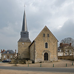 The church of Saint Martin | |
Location of Courgenard  | |
 Courgenard  Courgenard | |
| Coordinates: 48°09′08″N0°44′11″E / 48.1521°N 0.7365°E | |
| Country | France |
| Region | Pays de la Loire |
| Department | Sarthe |
| Arrondissement | Mamers |
| Canton | Saint-Calais |
| Intercommunality | CC du Perche Emeraude |
| Government | |
| • Mayor (2020–2026) | Thierry Renvoizé [1] |
Area 1 | 11.32 km2 (4.37 sq mi) |
| Population (2022) [2] | 460 |
| • Density | 41/km2 (110/sq mi) |
| Demonym(s) | Cosnellien, Cosnellienne |
| Time zone | UTC+01:00 (CET) |
| • Summer (DST) | UTC+02:00 (CEST) |
| INSEE/Postal code | 72105 /72320 |
| 1 French Land Register data, which excludes lakes, ponds, glaciers > 1 km2 (0.386 sq mi or 247 acres) and river estuaries. | |
Courgenard is a commune in the Sarthe department in the Pays de la Loire region in north-western France.