The Middle Peninsula is the second of three large peninsulas on the western shore of Chesapeake Bay in Virginia, in the United States. It lies between the Northern Neck and the Virginia Peninsula. This peninsula is bounded by the Rappahannock River on the north and the York River on the south, with the Chesapeake Bay to the east. It encompasses six Virginia counties: Essex, Gloucester, King and Queen, King William, Mathews, and Middlesex. Developed for tobacco plantations in the colonial era, in the 21st century the Middle Peninsula is known for its quiet rural life, vegetable truck-farming, and fishing industry.
Bigler's Mill was a small town in Virginia near Williamsburg in York County which is now extinct. It is considered one of the many lost towns of Virginia. The original community on this site was founded by James Bigler in the spring of 1852, who purchased 2400 acres of timberland, part of the tract known as Rippon Hall. He built a sawmill and gristmill with a long pier extending into the York River. A series of homes, a store and church were also constructed. During the Peninsula Campaign of the Civil War, the property was occupied by Confederate forces; in May of 1862, Federal gunboats shelled the mill and set fire to the buildings and the pier, for which Bigler was later compensated.
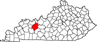
Rosine is an unincorporated community in Ohio County, Kentucky, United States. Bill Monroe, The Father of Bluegrass, is buried in the town and memorialized with a bronze cast disk affixed to the barn where his music remains alive. The community was named for the pen name of Jenny Taylor McHenry, poet and wife of founder Henry D. McHenry. The ZIP Code is 42370 and the area code is 270. The nearest towns are Horse Branch, and Beaver Dam; and the nearest major cities are Owensboro and Bowling Green. The community sits at an elevation of 429 feet. At one time, Rosine was a thriving community with several stores, a school, a pickle factory, and a bat mill that milled bats for the Louisville Slugger bat factory.
Hopewell is an unincorporated community in eastern Washington County, Missouri, United States. The community lies on Hopewell Creek south of Summit and Missouri Route 8.
Chatham Heights is an unincorporated community in Stafford County, in the U.S. state of Virginia.
Burtons Corner is an unincorporated community in Northumberland and Richmond counties, in the U.S. state of Virginia.
Lara is an unincorporated community in Northumberland and Richmond counties, in the U.S. state of Virginia.
Luttrellville is an unincorporated community in Northumberland and Richmond counties, in the U.S. state of Virginia.
Mila is an unincorporated community in Northumberland County, in the U.S. state of Virginia. Mila is located at 37°50′32″N76°19′39″W.
Miskimon is an unincorporated community in Northumberland County, in the U.S. state of Virginia.
Moon Corner is an unincorporated community in Northumberland and Richmond counties, in the U.S. state of Virginia.
Rainswood is an unincorporated community in Northumberland and Richmond counties, in the U.S. state of Virginia.
Walkers Corner is an unincorporated community in Northumberland and Richmond counties, in the U.S. state of Virginia.
Moores Mill is an unincorporated community in Richmond County, in the U.S. state of Virginia.
Reedy Mill is an unincorporated community in Caroline County, in the U.S. state of Virginia.
Williams is an unincorporated community in Mathews County, in the U. S. state of Virginia.
Capahosic is an unincorporated community in Gloucester County, in the U. S. state of Virginia.
Mill Creek, Gloucester County is an unincorporated community in Gloucester County, in the U. S. state of Virginia.
Owl Trap is an unincorporated community in Gloucester County, in the U. S. state of Virginia.
Huskey is an unincorporated community in Bollinger County, in the U.S. state of Missouri.