Related Research Articles

Richmond County is a county located on the Northern Neck in the U.S. state of Virginia. As of the 2020 census, the population sits at 8,923. Its county seat is Warsaw. The rural county should not be confused with the large city and state capital Richmond, Virginia. It was formed in 1692 when the first Rappahannock County was divided to form Richmond County and Essex County.

Bensley is a census-designated place (CDP) in Chesterfield County, Virginia, United States. It is an inner suburb of Richmond, Virginia. The population was 5,819 at the 2010 census. Bensley Community building is inside of Bensley park. The community building is outside of Bensley, setting in walking distance of the CDP. The community is an old village with no active government. The community is over 100 years old. A new police substation in the village is next to the old Bensley Bermuda Rescue Squad, near DuPont Spruance.

The York River is a navigable estuary, approximately 34 miles (55 km) long, in eastern Virginia in the United States. It ranges in width from 1 mile (1.6 km) at its head to 2.5 miles (4.0 km) near its mouth on the west side of Chesapeake Bay. Its watershed drains an area of the coastal plain of Virginia north and east of Richmond.
Massey Drive is a Canadian town located on the west coast of the island of Newfoundland in the province of Newfoundland and Labrador. Its name is derived from the original road through the town, named Massey Drive, which in turn is named after Vincent Massey, former Governor General of Canada (1952–59). It is adjacent to the city of Corner Brook, from which it seceded in 1971. It is primarily a residential area.
Threeway is an unincorporated community in Westmoreland County, in the U. S. state of Virginia. Located at the junction of routes 203 and 620, it was previously the site of a post office and was known as Cary's Corner in the 19th century.
Mammoth Creek is a creek in Iron and Garfield counties in southern Utah, United States, that flows for over 20 miles (32 km) through mountains and forests from Mammoth Summit, through the Mammoth Valley, to its confluence with the Sevier River. The creek contains wild brown trout and hatchery rainbow trout.
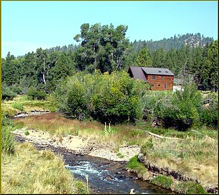
Bryant Corner is an unincorporated community in Northumberland County, in the U.S. state of Virginia.

Claraville is an unincorporated community in Northumberland County, in the U.S. state of Virginia.
Lara is an unincorporated community in Northumberland and Richmond counties, in the U.S. state of Virginia.
Luttrellville is an unincorporated community in Northumberland and Richmond counties, in the U.S. state of Virginia.
Mila is an unincorporated community in Northumberland County, in the U.S. state of Virginia. Mila is located at 37°50′32″N76°19′39″W.
Rainswood is an unincorporated community in Northumberland and Richmond counties, in the U.S. state of Virginia.
Clopton is an unincorporated community in Richmond County, in the U.S. state of Virginia.
Farnham is an unincorporated community in Richmond County, in the U.S. state of Virginia.
Simons Corner is an unincorporated community in Richmond County, in the U.S. state of Virginia.
Bandanna, also known as Pleasant Hill, is an unincorporated area in York County, Pennsylvania, United States. Bandanna is located on Pennsylvania Route 94 about 3 miles south of Hanover.
Capahosic is an unincorporated community in Gloucester County, in the U. S. state of Virginia.
Gorrell Run is a stream in the U.S. state of West Virginia.
Brazito is an unincorporated community in Cole County, in the U.S. state of Missouri.
Ottery Creek is a stream in Iron and Reynolds counties in the U.S. state of Missouri. It is a tributary to the Middle Fork Black River.
References
Municipalities and communities of Northumberland County, Virginia, United States | ||
|---|---|---|
| Town |  | |
| CDP | ||
| Other communities |
| |
| Footnotes | ‡This populated place also has portions in an adjacent county or counties | |
Coordinates: 37°56′14″N76°26′44″W / 37.93722°N 76.44556°W
| | This Northumberland County, Virginia state location article is a stub. You can help Wikipedia by expanding it. |