| Crays Hill | |
|---|---|
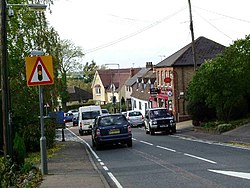 Crays Hill | |
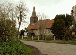 The church at Crays Hill | |
 Crays Hill Location within Essex | |
| OS grid reference | TQ712921 |
| Civil parish | |
| District | |
| Shire county | |
| Region | |
| Country | England |
| Sovereign state | United Kingdom |
| Post town | BILLERICAY |
| Postcode district | CM11 2 |
| Dialling code | 01268 |
| Police | Essex |
| Fire | Essex |
| Ambulance | East of England |
| UK Parliament | |
Crays Hill is a village in the Basildon borough of Essex, England. The River Crouch passes under Church Lane. [1]
Contents
The village was listed in Domesday Book of 1086 when the Lord of the manor and tenant-in-chief was Sasselin of Layer. [2]
Crays Hill was part of the civil parish of Ramsden Crays until 1934 when it was abolished to enlarge South Hanningfield. [3]