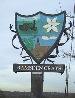
Ramsden Crays | |
---|---|
Ramsden Crays village sign | |
Location within Essex | |
Population | 1,838 2011 Census |
OS grid reference | TQ 71769 92312 |
Civil parish |
|
Shire county | |
Region | |
Country | England |
Sovereign state | United Kingdom |
Post town | Chelmsford |
Postcode district | CM11 |
Dialling code | 01268 |
Police | Essex |
Fire | Essex |
Ambulance | East of England |
UK Parliament | |
Ramsden Crays is a civil parish in the Basildon district of Essex, England. It lies north of Basildon and west of Wickford. The parish includes the village of Crays Hill and is located north of the A127. The River Crouch runs through the parish. The 2011 census records that there were 862 males and 976 females living in the parish. [1]
The place-name 'Ramsden' is first attested in the Domesday Book of 1086, where it appears as Ramesdana. The name means 'wild garlic dene or valley' (cf. the plant ramsons), or possibly 'ram's valley'. Close Rolls show that Ramsden Crays was held by Simon de Craye in 1252, Craye referring to Cray or Craye in France. [2]
In the early 1870s, John Marius Wilson describes:
"RAMSDEN-CRAYS, a parish in Billericay district, Essex; on the river Crouch, 2 miles E S E of Billericay, and 4½ N N W of Pitsea r. station. Post-town, Billericay. Acres, 1, 453. Real property, £2, 307. Pop., 262. Houses, 44. The property is divided among a few. The manor, with the Ashes, belongs to F. M. B. Batard, Esq. The living is a rectory in the diocese of Rochester. Value, £370. Patron, F. Francis, Esq" [3]
The parish was re formed on 2 September 1996 from Basildon unparished area. [4] [5]
Between 1801 and 1931, population growth in Ramsden Crays was small, growing by 117 when compared to the large change between 1931 and 2001 where the population grew to 1,085. Population growth had been relatively stable before 1931. Between 2001 and 2011, the population grew more to 1,838. This population spike was the result of the illegal Irish traveller site, Dale Farm, that grew in size in the late 1990s. [6]
The earliest known record of occupation in Ramsden Crays was in 1831, it listed males over the age of 20 in 9 different occupation categories. Similar to the occupational structure of 1881, agriculture was the dominant employer with 47 of the 75 listed working in agriculture, predominately as labourers. 17 men worked in retail and handicraft, this field was most likely split into more clear-cut roles for the 1881 census and beyond. Nearly every other role were occupied by 1–2 men. Some roles not occupied by men may have been occupied by women who were not recorded at the time of recording. [7]
The occupational structure for men and women in Ramsden Crays in 1881 illustrates that for men, agriculture was the dominant employer. Agriculture made up nearly2/3 of employment with 33, of these 24 were working as farm labourers. The remaining male occupations in Ramsden Crays like gamekeeper, carpenter and blacksmith were occupied by 1–2 people maximum, highlighting the dominance of agriculture in the parish. The female occupational structure was dominated by women who did not work or did not have a listed occupation, making up more than half of women. Women were also excluded from many occupations such as agriculture, commercial and vegetable substance services. In contrast, educational and dress making occupations were only occupied by women. [8]
The occupational structure between men and women in 2011 compared to that of men and women in 1881 is very different. For men, in 2011, there where a wider range of industries people worked in, increasing from 11 in 1881 to 17 in 2011. Agriculture, which had been the dominant occupation in 1881, employing 33 people employs only 4 in 2011, showing agriculture is no longer the dominant industry in the parish. Construction and the Repair of Motor Vehicles and Motor Cycles are now the most dominant industries, making up just under a half of occupations, showing that for males there is a wider range of employment opportunities. [9] The employment opportunities for females have also increased from 11 in 1881 to 17 in 2011. In 1881, women working in Domestic Offices and Services made up more than half of the female working population, with the number of women without a listed occupation made up a quarter. By 2011, women were working in wide range of occupations, similar to that of the male occupation structure. Education and Human Health and Social Activities are the dominant female occupations, but, together they make up less than a third of the female occupations. [10]
As of the 2011 census, half of residents in the parish are economically active, 737 of 1,289 residents aged 16–75 are either self-employed or employed full or part-time. Of the 517 economically inactive residents in the parish, 184 are retired, 24 are full-time students, 274 are looking after family members or their home, 24 are disabled and 11 are economically inactive for an unspecified reason. [11] There is only one school in Ramsden Crays, Crays Hill Primary school. The school made headlines in 2004 when an influx of traveller children came into the school, leading to local parents in the village withdrawing their children from the school and moving them elsewhere due to fears surrounding the quality of teaching, 200 were withdrawn overall leaving only 44 pupils, all of them from Dale Farm [12] Ramsden Crays is 4 miles from two hospitals, Basildon University Hospital and Mayflower Community Hospital. General health in the parish is good, 1,595 residents report 'very good' or 'good' health in the 2011 census with only 73 reporting 'very bad' or 'bad' health. In addition, 192 residents reported providing unpaid care work 1–50 hours per week, with 1,646 reporting no unpaid care per week. [13] The closest train station is 4 miles away in Wickford.
Dale Farm, the largest traveller site in Europe was located in Ramsden Crays. Basildon council had initially given permission for 40 English travellers to live on the site in the 1970s. The land was bought in 1996 by an Irish travelling family for £122,000 and after 2001 the population of 'Gypsy/Irish' 'travellers' started to grow, peaking at 675 in 2011 [14] Many families started moving to Dale Farm in 2001, leading to legal disputes with Basildon council. In 2005, part of the site was declared illegal by inspectors, however, the 'traveller' community continued to oppose the council's decision, leading to a public enquiry being launched in 2006. This proved unsuccessful as in 2009 Lord Justice Pill ruled that the site was illegal. It was not until March 2011 that Basildon Council voted to go ahead with the eviction of 400 travellers living their illegally. [15] The eviction itself took place on 19 October 2011. Altercations with the police from protesters led to the arrests of 45 people and 15 police officers injured. By the end of the day, the illegal section of the campsite had been cleared [16]
The 15th-century church of St Mary's has been converted to a private house. The entire church, excluding the bell tower and the broach spine was entirely rebuilt in 1871. Few elements of the original 15th-century church do remain. It is a grade II* listed building. [17] In 1617, Thomas Bartlet described St Mary's Church:
"Parish Church of St. Mary stands near the middle of the parish. The church has been entirely re-built in modern times, but incorporates some old work. In the S. wall of the chancel is a window with two 15th-century cinque-foiled heads to the lights and part of the moulded label of the same date. The N. wall of the nave has two windows, both with old splays and rear-arches; the eastern window has also jambs and head of two trefoiled lights with a moulded label, all of c. 1400". [18]
Adforton is a small village and a civil parish in north Herefordshire, England. It is on the A4110 main road approximately 22 miles (35 km) north of Hereford and of Wigmore, and is close to the Wales border.
Moor Crichel is a village and former civil parish, now in the parish of Crichel, in East Dorset, England situated on Cranborne Chase five miles east of Blandford Forum. The civil parish includes the hamlet of Manswood notable for a terrace of twelve thatched cottages. Dorset County Council's 2013 estimate of the parish population is 140. In the 2001 census the parish had a population of 180. In the 2011 census the population of Moor Crichel parish combined with the neighbouring parish of Long Crichel was 246. The civil parish was abolished on 1 April 2015 and merged with Long Crichel to form Crichel.
Sutton is a small village and civil parish in the Peterborough district, in the north-west of Cambridgeshire, England. Situated about 5.7 miles from Peterborough and approximately half a mile south of the A47 road.
Holmer and Shelwick is a civil parish in Herefordshire, England. It is immediately to the north of Hereford and includes Holmer, Munstone, Shelwick and Shelwick Green. It is surrounded by rural fields, however the amenities of Hereford are very close by.
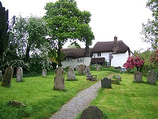
Ashton is a civil parish in the Teignbridge district of Devon, England. According to the 2001 census it had a population of 174, and it had a population of 203 according to the 2011 census. The parish consists of two villages, Higher Ashton and Lower Ashton, and is on the edge of the Dartmoor National Park. The France Brook flows through most of Ashton just south of its main road, and along Ashton's eastern boundary flows the River Teign. The parish is located approximately 13 km north of Newton Abbot, and roughly 10 km to the south west of its nearest city, Exeter. Historically, Ashton has primarily been based inside the agricultural sector, but one of its most notifiable landmarks is the St John the Baptists church located in the Higher Ashton district.
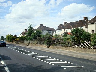
Darenth is a village and civil parish in the Borough of Dartford, Kent, England. It is located 3.4 miles south east of Dartford and 4.6 miles north east of Swanley.
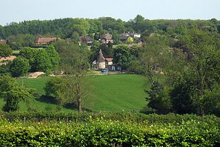
Sundridge and Ide Hill is a civil parish in the Sevenoaks District of Kent, England. It is located in the Darenth valley and lies between Sevenoaks and Westerham. The parish contains the villages of Sundridge and Ide Hill and the hamlet of Goathurst Common. It lies within the Kent Downs Area of Outstanding Natural Beauty and within London's Metropolitan Green Belt. It is approximately 21 miles south of London.
Parham is a village and civil parish in the East Suffolk district of Suffolk in eastern England. Located seven miles north of Woodbridge, in 2005 it had a population of 300, reducing to 263 at the 2011 census and according to the 2011 census there were 129 males and 134 females living at this time.
Dale Farm is a plot of land situated on Oak Lane in Crays Hill, Essex, United Kingdom. Until October 2011, it was the site of one of the largest Traveller concentrations in the UK, at its height housing over 1,000 people, along with the adjacent Oak Lane site. Although Basildon District Council had granted permission for the site to be used by a small number of Traveller families, no planning permission was given for the expansion of the site into land located within the Green Belt.
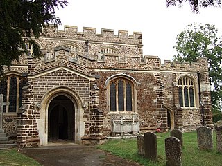
Tingrith is a small village and civil parish in Bedfordshire, England. It is located adjacent to the M1 motorway near the large village of Toddington. The nearest major town is Luton, located about 10 miles (16 km) to the southeast. The parish church of St Nicholas dates back to the 13th century and has Tingrith's only cemetery. The church can seat up to 200 people.
Kildale is a village and civil parish in Hambleton district of North Yorkshire, England. It lies approximately 3 miles (4.8 km) south-east from Great Ayton, within the North York Moors National Park and on the Cleveland Way National Trail. The parish occupies 5,730 acres (23.2 km2), with 3,416 acres (13.82 km2) being taken up by moorland.
Crays Hill is a village in the Basildon borough of Essex, England. The River Crouch passes under Church Lane.
Clopton is a village and civil parish in Suffolk. It is located between Ipswich and Debenham two kilometres north of Grundisburgh on the River Lark. The village is no larger than a series of houses either side of the B1078, surrounded by farm land. The village itself has no clear centre; houses and other buildings are concentrated around the four manors of Kingshall, Brendhall, Rousehall and Wascolies, all of which are mentioned in the Domesday Book of 1086.
Finningham is a village and civil parish in the Mid Suffolk district of Suffolk in the East of England, located approximately 7.5 miles north of Stowmarket and 16 miles from the county town of Ipswich. In 2011 its population was 480.
Fakenham Magna is a village and civil parish in the West Suffolk district of Suffolk in eastern England. The meaning of the word 'Fakenham' can be split into two: 'Faken' and 'ham', both of which derive from Old English. The former refers to somebody by the name of 'Facca', with the latter meaning 'a village / a homestead', making the direct translation 'Facca's homestead'. 'Magna' translates from Latin as 'great', hence the alternative name of the village of 'Great Fakenham'. During World War Two, however, the village was referred to as 'Little Fakenham', which was used to avoid confusion with the larger civil parish of Fakenham in Norfolk.
Great Livermere is a village and civil parish in the West Suffolk district of Suffolk in eastern England. It is located around four miles north-east of the borough's largest town Bury St Edmunds.
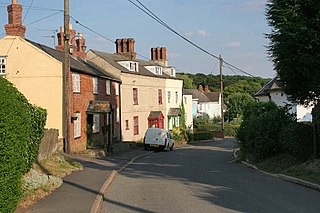
Tugby and Keythorpe is a civil parish comprising the village of Tugby and land surrounding Keythorpe Hall, Hall Farm and Lodge Farm in Leicestershire, England, part of the Harborough district. The Parish covers around 2,200 acres, situated 7 miles west of Uppingham, and 12 miles east of Leicester. According to the 2011 census the population of the parish was 330. The Anglican parish register for the parish dates back to 1568. The boundaries of the parish have not changed throughout the years, meaning that the parish's size remains the same as it did in 1568.
Eyke is a village and a civil parish in the East Suffolk district, in the English county of Suffolk. It is located on the A1152 road near the town of Woodbridge. Eyke has a primary school, the manor house of Lord and Lady Lucas with scenic pond and horse paddock, and a pub. The mediaeval parish church of All Saints was restored in the 1860s. Services are normally held on the first and third Sundays of the month.
Runwell is a village near Wickford and a civil parish on the A132 road, in the Chelmsford District, in the English county of Essex.
Not to be confused with Stapleford, Nottinghamshire.