Crooked River (Ireland)

Last updated

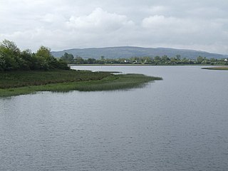
The Crooked River rises in Loughan Macmartin at the top of Slieve Rushen Mountain, in the townland of Carrowmore, County Cavan, Parish of Tomregan, Barony of Tullyhaw, County Cavan. It then flows in a southerly direction and discharges into the Shannon–Erne Waterway in the townland of Derryginny. It has a fish population of brown trout, pike, minnows, stoneloach and perch.

Slieve Rushen mountain in the United Kingdom

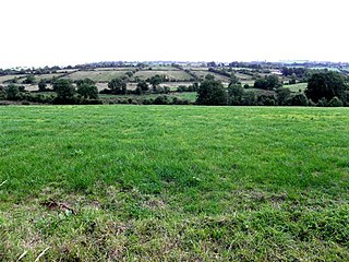
Slieve Rushen is a mountain which straddles the border between County Cavan in the Republic of Ireland and County Fermanagh in Northern Ireland. It is also called Slieve Russell or Ligavegra. It has an elevation of 404 metres above sea-level. OS 1/50k Mapsheet: 27A & 26. Grid Ref: H234 226. The mountain is made up of grey limestone with a cap of sandstone and shales and is extensively quarried by local companies. The surface is mostly covered with peat, pine forests and grazing fields. The mountain contains several caves and swallow-holes including Pollnagollum and Tory Hole which are a popular destination for potholers. It forms part of the Slieve Rushen Bog Natural Heritage Area. A recent addition to the mountain is the Slieve Rushen Wind Farm for generating electricity.

Carrowmore, County Cavan

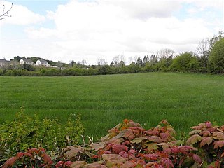
Carrowmore, County Cavan is a townland in the Parish of Tomregan, Barony of Tullyhaw, County Cavan, Ireland.

Tomregan human settlement in United Kingdom

Tomregan is a civil parish in the ancient barony of Tullyhaw. The parish straddles the international border between the Republic of Ireland and Northern Ireland. The largest population centre in the parish is Ballyconnell, County Cavan. The total area of the civil parish is 10,600 statute acres. Most of Tomregan's constituent townlands are situated in County Cavan while the remainder lie in County Fermanagh. In the Catholic Church, the ecclesiastical parish of Tomregan was split in the early 18th century, with the County Fermanagh townlands being assigned to the parish of Knockninny while the County Cavan townlands were united with the parish of Kildallan.

Related Research Articles

Snugborough

Snugborough is a townland in the Parish of Tomregan, Barony of Tullyhaw, County Cavan, Ireland.

Mullanacre Lower

Mullanacre Lower is a townland in the Parish of Tomregan, Barony of Tullyhaw, County Cavan, Ireland.

Corran, County Cavan

Corran is a townland in the civil parish of Templeport, County Cavan, Ireland. It lies in the Roman Catholic parish of Templeport and barony of Tullyhaw.

Lecharrownahone is a townland in the civil parish of Templeport, County Cavan, Ireland. It lies in the Roman Catholic parish of Templeport and barony of Tullyhaw.

Cavanaquill is a townland in the civil parish of Templeport, County Cavan, Ireland. It lies in the Roman Catholic parish of Templeport and barony of Tullyhaw.

Ray is a townland in the civil parish of Templeport, County Cavan, Ireland. It lies in the Roman Catholic parish of Templeport and barony of Tullyhaw.

Killyran

Killyran is a townland in the civil parish of Templeport, County Cavan, Ireland. It lies in the Roman Catholic parish of Templeport and barony of Tullyhaw.

Drumlougher

Drumlougher is a townland in the civil parish of Templeport, County Cavan, Ireland. It lies in the Roman Catholic parish of Templeport and barony of Tullyhaw.

Kilsallagh is a townland in the civil parish of Templeport, County Cavan, Ireland. It lies in the Roman Catholic parish of Templeport and barony of Tullyhaw.

Moherloob is a townland in the civil parish of Templeport, County Cavan, Ireland. It lies in the Roman Catholic parish of Templeport and barony of Tullyhaw.

Cornagunleog

Cornagunleog is a townland in the civil parish of Templeport, County Cavan, Ireland. It lies in the Roman Catholic parish of Templeport and barony of Tullyhaw.

Killyneary

Killyneary is a townland in the civil parish of Templeport, County Cavan, Ireland. It lies in the Roman Catholic parish of Templeport and barony of Tullyhaw.

Corracholia More

Corracholia More is a townland in the civil parish of Templeport, County Cavan, Ireland. It lies in the Roman Catholic parish of Corlough and barony of Tullyhaw.

Cronery

Cronery is a townland in the civil parish of Templeport, County Cavan, Ireland. It lies in the Roman Catholic parish of Corlough and barony of Tullyhaw. The local pronunciation is Crinnera.

Derry More is a townland in the civil parish of Templeport, County Cavan, Ireland. It lies in the Roman Catholic parish of Corlough and barony of Tullyhaw.

Derrynacreeve

Derrynacreeve is a townland in the civil parish of Templeport, County Cavan, Ireland. It lies in the Roman Catholic parish of Corlough and barony of Tullyhaw.

Drumbeagh is a townland in the civil parish of Templeport, County Cavan, Ireland. It lies in the Roman Catholic parish of Corlough and barony of Tullyhaw.

Drumlaydan is a townland in the civil parish of Templeport, County Cavan, Ireland. It is also called Bonebrook locally. It lies in the Roman Catholic parish of Corlough and barony of Tullyhaw.

Tirnawannagh townland in County Cavan, Ireland

Tirnawannagh is a townland in the civil parish of Templeport, County Cavan, Ireland. It lies in the Roman Catholic parish of Corlough and barony of Tullyhaw.

Moneynure is a townland in the civil parish of Templeport, County Cavan, Ireland. It lies in the Roman Catholic parish of Corlough and barony of Tullyhaw.

References

    Coordinates: 52°57′N7°08′W / 52.950°N 7.133°W / 52.950; -7.133

    Geographic coordinate system Coordinate system

    A geographic coordinate system is a coordinate system that enables every location on Earth to be specified by a set of numbers, letters or symbols. The coordinates are often chosen such that one of the numbers represents a vertical position and two or three of the numbers represent a horizontal position; alternatively, a geographic position may be expressed in a combined three-dimensional Cartesian vector. A common choice of coordinates is latitude, longitude and elevation. To specify a location on a plane requires a map projection.