Related Research Articles

Galax is an independent city in the southwestern part of the Commonwealth of Virginia. As of the 2010 census, the population was 7,042. In 2018 the estimated population was 6,423.

Floyd County is a county located in the Commonwealth of Virginia. As of the 2010 census, the population was 15,279. Its county seat is the town of Floyd.

Fries is an incorporated town located on the New River in Grayson County, Virginia, 24 kilometers (15.5 mi) north-east of the county seat in Independence — in Virginia's Blue Ridge Highlands and on Virginia's musical heritage trail, The Crooked Road.

Abingdon is a town in Washington County, Virginia, United States, 133 miles (214 km) southwest of Roanoke. The population was 8,191 at the 2010 census. It is the county seat of Washington County. The town encompasses several historically significant sites and features a fine arts and crafts scene centered on the galleries and museums along Main Street.
Virginia's musical contribution to American culture has been diverse, and includes Piedmont blues, jazz, folk, brass, hip-hop, and rock and roll bands, as well as the founding origins of country music in the Bristol sessions by Appalachian Virginians.

The Roanoke River is a river in southern Virginia and northeastern North Carolina in the United States, 410 miles (660 km) long. A major river of the southeastern United States, it drains a largely rural area of the coastal plain from the eastern edge of the Appalachian Mountains southeast across the Piedmont to Albemarle Sound. An important river throughout the history of the United States, it was the site of early settlement in the Virginia Colony and the Carolina Colony. An 81-mile (130 km) section of its lower course in Virginia between the Leesville Lake and Kerr Lake is known as the Staunton River, pronounced, as is the Shenandoah Valley city of that name. It is impounded along much of its middle course to form a chain of reservoirs.
U.S. Route 58 is an east–west U.S. Highway that runs for 508 miles (818 km) from U.S. Route 25E just northwest of Harrogate, Tennessee, to U.S. Route 60 in Virginia Beach, Virginia. Until 1996, when the Cumberland Gap Tunnel opened, US 58 ran only inside the commonwealth of Virginia. It was then extended southwest along a short piece of former US 25E, which no longer enters Virginia, to end at the new alignment in Tennessee.

Appalachian music is the music of the region of Appalachia in the Eastern United States. It is derived from various European and African influences, including English ballads, Irish and Scottish traditional music, hymns, and African-American blues. First recorded in the 1920s, Appalachian musicians were a key influence on the early development of Old-time music, country music, and bluegrass, and were an important part of the American folk music revival of the 1960s. Instruments typically used to perform Appalachian music include the banjo, American fiddle, fretted dulcimer, and guitar.
The Southwest District is a high school conference of the Virginia High School League that includes schools from southwestern Virginia, United States. The Southwest District was established in the former AA Region IV.

Meadows of Dan is an unincorporated community in Patrick County, Virginia, where the Blue Ridge Parkway crosses U.S. Route 58. There are numerous country shops, classic houses, and restaurants in the community. It is located near the Patrick/Floyd county line about 20 miles east of Hillsville and about 14 miles northwest of Stuart, Virginia. The community's name is credited to one of its earliest English settlers, James Steptoe Langhorne, and comes from the beautiful meadows that abound near the Dan River which flows through the area. The community's motto as posted on the welcoming sign is "A simpler place in time". Meadows of Dan is located along the Crooked Road, Virginia and the Crooked Road, Virginia's heritage music trail and in the Rocky Knob American Viticultural Area.
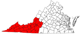
Southwest Virginia, often abbreviated as SWVA, is a mountainous region of Virginia in the westernmost part of the commonwealth. Located within the broader region of western Virginia, Southwest Virginia has been defined alternatively as all Virginia counties on the Appalachian Plateau, all Virginia counties west of the Eastern Continental Divide, or at its greatest expanse, as far east as Blacksburg and Roanoke. Another geographic categorization of the region places it as those counties within the Tennessee River watershed. Regardless of how borders are drawn, Southwest Virginia differs from the rest of the commonwealth in that its culture is more closely associated with Appalachia than the other regions of Virginia. Historically, the region has been and remains a rural area, but in the 20th century, coal mining became an important part of its economy. With the decline in the number of coal jobs and the decline of tobacco as a cash crop, Southwest Virginia is increasingly turning to tourism as a source of economic development. Collectively, Southwest Virginia's craft, music, agritourism and outdoor recreation, such as a kayak adventure on the Clinch River, are referred to as the region's "creative economy."

U.S. Route 23 is a part of the U.S. Highway System that runs from Jacksonville, Florida to Mackinaw City, Michigan. In Virginia, the U.S. Highway runs 60.80 miles (97.85 km) from the Tennessee state line near Weber City north to the Kentucky state line near Pound. US 23, which is known as Orby Cantrell Highway for most of its course, is a four-lane divided highway that follows Corridor B of the Appalachian Development Highway System through Southwest Virginia. The U.S. Highway serves as the main east–west highway of Scott County and the primary north–south highway of Wise County. US 23 runs concurrently with US 58 from Weber City to Duffield and with US 58 Alternate between Big Stone Gap and the independent city of Norton.

State Route 72 is a primary state highway in the southwest part of the U.S. state of Virginia. It runs from SR 71 in Gate City north to SR 65 at Fort Blackmore, northeast with SR 65 to Dungannon, and north via Coeburn to SR 83 near Clintwood.
The Bluegrass Brothers is an American bluegrass band from Southwest Virginia.

The Blue Ridge Music Center is a music venue, museum, and visitor center located at milepost 213 on the Blue Ridge Parkway near Galax, Virginia. The center celebrates the music and musicians of the Blue Ridge Mountains through concerts, exhibits, and programs that highlight living musical heritage of the Blue Ridge region and interpret its significance within the larger landscape of American music and culture. The site is operated through a partnership between the National Park Service and Blue Ridge Parkway Foundation.
The Roanoke Region is the area of the Commonwealth of Virginia surrounding the city of Roanoke. Its usage may refer to the metropolitan statistical area or the Roanoke Valley, but it sometimes includes areas in the Allegheny Mountains and New River Valley which includes Alleghany County, Montgomery County, Covington, Clifton Forge, Blacksburg, Christiansburg, and Radford. Bedford County and Floyd County are sometimes included as part of the region.

The Ralph Stanley Museum is a monument to Ralph Edmond Stanley, an American bluegrass musician known for his distinctive singing and banjo playing.
The Southwest Virginia Cultural Center & Marketplace is a visitor center, music venue, artisan marketplace and community space located in beautiful Southwest Virginia in Abingdon, Virginia and is the gateway to regional craft, music, food outdoors and local culture.
The Music of East Tennessee has a rich history, and played a major role in the development of modern country and bluegrass music. Bristol, known as "the birthplace of country music",, and Johnson City, notable for the Johnson City recording sessions, are both towns in the Tri-Cities region of East Tennessee. The music of East Tennessee is defined by country, gospel, and bluegrass artists, and has roots in Appalachian folk music.
Donald DePoy is an American bluegrass musician, music educator, and music event organizer. He is a fifth-generation bluegrass musician from the Shenandoah Valley and a multi-instrumentalist. He and his wife Martha Hills have performed as the duo Me & Martha since 2005. He is founder of the Shenandoah Music Trail and the first "bluegrass church". He won first place in dulcimer at the 2017 Old Fiddlers' Convention in Galax, Virginia.
References
- ↑ The Crooked Road.
- ↑ https://thecrookedroad.org/venues/
- ↑ The Crooked Road: Virginia's Heritage Music Trail. The Crooked Road, n.d.
- ↑ Crooked Road Map