Crow, Texas | |
|---|---|
 Crow  Crow | |
| Coordinates: 32°36′57″N95°18′35″W / 32.61583°N 95.30972°W | |
| Country | United States |
| State | Texas |
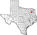
| County | Wood |
| Elevation | 345 ft (105 m) |
| Time zone | UTC-6 (Central (CST)) |
| • Summer (DST) | UTC-5 (CDT) |
| Area code(s) | 430 & 903 |
| GNIS feature ID | 1378188 [1] |
Crow is an unincorporated community in Wood County, Texas, United States. [1] According to the Handbook of Texas,[ citation needed ] Crow had a population of 25 in 2000.