Little Hope, Texas | |
|---|---|
 Little Hope  Little Hope | |
| Coordinates: 32°46′46″N95°15′25″W / 32.77944°N 95.25694°W | |
| Country | United States |
| State | Texas |
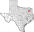
| County | Wood |
| Elevation | 413 ft (126 m) |
| Time zone | UTC-6 (Central (CST)) |
| • Summer (DST) | UTC-5 (CDT) |
| Area codes | 430, 903 |
| GNIS feature ID | 1380875 [1] |
Little Hope is an unincorporated community in Wood County, located in the U.S. state of Texas. [1] According to the Handbook of Texas, Little Hope had a population of 25 in 2000. [2] When the nearby Little Hope Missionary Baptist Church was established in 1881, it was said that it had little hope of surviving more than a year. [3]