Daly River, Northern Territory

Last updated

Daly River
Northern Territory
Daly River Inn.JPG
Daly River Roadside Inn
Australia Northern Territory location map.svg
Red pog.svg
Daly River
Coordinates 13°35′11″S130°38′28″E / 13.5864°S 130.6411°E / -13.5864; 130.6411 Coordinates: 13°35′11″S130°38′28″E / 13.5864°S 130.6411°E / -13.5864; 130.6411 [1]
Population127 (2016 census) [2]
Established1865
4 April 2007 (locality) [1]
Postcode(s) 0822
Time zone ACST (UTC+9:30)
Location
LGA(s)
Territory electorate(s) Daly
Federal division(s) Lingiari
Suburbs around Daly River:
Rakula Rakula Litchfield Park
Nemarluk Daly River Litchfield Park
Tipperary
Nauiyu
Maranunga
Nauiyu
Tipperary
Nemarluk Nemarluk
Tipperary
Tipperary
FootnotesAdjoining localities [3] [4]

Daly River is a town adjacent to the Daly River in the Northern Territory of Australia. At the 2006 census, Daly River had a population of 468. [2] The town is part of the Victoria Daly Region local government area. The area is popular for recreational fishing, being regarded as one of the best places to catch Barramundi in Australia.

Contents

History

Early settlement and mission

The traditional owners of the area are the Mulluk-Mulluk people who live both in Nauiyu and at Wooliana downstream from the community.

European settlement of Daly River began in 1865 with the arrival of Boyle Travers Finniss, the first Premier of South Australia and the first Government Resident of the Northern Territory. Finniss named the river after Sir Dominick Daly, the Governor of South Australia, since the Northern Territory was at that time part of South Australia. The region lay untouched by Europeans until 1882 when copper was discovered.

Daly River town was the scene of some particularly bloody exchanges between the local Aborigines and the miners. In 1884 three miners were killed. The miners in the town wreaked vengeance on the local Aborigines out of proportion to the perceived crime. A year later, probably aware of the tensions in the area, the Society of Jesus order of the Roman Catholic Church established a mission in the town, introducing Christianity and farming techniques to the local Aboriginal population. The original mission endured until 1899, when following a significant flood the missionaries were withdrawn.

In 1954, contact between traditional Malak Malak elders and the then bishop of Darwin led to the mission being reestablished. In 1955, the church purchased 4,000 acres (1,600 ha) of land and the Missionaries of the Sacred Heart helped to establish a school and a clinic for the community. The mission was later renamed Nauiyu and with the exception of the church, convent, school and associated residences transferred to community ownership. [5] Due to the influence of the mission in the town, 75% percent of the population identify as Roman Catholics.

Through the twentieth century there were a number of attempts to settle the town without real success. In 1911 the Commonwealth Government tried to convince people to move to the town. By the 1920s there were plans for crops of peanuts and tobacco which came to nothing. Cashews and sugar cane were also planted unsuccessfully. In 1967 the Tipperary Land Corporation cleared large tracts of land around the settlement and started growing sorghum but the operation was closed down in 1973.

Floods

Like other rivers of the Top End, the Daly is prone to seasonal flooding and this has had a significant impact on the small community throughout its history. Major flood events devastated the town in 1899 and 1957, causing widespread property damage. On 28 January 1998, a major natural disaster saw every building in the town inundated and the entire population airlifted to Batchelor during the emergency evacuation. The floodwaters, fed by heavy rainfall in the wake of Tropical Cyclone Les continued to rise until 3 February, reaching a peak of 16.8 m (55 ft), the highest level recorded to date.[ citation needed ]

Economy and infrastructure

Daly River is considered a remote community, and is primarily accessed via the Daly River Road which was sealed as far as the river crossing in 2007, providing all weather access to Darwin. A sealed airstrip at Nauiyu provides for charter and medical evacuation flights, however there are no scheduled air services to the airport, or aircraft regularly based in the town.

Other public facilities at Daly River include a public library, swimming pool, school and health clinic. There is a Catholic church, St Francis Xavier located in Nauiyu. The Victoria Daly Regional Council maintains a regional office in the community, contributing more than 40 jobs to the local economy. [6] Public Administration is by far the largest employment industry, accounting for over half of the workforce.

The town and surrounding district are served by a modern police station, built in 1994. Two members of the Northern Territory Police are based here. The area serviced by the station is 33,000 km2 (13,000 sq mi), and the responsibilities of the Daly River members include Emergency Management and boat access to the communities when the roads are cut by seasonal flooding. [7]

Attractions

Today the town has a pub with motel units, a police station, and a number of caravan parks. It is located on the banks of the river a couple of kilometres from the Daly River Crossing, now by sealed road from the main tourist route, the Stuart Highway. The settlement is a centre for visitors to explore the Daly River Nature Park and fishermen after barramundi. The park is home to saltwater crocodiles, reptiles, spiders, cockatoos, wild pigs, feral Water Buffalo, mangroves, giant bamboos, pandanus and the red kapok tree, Bombax ceiba . [8]

On the road 5 kilometres (3 mi) east of Daly River is a turnoff to Woolianna, where there are numerous caravan parks. Just before entering the town there is a turnoff to the Nauiyu Aboriginal Community, home to the Roman Catholic Mission and Merrepen Arts Centre where local art is sold. Merrepen Arts has become a well known art centre in the top end. In recent years a number of artists from the area have become nationally famous including Marita Sambono and Kieren Karritpul. The art centre and workshops are open to the public on weekdays.

See also

Related Research Articles

<span class="mw-page-title-main">Northern Territory</span> Territory of Australia

The Northern Territory is an Australian territory in the central and central northern regions of Australia. The Northern Territory shares its borders with Western Australia to the west, South Australia to the south, and Queensland to the east. To the north, the territory looks out to the Timor Sea, the Arafura Sea and the Gulf of Carpentaria, including Western New Guinea and other islands of the Indonesian archipelago.

Litchfield National Park, covering approximately 1500 km2, is near the township of Batchelor, 100 km south-west of Darwin, in the Northern Territory of Australia. Each year the park attracts over 260,000 visitors.

<span class="mw-page-title-main">Palmerston, Northern Territory</span> City in the Northern Territory, Australia

Palmerston is a planned satellite city of Darwin, the capital and largest city in Australia's Northern Territory. The city is situated approximately 20 kilometres from Darwin and 10 kilometres from Howard Springs and the surrounding rural areas. Palmerston had a population of 33,695 at the 2016 census, making it the second largest city in the Northern Territory.

<span class="mw-page-title-main">Katherine, Northern Territory</span> Town in the Northern Territory, Australia

Katherine is a town in the Northern Territory of Australia. It is situated on the Katherine River, after which it is named, 320 kilometres (200 mi) southeast of Darwin. It is the fourth largest settlement in the Territory and is known as the place where "The outback meets the tropics". Katherine had an urban population of approximately 6,300 at the 2016 Census.

Wadeye is a town in Australia's Northern Territory. It was formerly known as Port Keats. At the 2016 census, Wadeye had a population of 2,280. Wadeye is the 6th most populous town, and the largest Indigenous community in the Northern Territory.

<span class="mw-page-title-main">Kalkarindji</span> Aboriginal settlement in the Victoria Daly Region, Northern Territory, Australia

Kalkarindji is a town and locality in the Northern Territory of Australia, located on the Buntine Highway about 554 kilometres (344 mi) south of the territory capital of Darwin and located about 460 kilometres (290 mi) south of the municipal seat in Katherine.

Malak-Malak, also known as Ngolak-Wonga (Nguluwongga), is an Australian Aboriginal language spoken by the Mulluk-Mulluk people. Malakmalak is nearly extinct, with children growing up speaking Kriol or English instead. The language is spoken in the Daly River area around Woolianna and Nauiyu. The Kuwema or Tyaraity (Tyeraty) variety is distinct.

<span class="mw-page-title-main">Coomalie Shire</span> Local government area in the Northern Territory, Australia

The Coomalie Community Government Council is a local government area in Australia's Northern Territory, situated south of Darwin and Palmerston. The council governs an area of 2,056 km2 (794 sq mi). The shire had a population of 1,391 in June 2018.

<span class="mw-page-title-main">Victoria Daly Regional Council</span> Local government area in the Northern Territory, Australia

The Victoria Daly Regional Council is a local government area in the Northern Territory of Australia. The shire covers an area of 153,287 square kilometres (59,184 sq mi) and had a population of 3,138 in June 2018.

<span class="mw-page-title-main">Malak, Northern Territory</span> Suburb of Darwin, the Northern Territory, Australia

Malak is a Northern suburb of Darwin, Northern Territory, in the Northern Territory of Australia.

<span class="mw-page-title-main">Daly River (Northern Territory)</span> River in Northern Territory, Australia

The Daly River is a river in the Northern Territory of Australia. Settlement on the river is centred on the Aboriginal community of Nauiyu, originally the site of a Catholic mission, as well as the town of Daly River itself, at the river crossing a few kilometres to the south. The Daly River is part of the Daly Catchment that flows from northern Northern Territory to central Northern Territory.

Timber Creek, traditionally known as Makalamayi, is an isolated small town on the banks of the Victoria River in the Northern Territory of Australia. The Victoria Highway passes through the town, which is the only significant settlement between the Western Australia border and the town of Katherine to the east. Timber Creek is approximately 600 kilometres (370 mi) south of Darwin, in an area known for its scenic escarpments and boab trees.

Daguragu, previously also known as Wattie Creek by the Gurindji people as it is situated on a tributary of the Victoria River, is a locality in the Northern Territory of Australia. It is located about 551 kilometres (342 mi) south of the territory capital of Darwin and located about 460 kilometres (290 mi) south-west of the municipal seat in Katherine. It is around 8 km (5.0 mi) north-west of Kalkarindji. Daguragu community is situated on Aboriginal land held under perpetual title; it was also formerly a local government area until its amalgamation into the Victoria Daly Shire on 1 July 2008.

<span class="mw-page-title-main">Regions of the Northern Territory</span> Variously divided administrative regions of the Northern Territory of Australia

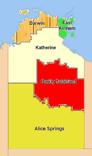
Federal and territory government agencies divide the Northern Territory of Australia into different administrative regions of the Northern Territory, though the names and boundaries vary.

Nganmarriyanga, formerly known as Palumpa, is an Aboriginal community in the Daly River region of the Northern Territory, Australia.

<span class="mw-page-title-main">Finniss River (Northern Territory)</span> River in Northern Territory, Australia

The Finniss River is a river south of Darwin, running west from the flank of Mount Minza, passing north of Litchfield National Park and flowing into the sea at Fog Bay. The East Branch of the Finniss was heavily polluted during the 1970s due to uranium mining at Rum Jungle mine about 105 km south of Darwin. The Finniss River Land Claim was presented to Judge John Toohey in 1981 but the former Rum Jungle mine site, contained within Area 4 of the Finniss River Land Claim (1981) was excluded from the grant to the Finniss River Land Trust due to the concerns of the Kungarakany and Warai peoples who are joint traditional Aboriginal owners of that area.

The Mulluk-Mulluk, otherwise known as the Malak-Malak, are an indigenous Australian people of the Northern Territory, Australia.

Nauiyu Nambiyu is an Aboriginal community in the Katherine Region of the Northern Territory, Australia.

The Kungarakany people, also spelt Koongurrukuñ, Kungarrakany, Kungarakan and other variants, are an Aboriginal Australian people of the Northern Territory. They were called the "Paperbark People" by European settlers.

The Ngolokwangga are an Aboriginal Australian people of the Northern Territory.

References

  1. 1 2 3 "Place Names Register Extract for Daly River (locality)". NT Place Names Register. Northern Territory Government. Retrieved 25 May 2019.
  2. 1 2 Australian Bureau of Statistics (27 June 2017). "2016 Community Profiles: Daly River (State Suburb)". 2016 Census of Population and Housing. Retrieved 25 May 2019. OOjs UI icon edit-ltr-progressive.svg
  3. 1 2 "Daly River (locality)". NT Atlas and Spatial Data Directory. Northern Territory Government. February 2005. Retrieved 25 May 2019.
  4. 1 2 "Localities within Victoria-Daly Shire (map)" (PDF). Northern Territory Government. 3 April 2007. Archived from the original (PDF) on 18 March 2019. Retrieved 25 May 2019.
  5. "Our Mission - Daly River". Diocese of Darwin. Archived from the original on 19 July 2012. Retrieved 25 November 2012.
  6. "Nauiyu / Daly River". Victoria Daly Regional Council. Archived from the original on 20 April 2013. Retrieved 25 November 2012.
  7. "Daly River". Northern Territory Police. Archived from the original on 21 March 2012. Retrieved 26 November 2012.
  8. "Species: Bombax ceiba (Bombax)". Atlas of Living Australia. Retrieved 2 May 2023.