Darenth Country Park

Last updated

Darenth Country Park
Kent UK location map.svg
Red pog.svg
Darenth Country Park shown within Kent
OS grid TQ627734
Coordinates 51°25′51″N0°15′01″E / 51.4309°N 0.2503°E / 51.4309; 0.2503
Area100 hectares (250 acres)
Created1999
Operated by Dartford Borough Council
Open7 days a week, dawn until dusk
Website Official website

Darenth Country Park is in Darenth near Dartford, in Kent, England. On the site of a former demolished hospital site Darenth Park Hospital, also the site of a scheduled ancient monument and the site of ancient Saxon burials. Due to this protection it was turned into a millennium open-space park.

Contents

History

In 1954, General Post Office (GPO) engineers while digging a cable trench past the Hospital, cut through a Saxon grave and also recovered a late 6th century silver gilt square headed brooch and parts of a bronze howl. These finds were then given to the British Museum to research and store. [1]

In 1978, 'Dartford & District Archaeological Group' excavated a trench on the site, before a planning application was made by Associated Portland Cement Manufacturers Ltd. for chalk extraction on the site. This trench found an ancient Saxon burial ground (5th century), with 12 Saxon graves, as well as various artefacts (including a spearhead, brooches and a glass bowl) from the period. [2] The glass bowl is now known as the 'Darenth bowl' (which is known to be dedicated to St. Rufinus of Soissons c.450 A.D.), is now in Dartford Borough Museum. [3] The graves were then deemed important enough to be scheduled as an Ancient Monument. [4]

The hospital buildings were then demolished in 1995. [5] The new Darent Valley Hospital was built on part of the site. Then a 'village' of 300 new houses was also built on a portion and the remaining 100 acres became the Darenth Country Park. [6] The only surviving building is the former 'Darenth Park Hospital Farm', which is now used as a riding school. Arrow Riding School for the disabled. [7] Also survived was The Darenth Hospital War Memorial, which was unveiled on 16 December 1927 by General Fell. It commemorates hospital staff who were killed in both World Wars. Eleven names are from the 1st World War. [8]

The park was developed as a "Changing Places" National Millennium Project [9]

The council employed artist Andy McKeown to work with local schools and community groups to design the sculpture in the park. [10]

In 2004, Kent Thameside Green Grid Design Strategy and Guidelines was produced by Kent County Council. It proposed to extend both Beacon Wood Country Park and Darenth Country Park to create a ‘joined’ Darenth and Beacon Country Park. [11]

Ecology

It is situated on the edge of the North Downs and a portion of the wood (on the northern boundary) in the park, is part of Site of Special Scientific Interest. [12]

The park is within a shallow river valley with the main 'Chestnut Driveway' path marking the bottom of the valley. Which leads East - West to Gore Road (on the eastern edge).

The chalk grassland are used as grazing for farm animals, but some were left to naturalise into wildflower meadows after the park was formed, these grasslands were cleared of scrub to allow the rare chalk land plants and animals to re-establish including the Musk Orchid, and Chalkhill Blue butterfly. This is one of the only three sites within Kent, that Watling Street Thistle, Eryngium campestre can be found. [13]

The park also has 'traditional' orchards planted in 1995. Chapel Orchard has over 150 varieties of apple, pear, plum, cherry and cob nut tree.

Includes apple varieties such as "Kentish Fillibasket" (1820) [14] and "Golden Pippin" (1629) [15] are at the top end of the orchard. Towards the other end of the orchard there are modern dwarf and semi-dwarf varieties, such as "Discovery" and "Red Devil". [16]

In addition there are horse grazing paddocks [17]

How to get there

Head south from the A296 (between Dartford and the A2 to Gravesend), down Gore Road.

Related Research Articles

<span class="mw-page-title-main">Swanscombe</span> Human settlement in England

Swanscombe /ˈswɒnzkəm/ is a village in the Borough of Dartford in Kent, England, and the civil parish of Swanscombe and Greenhithe. It is 4.4 miles west of Gravesend and 4.8 miles east of Dartford.

<span class="mw-page-title-main">River Darent</span> River in Kent, England

The Darent is a Kentish tributary of the River Thames and takes the waters of the River Cray as a tributary in the tidal portion of the Darent near Crayford. 'Darenth' is frequently found as the spelling of the river's name in older books and maps, Bartholomew's Canals and River of England being one example. Bartholomew's Gazetteer (1954) demonstrates that Darent means "clear water", a result of it springing from and running through chalk. The purity of the water was a major factor in the development of paper and pharmaceuticals in the area.

<span class="mw-page-title-main">Greenhithe, Kent</span> Village in the Borough of Dartford, Kent, England

Greenhithe is a village in the Borough of Dartford in Kent, England, and the civil parish of Swanscombe and Greenhithe. It is located 4 miles east of Dartford and 5 miles west of Gravesend.

<span class="mw-page-title-main">Swanley</span> Town in Kent, England

Swanley is a town and civil parish in the Sevenoaks District of Kent, England, 16 miles (26 km) southeast of central London, adjacent to the Greater London boundary and within the M25 motorway periphery. The population at the 2021 census was 17,826.

Cuckmere Valley is a civil parish in the Wealden District of East Sussex, England. As its name suggests, the parish consists of a number of small settlements in the lower reaches of the River Cuckmere.

<span class="mw-page-title-main">Dartford</span> Human settlement in England

Dartford is the principal town in the Borough of Dartford, Kent, England. It is located 18 mi (29 km) south-east of Central London and is situated adjacent to the London Borough of Bexley to its west. To its north, across the Thames estuary, is Thurrock in Essex, which can be reached via the Dartford Crossing. To its east lies the Borough of Gravesham and to the south the district of Sevenoaks. It had a population of 51,240.
<span class="mw-page-title-main">Darenth Park Hospital</span> Hospital in England

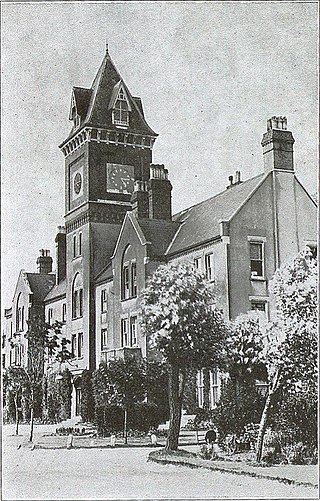
Darenth Park Hospital was a healthcare facility in Darenth near Dartford in Kent, originally founded as Darenth School.

Valerius and Rufinus are venerated as Christian saints and martyrs. Their legend states that they were imperial tax collectors in Soissons who were pious Christians. They were ordered to be arrested by Rictius Varus, the praefectus-praetorii in Gaul. The two saints hid themselves but were eventually caught, and then tortured and beheaded on the high road leading to Soissons.

<span class="mw-page-title-main">St John's Jerusalem</span> Manor House in Kent, England

St John's Jerusalem or Sutton-at-Hone Preceptory is a National Trust property at Sutton-at-Hone, Kent, England which includes the 13th century chapel of the Knights Hospitaller and a garden moated by the River Darent. The chapel and garden are open to the public.

<span class="mw-page-title-main">Clayton to Offham Escarpment</span> Landform in Sussex, England

Clayton to Offham Escarpment is a 422.5-hectare (1,044-acre) linear biological Site of Special Scientific Interest (SSSI) which runs from Clayton in West Sussex to Lewes in East Sussex. Its ownership and management is divided between over fifteen landowners and farmers. Parts of Ditchling's Downs, e.g. TQ 323 133, and the scarp between Blackcap and Mount Harry, e.g. TQ 378 124, are owned by the National Trust. What remains of Ditchling Tenantry Down common at Ditchling Beacon is leased to the Sussex Wildlife Trust.
<span class="mw-page-title-main">Riverside Country Park</span>

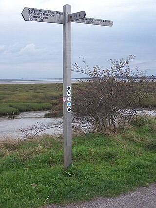
Riverside Country Park is a large coastal public park, situated alongside the River Medway estuary between Gillingham and Rainham. The park covers about 100 hectares - approximately 247 acres (1.00 km2). There are a variety of natural habitats within the park, including mudflats and salt marsh, ponds and reed-beds, grassland and scrub, which provide a haven for wildlife.

<span class="mw-page-title-main">Shorne Woods Country Park</span>

Shorne Woods Country Park is located between Strood and Gravesend, in the English county of Kent. It was once part of a large estate, later passed to the county council to be used as a country park.

<span class="mw-page-title-main">Beacon Wood Country Park</span>

Beacon Wood Country Park is a public woodland in Bean near Dartford, in Kent, England. It was previously an industrial claypit then re-claimed as woodland park open to the public, currently owned by Tarmac.
<span class="mw-page-title-main">Lullingstone Country Park</span>

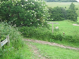
Lullingstone Country Park is near Eynsford, in Kent, England. A former deer park of a large estate, it was later sold to become an open-space and woodland park. The park and Lullingstone Castle are a Scheduled Monument, and an area of 66.4-hectare (164-acre) is a biological Site of Special Scientific Interest Kent.

<span class="mw-page-title-main">Preston Hill Country Park</span>

Preston Hill Country Park is in Eynsford, in Kent, England. It is a woodland and former military firing range.

Northfleet Urban Country Park is in Northfleet, in Kent, England. The site is land encompassed by Springhead Road, Thames Way, west of Vale Road and the railway . The site is owned by and managed by Gravesham Borough Council.

Finglesham Anglo-Saxon cemetery is a place of burial that was used from the sixth to the eighth centuries CE. It is located adjacent to the village of Finglesham, near Sandwich in Kent, South East England. Belonging to the Anglo-Saxon period, it was part of the much wider tradition of burial in Early Anglo-Saxon England.

<span class="mw-page-title-main">Darent Valley Hospital</span> Hospital in England

Darent Valley Hospital is a 478-bed, acute district general hospital in Dartford, Kent, England. The hospital has an Emergency Department. The hospital is managed by the Dartford and Gravesham NHS Trust.

<span class="mw-page-title-main">Dartford Heath</span>

Dartford Heath Common is an area of open heathland situated to the south-west of Dartford, Kent, England, that covers around 314 acres (127 ha) of open space. Dartford Heath is classified as lowland heath and is one of only two substantial heathland blocks remaining in Kent. The heath supports a number of rare plants and invertebrates, as well as reptiles, including the common lizard and slow-worm, and rabbits.

<span class="mw-page-title-main">Kingston Brooch</span> 7th-century Anglo-Saxon composite brooch

The Kingston Brooch is the largest known Anglo-Saxon composite brooch, and is considered by scholars to be an outstanding example of the composite disc brooch style. Over time, the Kingston brooch has become widely recognized for its charm, inherent value and detailed workmanship. The brooch, created in the seventh century, is now in the World Museum Liverpool in Liverpool, England.

References

  1. "6. Darenth Park Hospital". Kentarchaeology.org.uk. March 2006. Retrieved 30 November 2013.
  2. "SAXON SETTLERS IN THE DARTFORD AREA". www.dartfordarchive.org.uk. Retrieved 30 November 2013.
  3. "Darenth bowl". www.dartfordarchive.org.uk. Retrieved 30 November 2013.
  4. Historic England (1979). "Anglo-Saxon cemetery at Darenth Park (1003126)". National Heritage List for England . Retrieved 30 November 2013.
  5. Veronika & Fred Chambers and Rob Higgins Hospitals of London (2014) , p. 177, at Google Books
  6. "Darenth Park Hospital". ezitis.myzen.co.uk. June 2009. Retrieved 30 November 2013.
  7. "Darenth Country Park". www.bfdc.co.uk. 4 July 2000. Retrieved 30 November 2013.
  8. Stephen Wynn Dartford in the Great War (2016) , p. 100, at Google Books
  9. "Millennium capital project: Changing Places: Darenth Country Park, Dartford, Kent: monthly project measures; detailed appraisal review (DAR)". Nationalarchives.gov.uk. 1 January 1995. Retrieved 30 November 2013.
  10. "Darenth Country Park". Bushcraftexperience.com. 5 February 2012. Retrieved 30 November 2013.
  11. "Archived copy" (PDF). Archived from the original (PDF) on 26 March 2012. Retrieved 23 June 2011.{{cite web}}: CS1 maint: archived copy as title (link)
  12. "SSSI name: Scord's Wood and Brockhoult Mount" (PDF). Sssi.naturalengland.org.uk. 1968. Archived from the original (PDF) on 24 October 2012. Retrieved 30 November 2013.
  13. "Darenth Country Park". Woodland Trust. Retrieved 12 September 2022.
  14. "Kentish fillbasket apple". Orangepippin.com. Retrieved 2 December 2013.
  15. "Golden Pippin Apple". Keepers-nursery.co.uk. Archived from the original on 28 December 2014. Retrieved 2 December 2013.
  16. "Red Devil apple". Orangepippin.com. Retrieved 2 December 2013.
  17. "Pony close to death after food swells in stomach following Darenth Country Park break-in". Newsshopper.co.uk. South East UK. 13 November 2013. Retrieved 30 November 2013.