Lewes is an incorporated city on the Delaware Bay in eastern Sussex County, Delaware, United States. According to the 2020 census, its population was 3,303. Along with neighboring Rehoboth Beach, Lewes is one of the principal cities of Delaware's rapidly growing Cape Region. The city lies within the Salisbury, Maryland–Delaware Metropolitan Statistical Area. Lewes proudly claims to be "The First Town in The First State."

Dewey Beach is an incorporated coastal town in eastern Sussex County, Delaware, United States. According to the 2010 census, the population of the town is 341, an increase of 13.3% over the previous decade. It is part of the rapidly growing Cape Region and lies within the Salisbury, Maryland-Delaware Metropolitan Statistical Area. In 2011, the NRDC awarded Dewey Beach with a 5-Star rating in water quality. This award was given only to 12 other locations, one being neighboring Rehoboth Beach. Out of the 30 states with coastline, the Delaware Beaches ranked number 1 in water quality in 2011.

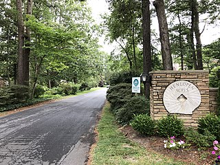
Henlopen Acres is a municipality north of Rehoboth Beach in Sussex County, Delaware, United States, and is the third smallest incorporated town in Delaware. According to 2010 census figures, the population of the town is 122, a 12.2% decrease from the 2000 census. It is part of the Salisbury, Maryland-Delaware Metropolitan Statistical Area.

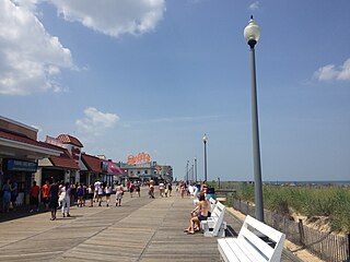
Rehoboth Beach is a city on the Atlantic Ocean along the Delaware Beaches in eastern Sussex County, Delaware, United States. As of 2020, its population was 1,108. Along with the neighboring coastal town of Lewes, Rehoboth Beach is one of the principal cities of Delaware's rapidly growing Cape Region. Rehoboth Beach lies within the Salisbury metropolitan area.

U.S. Route 113 (US 113) is a U.S. Highway that is a spur of US 13 in the U.S. states of Maryland and Delaware. The route runs 74.75 miles (120.30 km) from US 13 in Pocomoke City, Maryland, north to Delaware Route 1 (DE 1) in Milford, Delaware. In conjunction with DE 1, US 113 is one of two major north–south highways on the Delmarva Peninsula that connect Dover with Pocomoke City and the Eastern Shore of Virginia. The U.S. Highway is the primary north–south highway in Worcester County, Maryland, where it connects Pocomoke City with Snow Hill and Berlin. US 113 is one of three major north–south highways in Sussex County, Delaware, where it connects Selbyville, Millsboro, and Georgetown with Milford. While US 113 does not pass through Ocean City or the Delaware Beaches, the U.S. Highway intersects several highways that serve the Atlantic seaboard resorts, including US 50, Maryland Route 90 (MD 90), US 9, DE 404, DE 16, and DE 1. US 113 is a four-lane divided highway for its whole length.

Delaware Route 1 (DE 1) is the longest numbered state highway in the U.S. state of Delaware. The route runs 102.63 mi (165.17 km) from the Maryland state line in Fenwick Island, Sussex County, where the road continues south into that state as Maryland Route 528 (MD 528), north to an interchange with Interstate 95 (I-95) in Christiana, New Castle County, where the roadway continues north as part of DE 7. Between Fenwick Island and Dover Air Force Base in Dover, Kent County, DE 1 is a multilane divided highway with at-grade intersections and occasional interchanges. The route heads north through the Delaware Beaches resort area along the Atlantic Ocean before it runs northwest through rural areas, turning north at Milford to continue to Dover. Upon reaching Dover, DE 1 becomes the Korean War Veterans Memorial Highway, a freeway that is partially tolled. Between Dover and Tybouts Corner, DE 1 parallels U.S. Route 13 (US 13), crossing over and featuring interchanges with it multiple times. Past Tybouts Corner, the freeway heads north parallel to DE 7 to the northern terminus of DE 1 in Christiana. DE 1 serves as the main north-south state highway in Delaware, connecting the Delaware Beaches with the Dover and Wilmington areas.

Delaware Route 404 (DE 404) is a major state highway in Sussex County, Delaware that spans the east-west width of the state. DE 404's western terminus is at the Maryland border northwest of Bridgeville, where the road continues into that state as Maryland Route 404 (MD 404), and its eastern terminus is at the Five Points intersection with U.S. Route 9 (US 9), DE 1, and US 9 Business in Nassau. The route passes through rural areas as well as the towns of Bridgeville and Georgetown. DE 404 runs concurrent with DE 18 from east of Bridgeville to Georgetown and with US 9 from Georgetown to Five Points. DE 404 has a business route, DE 404 Bus., that passes through Bridgeville and a truck route, DE 404 Truck, that bypasses Georgetown. DE 404, along with MD 404, serves as a major route connecting the Chesapeake Bay Bridge and the Baltimore–Washington Metropolitan Area with the Delaware Beaches.

Delaware Route 16 (DE 16) is an east-west state highway in Delaware, mainly across northern Sussex County, with a small portion near the Maryland border in extreme southwestern Kent County. It runs from Maryland Route 16 (MD 16) at the Maryland border in Hickman east to the Delaware Bay at Broadkill Beach. The route passes through rural areas along with the towns of Greenwood, Ellendale, and Milton. DE 16 intersects DE 36 and U.S. Route 13 (US 13) in Greenwood, US 113 in Ellendale, DE 30 and DE 5 in the Milton area, and DE 1 between Milton and Broadkill Beach. West of DE 1, the route serves as part of a connection between the Baltimore–Washington Metropolitan Area and the Delaware Beaches. DE 16 was built as a state highway during the 1920s and 1930s. By 1936, the route was designated onto its current alignment.

Delaware Route 896 (DE 896) is a state highway located in New Castle County, Delaware. The route runs from U.S. Route 13 (US 13) in Boyds Corner north to the Maryland border northwest of Newark, where the road becomes unsigned Maryland Route 896 (MD 896) briefly before heading into Pennsylvania as Pennsylvania Route 896 (PA 896). The route heads west from US 13 before turning north along with DE 71 in Mount Pleasant, crossing the Chesapeake & Delaware Canal on the Summit Bridge. After the bridge, DE 71 splits off to the east and the road continues to Glasgow, where it comes to an intersection with US 40. DE 896 continues north and interchange with Interstate 95 (I-95) before reaching Newark, where it bypasses the University of Delaware to the west by following DE 4, Elkton Road, and South Main Street. DE 896 comes to downtown Newark and continues northwest to the Maryland border. DE 896 has a business route, DE 896 Business, that passes through Glasgow, and had an alternate alignment south of Glasgow called DE 896 Alternate.

Delaware Route 273 (DE 273) is a state highway in New Castle County, Delaware. The route runs from Maryland Route 273 (MD 273) at the Maryland border near Newark east to DE 9 and DE 141 in New Castle. The route heads through suburban areas between Newark and New Castle as a multilane road, passing through Ogletown and Christiana. DE 273 intersects DE 896 in downtown Newark; DE 2/DE 72 on the eastern edge of Newark; DE 4 in Ogletown; Interstate 95 (I-95), DE 7, and DE 1 in Christiana; DE 37 in Pleasantville; and DE 58 and U.S. Route 13 (US 13)/US 40 in Hares Corner.

Cape Henlopen Light was a lighthouse near Lewes, in present-day Cape Henlopen State Park, Delaware, United States. The lighthouse was on the north side of the Great Dune on Cape Henlopen, Delaware. It was the sixth lighthouse built in the colonies.

Delaware Route 14 (DE 14) is a state highway in the southern part of Kent County, Delaware. The route runs from the Maryland state line near Burrsville, Maryland, where the road continues as Maryland Route 317 (MD 317), east to DE 1 in Milford. The route passes through Harrington, where it intersects U.S. Route 13 (US 13), and heads to the north of Houston before coming to Milford, where it intersects DE 15, US 113, and DE 1 Business. DE 14 has a truck bypass of Harrington known as DE 14 Truck.

Delaware Route 10 (DE 10) is a state highway in Kent County, Delaware. It runs from Maryland Route 287 (MD 287) at the Maryland border in Sandtown east to an interchange with the DE 1 freeway at the North Gate of Dover Air Force Base in the southeastern part of the city of Dover. The route passes through the towns of Camden and Wyoming along the way. From the Maryland border to Camden, it is a two-lane undivided road that passes through rural areas. DE 10 is a four-lane divided highway called Lebanon Road between U.S. Route 13 (US 13) in Camden and DE 1. DE 10 has one alternate route, DE 10 Alternate, which runs between Willow Grove and Highland Acres along an alignment further to the south, passing through Woodside and Rising Sun.

Delaware Route 24 (DE 24) is a state highway located in Sussex County, Delaware. The route runs from Maryland Route 348 (MD 348) at the Maryland border east of Sharptown, Maryland, east to an intersection with DE 1 in Midway, between Lewes and Rehoboth Beach. Along the way, DE 24 passes through Laurel, Millsboro, and Long Neck. DE 24 intersects U.S. Route 13 (US 13) in Laurel, US 113/DE 20 and DE 30 in Millsboro, and DE 5 and DE 23 in Long Neck. DE 24 features an alternate route, DE 24 Alternate, that runs to the north of the route from US 113 in Stockley to DE 24 near Midway. DE 24 was built as a state highway throughout the 1920s, with completion of the entire route by 1931. DE 24 was assigned onto its current alignment by 1936. DE 24 Alt. was designated by 2006.

Delaware Route 23 (DE 23) is a 15.63-mile-long (25.15 km) state highway in Sussex County, Delaware. Its southern terminus is at Massey's Landing in Long Neck, near the confluence of Rehoboth Bay and Indian River Bay and its northern terminus is at the Five Points intersection in Nassau, where it ends at U.S. Route 9 (US 9)/DE 404. From the southern terminus, the route runs west through residential areas of Long Neck before heading north through rural areas with some development. DE 23 is concurrent with DE 5 between the DE 24 intersection in Long Neck and Fairmount. It is also concurrent with DE 24 Alternate between Hollymount and the DE 1D intersection in Five Points. The road was designated as part of DE 22 south of Fairmount for a short time in the 1930s, with DE 5 designated along the stretch between DE 24 and Fairmount by 1938; the remainder of the road was unnumbered. The road was fully paved by 1970. The DE 23 designation was assigned by 1994.

U.S. Route 9 (US 9) is a United States Numbered Highway in the Northeastern U.S., running from Laurel, Delaware, north to Champlain, New York. In Delaware, the route runs a southwest–northeast path through Sussex County. Even though US 9 is signed north–south for the remainder of its route, the segment in Delaware is signed east–west. The highway runs from its western terminus at US 13 in Laurel northeast to the Cape May–Lewes Ferry terminal in Lewes, where the ferry carries the route across the Delaware Bay to North Cape May, New Jersey. US 9 passes through rural areas and serves the communities of Laurel, Georgetown, and Lewes. US 9 intersects Delaware Route 20 (DE 20) in Hardscrabble, US 113 and DE 18/DE 404 in Georgetown, DE 30 in Gravel Hill, DE 5 in Harbeson, and DE 1 at the Five Points intersection in Nassau. US 9 runs concurrent with DE 404 between Georgetown and Five Points and with DE 1 between Five Points and Carpenters Corner.

U.S. Route 13 (US 13) is a U.S. highway running from Fayetteville, North Carolina, north to Morrisville, Pennsylvania. In the U.S. state of Delaware, the route runs for 103.33 mi (166.29 km). It traverses the entire north–south length of the state from the Maryland state line in Delmar, Sussex County, north to the Pennsylvania state line in Claymont, New Castle County. US 13 connects many important cities and towns in Delaware, including Seaford, Dover, and Wilmington. The entire length of US 13 in Delaware is a multilane divided highway with the exceptions of the segment through Wilmington and parts of the route in Claymont. Between the Maryland state line and Dover, US 13 serves as one of the main north–south routes across the Delmarva Peninsula. From Dover north to Tybouts Corner, the route is followed by the controlled-access Delaware Route 1 (DE 1) toll road, which crosses the route multiple times and has multiple interchanges with it. US 13 bypasses downtown Wilmington to the east before it heads northeast of the city parallel to Interstate 495 (I-495) and the Delaware River to Claymont. US 13 is the longest numbered highway in the state of Delaware.

U.S. Route 13 (US 13) runs along the Atlantic coastline for over 500 miles (800 km), passing through five states. Along its route, it possessed numerous special routes, which are all loops off the mainline US 13. At present, there are at least 15 special routes in existence: two in North Carolina, five in Virginia, two in Maryland, four in Delaware, and two in Pennsylvania. 13 others have existed in the past but have been deleted.

A total of at least three special routes of U.S. Route 9 (US 9) exist and at least seven have been decommissioned.

The Cape Henlopen Region, or the Cape Region, is a region in Sussex County, in southern Delaware, on the Delmarva Peninsula. The region is part of the Salisbury, Maryland-Delaware Metropolitan Statistical Area. The region takes its name from Cape Henlopen, as does the Cape Henlopen School District and Cape Henlopen State Park. Much of the region's populated areas are found along the Delaware Bay, Rehoboth Bay and the Atlantic Ocean. Northern and western parts of the Cape Region are rural areas dominated by farmland and wetlands. The area is often referred to as the Delaware Beaches.


