Dellach im Drautal

Last updated
Dellach im Drautal
Pfarrkirche Dellach im Drautal.JPG
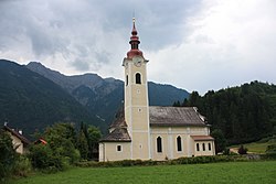
Dellach im Drautal parish church
AUT Dellach im Drautal COA.svg
Austria adm location map.svg
Red pog.svg
Dellach im Drautal
Location within Austria
Coordinates: 46°44′N13°5′E / 46.733°N 13.083°E / 46.733; 13.083
Country Austria
State Carinthia
District Spittal an der Drau
Government
   Mayor Johannes Pirker
Area
[1]
  Total
76.12 km2 (29.39 sq mi)
Elevation
614 m (2,014 ft)
Population
 (2018-01-01) [2]
  Total
1,595
  Density21/km2 (54/sq mi)
Time zone UTC+1 (CET)
  Summer (DST) UTC+2 (CEST)
Postal code
9772
Area code 04714
Website www.dellach-drau.at

Dellach im Drautal is a town in the district of Spittal an der Drau in the Austrian state of Carinthia.

Contents

Geography

Dellach im Drautal lies in the Drau valley about halfway between Lienz and Spittal, between the Gailtal Alps on the south and the Kreuzeck group of the Hohe Tauern on the north.

Climate

Climate data for Dellach im Drautal, Austria
MonthJanFebMarAprMayJunJulAugSepOctNovDecYear
Mean daily maximum °C (°F)1
(34)
7
(45)
12
(54)
16
(61)
22
(72)
23
(73)
26
(79)
25
(77)
20
(68)
15
(59)
6
(43)
1
(34)
15
(58)
Mean daily minimum °C (°F)−6
(21)
−4
(25)
0
(32)
3
(37)
9
(48)
11
(52)
13
(55)
13
(55)
9
(48)
6
(43)
0
(32)
−5
(23)
4
(39)
Average precipitation mm (inches)68
(2.7)
10
(0.4)
93
(3.7)
119
(4.7)
91
(3.6)
117
(4.6)
109
(4.3)
114
(4.5)
137
(5.4)
112
(4.4)
219
(8.6)
54
(2.1)
1,243
(49)
[ citation needed ]

References

  1. "Dauersiedlungsraum der Gemeinden Politischen Bezirke und Bundesländer - Gebietsstand 1.1.2018". Statistics Austria. Retrieved 10 March 2019.
  2. "Einwohnerzahl 1.1.2018 nach Gemeinden mit Status, Gebietsstand 1.1.2018". Statistics Austria. Retrieved 9 March 2019.