Irschen

Last updated
Irschen
Irschen.JPG
Wappen at irschen.png
Austria adm location map.svg
Red pog.svg
Irschen
Location within Austria
Coordinates: 46°45′N13°1′E / 46.750°N 13.017°E / 46.750; 13.017 Coordinates: 46°45′N13°1′E / 46.750°N 13.017°E / 46.750; 13.017
Country Austria
State Carinthia
District Spittal an der Drau
Government
   Mayor Gottfried Mandler
Area
[1]
  Total33.35 km2 (12.88 sq mi)
Elevation
809 m (2,654 ft)
Population
 (2018-01-01) [2]
  Total2,022
  Density61/km2 (160/sq mi)
Time zone UTC+1 (CET)
  Summer (DST) UTC+2 (CEST)
Postal code
9773
Area code 04710
Website www.irschen.at

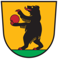
Irschen is a municipality in the district of Spittal an der Drau in the Austrian state of Carinthia.
Contents

Geography

It consists of the Katastralgemeinden Irschen, Ritterdorf, and Simmerlach. It is situated on the northern slope of the Upper Drava Valley, near the B 100 Drautal Straße highway and the Drautalbahn railway line.

Panorama near Potschling, panorama Bij Potschling, panorama IMG 1608 2019-08-08 14.00.jpg
Panorama near Potschling, panorama
View to Grofelhof Bij Grofelhof, dorpszicht IMG 1621 2019-08-08 14.28.jpg
View to Gröfelhof

History

A settlement area since the Early Iron Age (Hallstatt Culture), Irschen may be identical to the Idunum polis in the former Celtic kingdom of Noricum, as mentioned in Ptolemy's Geographia. In Roman times a mansio laid on the road leading over the Gailbergsattel mountain pass to Italia. Ursus I, Patriarch of Aquileia probably built a first church about 810 in the place then called Ursen, which was mentioned as Castrum Ursen in a 1086 deed. In medieval times Irschen was a mining area, especially for gold.

It was recently revealed that English actress Billie Piper has a home in this region.

Related Research Articles

Bad Fischau-Brunn Place in Lower Austria, Austria

The market town of Bad Fischau-Brunn is an Austrian municipality in the district of Wiener Neustadt-Land in Lower Austria. It is situated some 50 km south of Vienna at the edge of Viennese Basin.

Krumbach, Lower Austria Place in Lower Austria, Austria

Krumbach is a market town in southern Lower Austria, Austria. It is part of the landscape Bucklige Welt.

Steinbach am Attersee Place in Upper Austria, Austria

Steinbach am Attersee is a municipality of the Vöcklabruck district in the Austrian state of Upper Austria. It is situated in the Hausruckviertel region on the eastern banks of the Attersee, part of the Salzkammergut area.

Frastanz Place in Vorarlberg, Austria

Frastanz is a market town in the district of Feldkirch in the westernmost Austrian state of Vorarlberg. In earlier times is was known for its production of tobacco.

Tadten Place in Burgenland, Austria

Tadten is a village in the district of Neusiedl am See in Burgenland in Austria.

Dellach Place in Carinthia, Austria

Dellach is a municipality in the district of Hermagor, in the Austrian state of Carinthia.

Glödnitz Place in Carinthia, Austria

Glödnitz is a municipality in the district of Sankt Veit an der Glan in the Austrian state of Carinthia.

Spitz, Austria town in Lower Austria, Austria

Spitz an der Donau is a market town in the district of Krems-Land in the Austrian state of Lower Austria, in the midst of the UNESCO World Heritage area Wachau, further down from Willendorf on the left bank of the Danube. The ferry across the Danube here is interesting in that it has no motor or sail: it is powered by rudder set against the river current, anchored to a cable above the river. The ferry carries passengers, bicycles, motorcycles, and automobiles.

Flaurling Place in Tyrol, Austria

Flaurling is a municipality in the district Innsbruck country in Tyrol (Austria). It lies in the Inn valley between Innsbruck and Telfs south of the Inn River.

Dienten am Hochkönig Place in Salzburg, Austria

Dienten am Hochkönig is a municipality in the district of Zell am See, in the state of Salzburg in Austria. The population is 800.

Flirsch Place in Tyrol, Austria

Flirsch is a municipality in the Landeck district in Austrian state of Tyrol. It is located 11 km west of Landeck and 10 km east of Sankt Anton am Arlberg.

Tulfes Place in Tyrol, Austria

Tulfes is a municipality in the district of Innsbruck-Land in the Austrian state of Tyrol, located 12 km east of Innsbruck and 6 km above Hall in Tirol. The village was mentioned as “Tellevo” for the first time in 1240. Main source of income is tourism. Tulfes became a popular area of settlement due to the cities of Innsbruck and Hall.

Thaur Place in Tyrol, Austria

Thaur is a municipality in the district of Innsbruck-Land in the Austrian state of Tyrol located 5 km east of Innsbruck between Rum, Austria and Hall in Tirol.

Ranggen Place in Tyrol, Austria

Ranggen is a municipality in the district of Innsbruck-Land in the Austrian state of Tyrol located 12 km west of Innsbruck. The location was mentioned as “Fergen” in 1482 for the first time. Ranggen has 17 parts.

Mils, Tyrol Place in Tyrol, Austria

Mils is a municipality in the district Innsbruck-Land of Tyrol, Austria. It is located 12 km east of Innsbruck. The area is restricted by the Weißenbach in the west and the Inn in the south. The location was mentioned in documents in 930 for the first time. In the last 40 years Mils grew enormously thanks to its sunny location.

Koppl Place in Salzburg, Austria

Koppl is a municipality in the district of Salzburg-Umgebung in the state of Salzburg in Austria. In the west it borders on the Salzburg urban area.

Ulrichsberg Place in Upper Austria, Austria

Ulrichsberg is a municipality in the district of Rohrbach in the Austrian state of Upper Austria.

Schwarzenberg am Böhmerwald Place in Upper Austria, Austria

Schwarzenberg am Böhmerwald is a municipality in the district of Rohrbach in the Austrian state of Upper Austria.

Grafendorf bei Hartberg Place in Styria, Austria

Grafendorf bei Hartberg is a municipality in the district of Hartberg-Fürstenfeld in Styria, Austria.

Kraubath an der Mur Place in Styria, Austria

Kraubath an der Mur is a municipality in the district of Leoben in the Austrian state of Styria.

References

  1. "Dauersiedlungsraum der Gemeinden Politischen Bezirke und Bundesländer - Gebietsstand 1.1.2018". Statistics Austria. Retrieved 10 March 2019.
  2. "Einwohnerzahl 1.1.2018 nach Gemeinden mit Status, Gebietsstand 1.1.2018". Statistics Austria. Retrieved 9 March 2019.