Obervellach

Last updated
Obervellach
Obervellach Hauptplatz 08042007 27.jpg
Main square
Obervellach CoA.svg
Austria adm location map.svg
Red pog.svg
Obervellach
Location within Austria
Coordinates: 46°55′N13°12′E / 46.917°N 13.200°E / 46.917; 13.200 Coordinates: 46°55′N13°12′E / 46.917°N 13.200°E / 46.917; 13.200
Country Austria
State Carinthia
District Spittal an der Drau
Government
   Mayor Arnold Klammer (SPÖ)
Area
[1]
  Total104.42 km2 (40.32 sq mi)
Elevation
690 m (2,260 ft)
Population
 (2018-01-01) [2]
  Total2,201
  Density21/km2 (55/sq mi)
Time zone UTC+1 (CET)
  Summer (DST) UTC+2 (CEST)
Postal code
9821
Area code 04782
Website www.obervellach.at

Obervellach (Slovene : Zgornja Bela) is a market town in the district of Spittal an der Drau, in the Austrian state of Carinthia.

Contents

Geography

Moll Valley with Obervellach (left) and Tauern Railway line PfaffenbergObervellach.jpg
Möll Valley with Obervellach (left) and Tauern Railway line

The town is situated in the valley of the Möll river, on the southern slope of the High Tauern mountain range, where the Tauern Railway line descends from neighbouring Mallnitz and the southern Tauern Tunnel portal. The municipal area comprises the cadastral communities of Obervellach proper, Pfaffenberg, Lassach, and Söbriach.

History

The settlement of Velach was first mentioned in a 10th-century deed issued by the Bishop Abraham of Freising (d. 993/94), a Bavarian missionary among the East Alpine Slavs in the Duchy of Carinthia (former Carantania), known for the Slovene Freising manuscripts. The name is probably derived from Slavic bela ("white"). The local church was mentioned as 'Freising basilica' in 1072, it later became the seat of a deanery of the Salzburg archbishops.

The traditional gold and silver mining area from the 12th century onwards was a possession of the comital House of Gorizia (Görz); in 1164 their ministeriales took their residence at Falkenstein Castle high above the valley. The Counts of Gorizia also held nearby Groppenstein Castle, first mentioned in 1254. Obervellach market rights were attested in 1256. After an armed conflict over the inheritance of late Count Ulrich II of Celje, in which the Count Leonhard of Gorizia and his brother John II were defeated by the forces of Emperor Frederick III, the area of Obervellach in 1460 finally was incorporated into the Inner Austrian possessions of the ruling House of Habsburg.

Mining authority building Obervellach - Oberbergmeisteramt.jpg
Mining authority building

The town remained an important mining area; the Habsburg emperor Maximilian I himself confirmed the market rights and in 1509 decided on Obervellach as the seat of the Inner Austrian mining authority (Oberbergmeisteramt). The present-day Late Gothic church building was built around 1500, it was consecrated by Bishop Berthold of Chiemsee. A notable Renaissance altar was installed about 1520 at the behest of the Imperial captain Christoph Frankopan (Frangipani), brother-in-law of the Salzburg prince-archbishop Matthäus Lang von Wellenburg; it includes several pieces by the Dutch painter Jan van Scorel (1495–1562).

In the 17th century, gold and silver deposits were progressively depleted, they were replaced by new copper mines. When the travel writer Joseph Kyselak toured the region in 1825, he found Obervellach a still prosperous town. The Obervellach municipality was established in 1849, it then also comprised neighbouring Mallnitz, Flattach, and the cadastral community of Penk (part of the Reißeck municipality since 1973), which all became independent in 1896.

The Tauern Railway line was inaugurated in 1909, with a station near the village of Kaponig high above the Obervellach centre, which was accessible by a cable car until 1975. The station was finally closed in 1999, today trains stop at the Tauernschleuse car shuttle station in Mallnitz (Mallnitz-Obervellach).

Landmarks

Politics

Town hall Obervellach - Gemeindeamt2.JPG
Town hall

Seats in the municipal assembly (Gemeinderat) as of 2015 local elections:

Twin towns

Obervellach is twinned with:

Related Research Articles

<span class="mw-page-title-main">Spittal an der Drau</span> Place in Carinthia, Austria

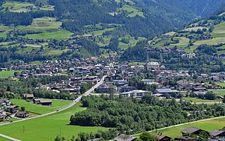
Spittal an der Drau is a town in the western part of the Austrian federal state of Carinthia. It is the administrative centre of Spittal an der Drau District, Austria's second largest district (Bezirk) by area.

<span class="mw-page-title-main">Lienz</span> Place in Tyrol, Austria

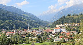
Lienz is a medieval town in the Austrian state of Tyrol. It is the administrative centre of the Lienz district, which covers all of East Tyrol. The municipality also includes the cadastral subdivision of Patriasdorf.

Bezirk Spittal an der Drau is an administrative district (Bezirk) in the state of Carinthia, Austria.

<span class="mw-page-title-main">Gmünd, Carinthia</span> Place in Carinthia, Austria

Gmünd in Kärnten is a municipality and historic town in the district of Spittal an der Drau, in the Austrian state of Carinthia.

<span class="mw-page-title-main">Seeboden</span> Place in Carinthia, Austria

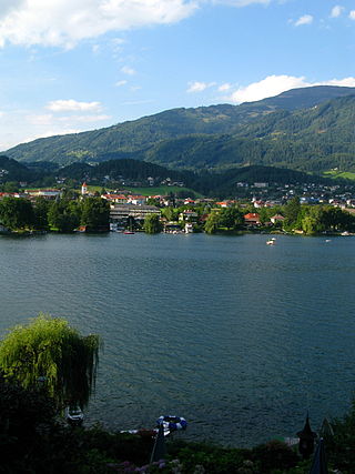
Seeboden am Millstätter See is a market town in Spittal an der Drau District in Carinthia, Austria.

<span class="mw-page-title-main">Moosburg, Austria</span> Place in Carinthia, Austria

Moosburg is a market town in the Klagenfurt-Land district in the Austrian state of Carinthia.

<span class="mw-page-title-main">Flattach</span> Place in Carinthia, Austria

Flattach is a municipality in Spittal an der Drau District in the Austrian state of Carinthia.

<span class="mw-page-title-main">Greifenburg</span> Place in Carinthia, Austria

Greifenburg is a market town in the district of Spittal an der Drau in the Austrian state of Carinthia.

<span class="mw-page-title-main">Krems, Carinthia</span> Place in Carinthia, Austria

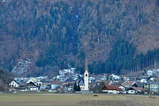
Krems in Kärnten is a municipality in the district of Spittal an der Drau in Carinthia in Austria.

<span class="mw-page-title-main">Mallnitz</span> Place in Carinthia, Austria

Mallnitz is a municipality in the Spittal an der Drau District in Carinthia, Austria.

<span class="mw-page-title-main">Oberdrauburg</span> Place in Carinthia, Austria

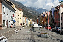
Oberdrauburg is a market town in the district of Spittal an der Drau at the western rim of the Austrian state of Carinthia.

<span class="mw-page-title-main">Reißeck</span> Place in Carinthia, Austria

Reißeck is a municipality in the district of Spittal an der Drau in Carinthia, Austria.

<span class="mw-page-title-main">Rennweg am Katschberg</span> Place in Carinthia, Austria

Rennweg am Katschberg is a market town in the district of Spittal an der Drau in Carinthia, Austria.

<span class="mw-page-title-main">Sachsenburg</span> Place in Carinthia, Austria

Sachsenburg is a market town in the district of Spittal an der Drau in Carinthia, Austria.

<span class="mw-page-title-main">Bad Bleiberg</span> Place in Carinthia, Austria

Bad Bleiberg is a market town in the district of Villach-Land, in Carinthia, Austria. Originally a mining area, especially for lead, Bad Bleiberg today due to its hot springs is a spa town.

<span class="mw-page-title-main">Wernberg</span> Place in Carinthia, Austria

Wernberg is a municipality in the district of Villach-Land in the Austrian state of Carinthia.

<span class="mw-page-title-main">Matrei in Osttirol</span> Place in Tyrol, Austria

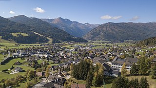
Matrei in Osttirol is a market town in the Lienz District in the Austrian state of Tyrol. It is situated about 29 km (18 mi) north of Lienz within the Hohe Tauern mountain range of the Central Eastern Alps. Its municipal area comprises parts of the Granatspitze Group and the Venediger Group, with the Großvenediger peak as its highest point. The population largely depends on tourism, seasonal agriculture and forestry.

<span class="mw-page-title-main">Sankt Michael im Lungau</span> Place in Salzburg, Austria

Sankt Michael im Lungau is a market town in the district of Tamsweg in the Austrian state of Salzburg.

<span class="mw-page-title-main">Falkenstein Castle (Niederfalkenstein)</span> Castle in Carinthia, Austria

Niederfalkenstein Castle is a medieval castle near Obervellach in Carinthia, Austria. It is part of the larger Falkenstein fortification complex; while the main fortress of Oberfalkenstein today is a ruin, the lower barbican of Niederfalkenstein is largely preserved.

<span class="mw-page-title-main">Möll</span> River in Carinthia, Austria

The Möll is a river in northwestern Carinthia in Austria, a left tributary of the Drava. Its drainage basin is 1,100.8 km2 (425.0 sq mi).

References

  1. "Dauersiedlungsraum der Gemeinden Politischen Bezirke und Bundesländer - Gebietsstand 1.1.2018". Statistics Austria. Retrieved 10 March 2019.
  2. "Einwohnerzahl 1.1.2018 nach Gemeinden mit Status, Gebietsstand 1.1.2018". Statistics Austria. Retrieved 9 March 2019.