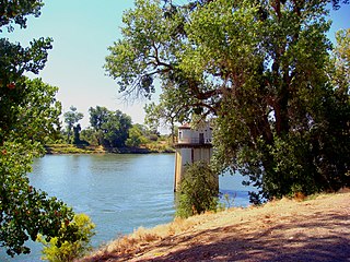
The Sacramento River is the principal river of Northern California in the United States and is the largest river in California. Rising in the Klamath Mountains, the river flows south for 400 miles (640 km) before reaching the Sacramento–San Joaquin River Delta and San Francisco Bay. The river drains about 26,500 square miles (69,000 km2) in 19 California counties, mostly within the fertile agricultural region bounded by the Coast Ranges and Sierra Nevada known as the Sacramento Valley, but also extending as far as the volcanic plateaus of Northeastern California. Historically, its watershed has reached as far north as south-central Oregon where the now, primarily, endorheic (closed) Goose Lake rarely experiences southerly outflow into the Pit River, the most northerly tributary of the Sacramento.

The Gold Country is a historic region in the northern portion of the U.S. state of California, that is primarily on the western slope of the Sierra Nevada. It is famed for the mineral deposits and gold mines that attracted waves of immigrants, known as the 49ers, during the 1849 California Gold Rush.

The Sacramento Valley is the area of the Central Valley of the U.S. state of California that lies north of the Sacramento–San Joaquin River Delta and is drained by the Sacramento River. It encompasses all or parts of ten Northern California counties. Although many areas of the Sacramento Valley are rural, it contains several urban areas, including the state capital, Sacramento.
You Bet is a small unincorporated community in Nevada County, California. You Bet is located in the Sierra Nevada foothills, 7 miles (11.3 km) east of Grass Valley and 5.5 miles (8.9 km) northeast of Chicago Park.
Sheep Ranch is an unincorporated community in Calaveras County, California. It lies at an elevation of 2359 feet.
Lake City is an unincorporated community in Nevada County, California. It lies at an elevation of 3300 ft. about 10 miles northeast of Nevada City as the crow flies, and about three miles southeast of North Columbia, and three miles southwest of North Bloomfield. It is located at the junction of modern day North Bloomfield, Back Bone and Lake City Roads. It was an important mining and transportation center in the second half of the 19th century.
The Sacramento Valley and Eastern Railway (SV&E) was a railway company that operated in Shasta County, California from 1908 until the early 1930s.
The Delta Consolidated Mining Company was an American mining company that operated a gold mine in Shasta County, California. A 3 ft narrow gauge railroad connecting the mine to the nearby town of Delta, California, operated for several decades.
Alpha was a gold mining town in Nevada County, located about 2 miles southeast of the town of Washington, California and about 15 miles northeast of Nevada City, California. It lay at an elevation of 4120 feet, about 2 miles below the South Yuba River and just west of Scotchman Creek.
Spenceville was a ranching, farming and mining community located in the southwestern part of Nevada County, California, on Spenceville Road just east of Waldo Road, about 17 miles from Grass Valley. Its elevation was about 400 feet. The former townsite is now part of the Spenceville Wildlife Area.
Little York is the name of one of the first gold mining towns established in Nevada County, California as well as the name of the township in which it was situated. The town was located on the Lowell Ridge between Steephollow Creek and the Bear River, about 13 miles east of Nevada City, California and about 1 mile southwest of Dutch Flat, California at an elevation of about 2800 feet.
Red Dog was a California gold rush mining town located in the Gold Country in south-central Nevada County, California, United States, 6 mi (9.7 km) northeast of Chicago Park. Red Dog Hill, a mine and campsite, was founded by three men all under the age of 22, and was named by their youngest, a 15-year-old prospector. As mining operations grew, the campsite became a settlement, and then a town with a population of 2,000 residents, before it was eventually abandoned. Still considered important today, Red Dog Townsite is listed on the National Register of Historic Places.

Southport is an unincorporated locale in Coos County, Oregon, United States. It was located along Southport Creek, near where the creek flows into Isthmus Slough, 6.5 miles (10 km) south of the city of Coos Bay, at an elevation of 30 feet. The former community is now a ghost town.

Cottonwood Creek is a major stream and tributary of the Sacramento River in Northern California. About 68 miles (109 km) long measured to its uppermost tributaries, the creek drains a large rural area bounded by the crest of the Coast Ranges, traversing the northwestern Sacramento Valley before emptying into the Sacramento River near the town of Cottonwood. It defines the boundary of Shasta and Tehama counties for its entire length. Because Cottonwood Creek is the largest undammed tributary of the Sacramento River, it is known for its Chinook salmon and steelhead runs.

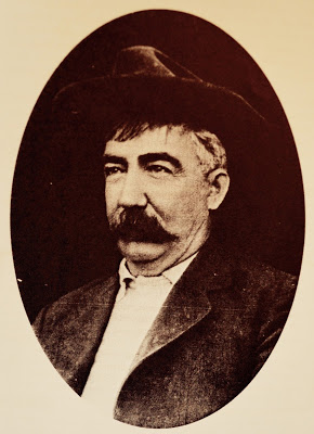
Joseph Mayer was an American businessman, gold prospector and pioneer who founded the town of Mayer, Arizona.
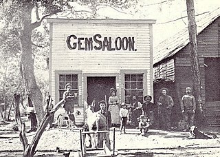
Beegum, also known as Bee Gum, is a defunct town which was located in an unincorporated area of Tehama and Shasta counties, in the U.S. state of California. In the early 1900s, it was a mining town in the Harrison Gulch mining district.

Manchester was a mining town in the Los Burros Mining District in the southern Big Sur region of Monterey County, California from about 1875 to 1895. The town was reached by a 20 miles (32 km) road from King City to Jolon. From Jolon travelers could ride or take a stage or wagon to the Wagon Caves, followed by a difficult 14 miles (23 km) trail over the steep Santa Lucia Mountains to the site, about 4 miles (6.4 km) inland of Cape San Martin. Prospecting began in the area in the 1850s.

Reading's Bar is a historical site in Redding, California in Shasta County. Reading's Bar is a California Historical Landmark No. 32 listed on August 1, 1932. Reading's Bar was named after Major Pierson Barton Reading, who discovered gold on the Clear Creek bar in May 1848, starting a California Gold Rush in the surrounding area. Later he found gold on a sandbar on the Trinity River that started the Trinity Alps Gold Rush. Reading's gold discovery was a major part of the California Gold Rush and news of the find created a rush of gold prospecting in Northern California, well north of the better-known gold fields of the Sierra Nevada foothills.

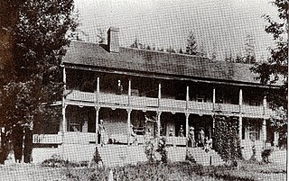
Southern's Stage Station was built in 1859 by Simeon Fisher Southern. The Southern's Stage Station site is on 9010 Mears Ridge Road, south of Castella, California in Shasta County. The Southern's Stage Station is a California Historical Landmark No. 33 listed on August 1, 1932. Simeon Fisher Southern and his Sarah Southern operated the Stagecoach Station wife Southern's Stage Station and Southern Hotel were log cabin building built in 1859. Travelers on the stagecoach or riding through could stop for rest and food for the 50 years this station operated till 1909. The town was called Hazel Creek, California, but change to Sims, California in 1871 as Southern's Stage Station and store was the center of the town.


