
The Yorkshire Dales are a series of valleys, or dales, in the Pennines, an upland range in England. They are mostly located in the ceremonial county of North Yorkshire, but extend into Cumbria and Lancashire; they were historically entirely within Yorkshire. The majority of the dales are within the Yorkshire Dales National Park, created in 1954. The exception is the area around Nidderdale, which forms the separate Nidderdale Area of Outstanding Natural Beauty.

The Settle–Carlisle line is a 73-mile-long (117 km) main railway line in northern England. The route, which crosses the remote, scenic regions of the Yorkshire Dales and the North Pennines, runs between Settle Junction, on the Leeds–Morecambe line, and Carlisle, near the English-Scottish borders. The historic line was constructed in the 1870s and has several notable tunnels and viaducts such as the imposing Ribblehead.

The Ribblehead Viaduct or Batty Moss Viaduct carries the Settle–Carlisle railway across Batty Moss in the Ribble Valley at Ribblehead, in North Yorkshire, England. The viaduct, built by the Midland Railway, is 28 miles (45 km) north-west of Skipton and 26 miles (42 km) south-east of Kendal. It is a Grade II* listed structure. Ribblehead Viaduct is the longest and the third tallest structure on the Settle–Carlisle line.

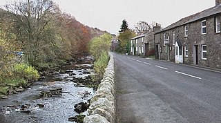
Dent is a village and civil parish in Cumbria, England, within the historic boundaries of the West Riding of Yorkshire. It lies in Dentdale, a narrow valley on the western slopes of the Pennines within the Yorkshire Dales National Park, 4 miles (6 km) south east of Sedbergh and 8 miles (13 km) north east of Kirkby Lonsdale. At the 2011 census, Dent and Middleton had a total population of 785.
Garsdale Head is a hamlet mainly within the South Lakeland district of Cumbria, England. Historically part of the West Riding of Yorkshire, the hamlet is now on the border with Richmondshire, North Yorkshire. It lies within the boundaries of the Yorkshire Dales National Park.

Great Knoutberry Hill, also commonly known as Widdale Fell, is a mountain located near Dent at the heads of Ribblesdale, Dentdale and Wensleydale, in the Yorkshire Dales National Park and within the boundaries of the historic county of Yorkshire. In fact, the borders between the West Riding and North Riding of Yorkshire meet at the summit, and the border between the modern administrative counties of Cumbria and North Yorkshire also runs over the fell. At a height of 2,205 feet (672 m) above sea level it is the 16th-highest fell in the Yorkshire Dales, with Rogan's Seat being exactly the same height.
River Skirfare is a small river in North Yorkshire, England, that flows through Littondale and ends where it joins the larger River Wharfe. The source is the confluence of Foxup Beck and Cosh Beck at the hamlet of Foxup.

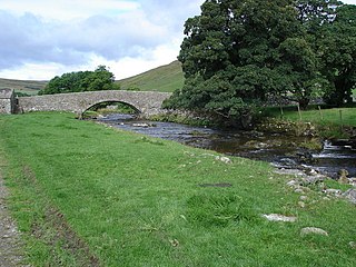
The River Dee is a river running through the extreme south east of Cumbria, a part of the Craven region traditionally part of the West Riding of Yorkshire. Its name possibly derives from Brythonic deva meaning goddess, or from Dent or Dentdale, through which the river flows.

Rylstone is a village and civil parish in the former Craven district of North Yorkshire, England. It is situated very near to Cracoe and about 6 miles (9.7 km) south west of Grassington. The population of the civil parish as of the 2001 census was 122, and had risen to 160 by the time of the 2011 census. In 2015, the population was estimated to be 180.
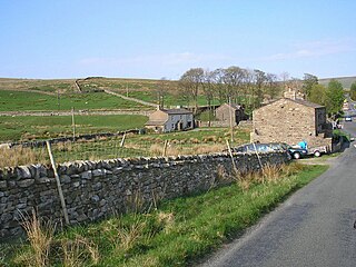
Garsdale is a dale or valley in the south east of Cumbria, England, historically a part of the West Riding of Yorkshire. It is now within the Westmorland and Furness local government district, and in the Yorkshire Dales National Park for planning purposes. In the 2001 census the parish had a population of 202, decreasing at the 2011 census to 191.

Dentdale is a dale or valley in the north-west of the Yorkshire Dales National Park in Cumbria, England. It is the valley of the River Dee, but takes its name from the village of Dent. The dale runs east to west, starting at Dent Head, which is the location of a railway viaduct on the Settle-Carlisle Line.

Sinnington is a village and civil parish in North Yorkshire, England. It is located on the southern boundary of the North York Moors National Park.

A Dales High Way is a long-distance footpath in northern England. It is 90 miles (140 km) long and runs from Saltaire in West Yorkshire to Appleby-in-Westmorland, Cumbria, roughly parallel to the line of the Settle and Carlisle Railway.

The Richmond to Lancaster Turnpike, was a road that was opened in the second half of the 18th century between Richmond, in the North Riding of Yorkshire and Lancaster in Lancashire, Northern England. The turnpike was built to allow goods to be taken from Yorkshire to the port of Lancaster. It was approved in 1751, but was not wholly completed until 1774.

Arten Gill Viaduct is an eleven-arch railway bridge in Dentdale, Cumbria, England. The viaduct carries the Settle to Carlisle railway line over Artengill Beck. The viaduct was originally designed to be further west, which is lower down the steep valley side, but by moving the line slightly eastwards, the viaduct could be installed at a higher location, thereby using fewer materials in its height. Arten Gill Viaduct is constructed partly from Dent Marble in the inside of the arches instead of the more usual brick. Dent Marble is a type of dark limestone which was quarried from Artengill beneath the viaduct itself. The viaduct is a grade II listed structure, and a scheduled monument.

Dent Head Viaduct is a railway viaduct on the Settle–Carlisle line in Dentdale, Cumbria, England. It is the second major viaduct on the line northwards after Ribblehead Viaduct, and is just north of Blea Moor Tunnel at milepost 251, and to the south of Arten Gill Viaduct. Construction of the viaduct began in 1869, and it was completed in 1875, extra time being needed due to periods of heavy rainfall. The line bows slightly to the east in order to follow the contours of Woldfell, which it navigates on the western side. The viaduct was grade II Listed in 1999. Dent Head Viaduct is 17 miles (27 km) north of Settle Junction, and 57 miles (92 km) south of Carlisle railway station.
Wether Fell, also known as Drumaldrace, is a mountain in the Yorkshire Dales National Park, in North Yorkshire, England. Wether Fell is mountain that divides Wensleydale in the north and Upper Wharfedale in the south. Its summit is 614 metres (2,014 ft). A Roman Road, the Cam High Road, passes along the southern edge of the summit reaching 1,900 feet (580 m).
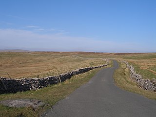
The Coal Road is an unclassified highway which connects the railway stations at Garsdale and Dent in Cumbria, England. The road is within the Yorkshire Dales National Park, and was historically part of the West Riding of Yorkshire. The name derives from its use transporting locally mined coal, although before that it was used as a droving route between England and Scotland through Mallerstang.

Chapel-le-Dale is west-facing valley in the Yorkshire Dales, England. The U-shaped valley of Chapel-le-Dale is one of the few which drain westwards towards the Irish Sea, however, the river that flows through the valley has several names with the Environment Agency and the Ordnance Survey listing it as the River Doe. However, some older texts insist the name of the watercourse through the dale is the River Greta, which runs from a point below the hamlet of Chapel-le-Dale, and onwards past Ingleton. The dale is sparsely populated with only one settlement, the hamlet of Chapel-le-Dale, which has a small chapel.

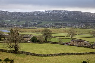
Sleddale is a short, narrow valley to the south of Wensleydale in North Yorkshire, England. The waters draining down the valley feed into the River Ure and form part of the Humber Catchment. The valley has only one settlement, Gayle, although Hawes lies at the mouth of the beck where it runs into the River Ure. The dale is characterised by upland farming and historical mine workings, and is between the slopes of Dodd Fell to the west, and Wether Fell to the east.
