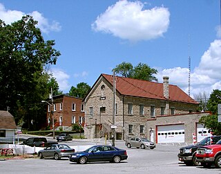
Northumberland County is an upper tier level of municipal government situated on the north shore of Lake Ontario, east of Toronto in Central Ontario.

The Madawaska River is a river in the Saint Lawrence River drainage basin in Ontario, Canada. The river is 230 km (143 mi) long and drains an area of 8,470 km2 (3,270 sq mi). Its name comes from an Algonquian band of the region known as "Matouweskarini", meaning "people of the shallows".

The Municipality of Marmora and Lake is nestled along the banks of Crowe River and Beaver Creek. A picturesque municipality, home to more than 4,000 full time and seasonal residents many of whom enjoy outdoor recreation and relaxation on Crowe Lake. Midway between Toronto and Ottawa on provincial highway 7 in beautiful Hastings County in Central Ontario, Canada.

English River is an unincorporated place on the border of geographic Corman Township, Kenora District and the Unorganized Part of Thunder Bay District in Northwestern Ontario, Canada. It was a Hudson's Bay Company trading post between 1894 and 1911, and is located where Ontario Highway 17 crosses the English River at its confluence with the Scotch River.

Lac-Sainte-Thérèse is a Dispersed Rural Community and unincorporated area in geographic Casgrain Township, Cochrane District in Northeastern Ontario, Canada. The community is counted as part of Unorganized Cochrane North Part in Canadian census data.

Missisa Lake is a lake in northeastern Kenora District in northwestern Ontario, Canada. It is in the James Bay drainage basin and is the source of the Missisa River, which begins at the southeast of the lake.

Night Hawk Lake is a lake in the city of Timmins, Cochrane District in northeastern Ontario, Canada. It is in the James Bay drainage basin and is the source of the Frederick House River, which flows via the Abitibi River and Moose River to James Bay. Night Hawk Lake is the largest lake within the boundaries of the City of Timmins.

The Kagiano River is a river in the east part of Thunder Bay District in northwestern Ontario, Canada. It is in the Great Lakes Basin and flows from Devork Lake, 42 kilometres (26 mi) south of the community of Longlac on Ontario Highway 11, to the Pic River 55 kilometres (34 mi) north northeast of the town of Marathon on Ontario Highway 17.

The Carp River is a river in the Unorganized North Part of Algoma District in Northeastern Ontario, Canada. The river is in the Great Lakes Basin and is a tributary of Lake Superior.

The Cedar Lakes are a series of small lakes in geographic Palmer Township in the Unorganized North Part of Algoma in Northeastern Ontario, Canada.

Fontaine's Landing is an unincorporated area in geographic Hanlan Township, Cochrane District in Northeastern Ontario, Canada. The community is counted as part of Unorganized Cochrane North Part in Canadian census data, and is located at the southwest corner of Wolverine Lake where the Valentine River enters the lake, about 15 kilometres (9.3 mi) northwest of Hearst.

Partridge Lake is a lake in the municipality of Greenstone, Thunder Bay District in northwestern Ontario, Canada. It is in the Great Lakes Basin.

Gathering Lake is a long, narrow lake in Thunder Bay District in northwestern Ontario, Canada. It is in the Great Lakes Basin.

Foxear Lake is a lake in the municipality of Greenstone, Thunder Bay District in northwestern Ontario, Canada. It is in the Great Lakes Basin, lies in the geographic township of Walters, and is the source of Foxear Creek.

Corrigan Lake is a lake in the municipality of Greenstone, Thunder Bay District in northwestern Ontario, Canada. It is in the Great Lakes Basin, lies in the geographic townships of Sandra and Irwin, and is the source of Corrigan Creek.

Kapuskasing Lake is a lake in Algoma District and Sudbury District in northeastern Ontario, Canada. It is in the James Bay drainage basin and is the source of the Kapuskasing River. The majority of the lake is in geographic Kapuskasing Township, Algoma District, with just the southern tip in geographic Sherlock Township, Sudbury District.

The Nemegosenda River is a river in Algoma District and Sudbury District in northeastern Ontario, Canada. It is in the James Bay drainage basin, and is a right tributary of the Kapuskasing River.

The Valentine River is a river in Cochrane District in northeastern Ontario, Canada. It is in the James Bay drainage basin, and is a tributary of Lac Pivabiska, the source of the Pivabiska River.

Gammon Lake is a lake in the Unorganized Part of Kenora District in Northwestern Ontario, Canada. It is in the Hudson Bay drainage basin, is within Woodland Caribou Provincial Park, and is the source of the Gammon River.

Embryo Lake is a lake in the Unorganized Part of Kenora District in Northwestern Ontario, Canada. It is in the Hudson Bay drainage basin, is within Woodland Caribou Provincial Park, and is the source of the Rostoul River.


