The geography of Canada describes the geographic features of Canada, the world's second largest country in total area.

ThePacific Coast Ranges, are the series of mountain ranges that stretch along the West Coast of North America from Alaska south to Northern and Central Mexico.

The Canadian Rockies or Canadian Rocky Mountains comprise the Canadian segment of the North American Rocky Mountains. They are the eastern part of the Canadian Cordillera, which is a system of multiple ranges of mountains which runs from the Canadian Prairies to the Pacific Coast. The Canadian Rockies mountain system comprises the southeastern part of this system, lying between the Interior Plains of Alberta and Northeastern British Columbia on the east to the Rocky Mountain Trench of BC on the west. The southern end borders Idaho and Montana of the United States. In geographic terms the boundary is at the Canada/US border, but in geological terms it might be considered to be at Marias Pass in northern Montana. The northern end is at the Liard River in northern British Columbia.

Kluane National Park and Reserve are two units of Canada's national park system in the southwest corner of the territory of Yukon. It is near the Alaskan border. Kluane National Park Reserve was established in 1972, covering 22,013 square kilometres.

The Mackenzie Mountains are a mountain range forming part of the Yukon-Northwest Territories boundary between the Liard and Peel rivers. The range is named in honour of Canada's second prime minister, Alexander Mackenzie, as well as the explorer. Nahanni National Park Reserve and Nááts'ihch'oh National Park Reserve are in the Mackenzie Mountains.

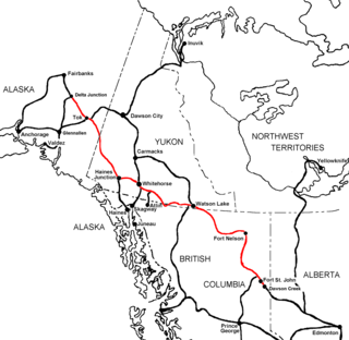
Yukon is in the northwestern corner of Canada and is bordered by Alaska and the Northwest Territories. The sparsely populated territory abounds with natural scenic beauty, with snowmelt lakes and perennial white-capped mountains, including many of Canada's highest mountains. The territory's climate is Arctic in the north, subarctic in the central region, between north of Whitehorse and Old Crow, and has a humid continental climate in the far south, south of Whitehorse and in areas close to the British Columbia border. The long sunshine hours in the short summer allow a profusion of flowers and fruit to blossom. Most of the territory is boreal forest, tundra being the main vegetation zone only in the extreme north and at high elevations.

The Aishihik River, also known as Canyon Creek, is a river in the Yukon Territory of Canada. Originating in Aishihik Lake, it flows south into the Dezadeash River, part of the Alsek River watershed.

Champagne Landing is a small First Nations settlement on the Alaska Highway in Canada's Yukon. The few residents are citizens of the Champagne and Aishihik First Nations. The resident population was 25 in the Canada 2011 Census.

The Boundary Ranges, also known in the singular and as the Alaska Boundary Range, are the largest and most northerly subrange of the Coast Mountains. They begin at the Nass River, near the southern end of the Alaska Panhandle in the Canadian province of British Columbia and run to the Kelsall River, near the Chilkoot Pass, beyond which are the Alsek Ranges of the Saint Elias Mountains, and northwards into the Yukon Territory flanking the west side of the Yukon River drainage as far as Champagne Pass, north of which being the Yukon Ranges. To their east are the Skeena Mountains and Stikine Plateau of the Interior Mountains complex that lies northwest of the Interior Plateau; the immediately adjoining subregion of the Stikine Plateau is the Tahltan Highland. To their northeast is the Tagish Highland, which is a subregion of the Yukon Plateau. Both highlands are considered in some descriptions as included in the Coast Mountains. The Alexander Archipelago lies offshore and is entirely within Alaska.

Mount Cook is a high peak on the Yukon Territory-Alaska border, in the Saint Elias Mountains of North America. It is approximately 15 miles southwest of Mount Vancouver and 35 miles east-southeast of Mount Saint Elias. It forms one of the corners of the jagged border, which is defined to run in straight lines between the major peaks. The same border also separates Kluane National Park in the Yukon Territory from Wrangell-St. Elias National Park and Preserve in Alaska.

The Cassiar Mountains are the most northerly group of the Northern Interior Mountains in the Canadian province of British Columbia and also extend slightly into the southernmost Yukon Territory. They lie north and west of the Omineca Mountains, west of the northernmost Rockies and the Rocky Mountain Trench, north of the Hazelton Mountains and east of the Boundary Ranges. They form a section of the Continental Divide, that, in this region, separates water drainage between the Arctic and Pacific Oceans. Physiographically, they are a section of the larger Yukon-Tanana Uplands province, which in turn are part of the larger Intermontane Plateaus physiographic division.

The Tuya Range is a rmountain range in the Stikine Ranges of the Cassiar Mountains in the far north of the Canadian province of British Columbia, near its border with the Yukon Territory and to the southwest of Watson Lake, Yukon, which is the nearest major settlement.
The Yukon Ranges are a mountain range comprising the mountains in the southeastern part of the U.S. state of Alaska and most of the Yukon in Canada. Named after the Yukon, this range has area of 364,710 square kilometres (140,820 sq mi).

The Pelly Mountains are a mountain range in the Yukon, Canada. It has an area of 44014 km2 and is a subrange of the Yukon Ranges which in turn form part of the Pacific Coast Ranges.

Dezadeash Lake is a lake of Yukon, Canada. It borders Kluane National Park, and lies along the edge of the Saint Elias Mountains.
Kusawa Lake is a lake in the southern Yukon, Canada. Kusawa means "long narrow lake" in the Tlingit language. The Kusawa Lake is a lake in Canada's Yukon Territory. It is located at an altitude of 671 m (2,201 ft) and is 60 km (37 mi) southwest of Whitehorse near the British Columbia border. It meanders over a length of 75 km (47 mi) with a maximum width of about 2.5 km (1.6 mi) through the mountains in the north of the Boundary Ranges. It is fed by the Primrose River and Kusawa River. The Takhini outflows to the Yukon River from the northern tip of Kusawa Lake. Kusawa Lake has an area of 142 km2 (55 sq mi). The lake has a maximum depth of 140 m (460 ft) and is of glacial origin. It is a common tourist destination and is also popular for fishing.