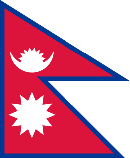
Nepal, officially the Federal Democratic Republic of Nepal, is a landlocked country in South Asia. It is located mainly in the Himalayas but also includes parts of the Indo-Gangetic Plain. With an estimated population of 26.4 million, it is 48th largest country by population and 93rd largest country by area. It borders China in the north and India in the south, east, and west while Bangladesh is located within only 27 km (17 mi) of its southeastern tip and Bhutan is separated from it by the Indian state of Sikkim. Nepal has a diverse geography, including fertile plains, subalpine forested hills, and eight of the world's ten tallest mountains, including Mount Everest, the highest point on Earth. Kathmandu is the nation's capital and largest city. Nepal is a multiethnic nation with Nepali as the official language.

Pushpa Kamal Dahal, also known as Prachanda, is a Nepalese politician, co-chair of the Nepal Communist Party and twice Prime Minister of Nepal, from 2008 to 2009 and from 2016 to 2017.
The 1991 Nepal census was a widespread national census conducted by the Nepal Central Bureau of Statistics.

Atarpur is a village in Sindhupalchok District in the Bagmati Zone of central Nepal. At the time of the 1991 Nepal census it had a population of 2008 and had 394 houses in the village.

Bansbari is a village in Sindhupalchok District in the Bagmati Zone of central Nepal. At the time of the 1991 Nepal census it had a population of 4474 and had 827 houses in the village.

Banskharka is a village in Sindhupalchok District in the Bagmati Zone of central Nepal. At the time of the 1991 Nepal census it had a population of 2420 and had 517 houses in the village.It is also known for one of the famous house Dhukuti Ghar which was constructed by Dasrath Kachyapati following son Krishna Bhakta Kachyapati following son Ram Bhakta Kachyapati. And now all developmental works for that house and mailny for village is seen by Ram Bhakta's son Harigopal Kachyapati and he has been the pillar of the village.

Bhotsiba is a village in Sindhupalchok District in the Bagmati Zone of central Nepal. At the time of the 1991 Nepal census it had a population of 4110 and had 782 houses in the village.

Kiul is a village in Sindhupalchok District in the Bagmati Zone of central Nepal. At the time of the 1991 Nepal census it had a population of 2914 and had 628 houses in the village.

Mahankal is a village in Sindhupalchok District in the Bagmati Zone of central Nepal. At the time of the 1991 Nepal census it had a population of 4086 and had 803 houses in the village.

Satungal is a village and former Village Development Committee that is now part of Chandragiri Municipality in Kathmandu District in Province No. 3 of central Nepal. Satungal is also known as Satyapur. At the time of the 1991 Nepal census it had a population of 2730 and had 464 households in it. At the time of the 2001 Nepal census Satungal had a population of 5834 and had 1375 households in it. Satungal had 5173 literate people i.e. 88.66%..

Naubasta is a town in Banke District in the Bheri Zone of south-western Nepal. At the time of the 1991 Nepal census it had a population of 11,160 and had 1663 houses in the town.

Dolalghat is a village development committee in Kabhrepalanchok District in the Bagmati Zone of central Nepal.

Chulachuli is a rural municipality (gaunpalika) out of six rural municipality located in Ilam District of Province No. 1 of Nepal. There are a total of 10 municipalities in Ilam in which 4 are urban and 6 are rural.
Laxmipur is a former town and Village Development Committee in Ilam District in the Mechi Zone of eastern Nepal.

Dullu is an urban Municipality in Dailekh District of Karnali Pradesh in Nepal.

Katari is a Municipality in Udayapur District in the Province No. 1 of south-eastern Nepal.It lies by the Tawa river having the bridge of length 123.5m. This was established by merging two existing village development committees i.e. Triveni and Katari on 18 May 2014. At the time of the 1991 Nepal census it had a population of 7230 people living in 1410 individual households.

Shivanagar is a town in Krishnanagar Municipality in Kapilvastu District in the Lumbini Zone of southern Nepal. The former VDC was merged to form the municipality established on 18 May 2014 Krishnanagar, Sirsihawa, Shivanagar VDCs. At the time of the 2011 Nepal census it had a population of 4,774 people living in 735 individual households.

Pathari Sanischare (पथरी-शनिश्चरे) is a Municipality in Morang District in the Koshi Zone of south-eastern Nepal. It was formed by merging two existing village development committees i.e. Pathari and Sanischare in May 2014.
The 2001 Nepal census was conducted by the Nepal Central Bureau of Statistics. According to Census, the population of Nepal in 2001 was 23,151,423. Working with Nepal's Village Development Committees at a district level, they recorded data from all the main towns and villages of each district of Nepal. The data included statistics on population size, households, sex and age distribution, place of birth, residence characteristics, literacy, marital status, religion, language spoken, caste/ethnic group, economically active population, education, number of children, employment status, and occupation.

Sundar Haraicha is a municipality in Morang District of Province No. 1 in Nepal that was established on 10 March 2017 by merging the former municipalities Sundar Dulari and Koshi Haraicha. At the time of the 2011 Nepal census, the localities out of which Chaudandigadhi would be formed had a joint population of 80,518 people living in 18,610 individual households.


