Dharapani धारापानी | |
|---|---|
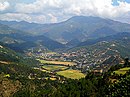
 Dharapani Location in Lumbini Province  Dharapani Dharapani (Nepal) | |
| Coordinates: 28°01′N83°02′E / 28.02°N 83.04°E | |
| Country | |
| Zone | Lumbini Zone |
| District | Arghakhanchi District |
| Population (2001) | |
• Total | 6,455 |
| • Religions | Hindu |
| Time zone | UTC+5:45 (Nepal Time) |
Dharapani is a small town in Arghakhanchi District in the Lumbini Zone of southern Nepal. At the time of the 1991 Nepal census, the town had a population of 5236 living in 1020 houses. [1] At the time of the 2001 Nepal census, the population was 6455, of which 65% was literate. [1]