Khandaha खनदह | |
|---|---|
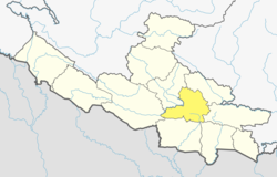
 Khandaha Location in Lumbini Province  Khandaha Khandaha (Nepal) | |
| Coordinates: 28°04′N83°07′E / 28.06°N 83.12°E | |
| Country | |
| Zone | Lumbini Zone |
| District | Arghakhanchi District |
| Population (1991) | |
• Total | 3,206 |
| • Religions | Hindu |
| Time zone | UTC+5:45 (Nepal Time) |
Khandaha is a small town in Arghakhanchi District in the Lumbini Zone of southern Nepal. At the time of the 1991 Nepal census it had a population of 3,206 and had 659 houses in the town. [1]