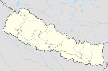
Solukhumbu District (Nepali: सोलुखुम्बु जिल्ला, Sherpa: ཤར་ཁུམ་བུ་རྫོང་།, Wylie: shar khum bu dzong) is one of 14 districts of Koshi Province of eastern Nepal. As the name suggests, it consists of the sub-regions Solu and Khumbu. The closest post office to Solukhumbu with a postal code assigned to it is the Sindhuli D.P.O., which has the postal code 56000.

Raxaul is a sub-divisional town in the East Champaran district of the Indian state of Bihar. It is situated at the India-Nepal border with Birgunj city (Nepal). Raxaul is a major railway junction.
Siraha is the headquarters and municipality of Siraha District, a part of Madhesh Province, Nepal. Siraha had a population of 28,442 according to the census of 2011. and a population of 82,531 as of 2015. The current population of Siraha municipality as of census 2022, is 96,543. It has a male population of 47,306 and female population of 49,237. The present mayor of Siraha Municipality is Dr. Nabin Kumar Yadav and Deputy Mayor is Babita Kumari Sah. Both assumed office on 25 May 2022. His predecessor mayor was Asheswor Yadav and the deputy mayor was Dr. Namita Yadav. Both assumed office on 25 September 2017 and their last working day was on 24 May 2022. The town is at 80 metres (260 ft) altitude, 29 kilometres (18 mi) ESE of Janakpur.
The 1991 Nepal census was a widespread national census conducted by the Nepal Central Bureau of Statistics.
Bhagavathi is a small town in Arghakhanchi District in the Lumbini Zone of southern Nepal. At the time of the 1991 Nepal census, the town had a population of 4418 living in 842 houses. At the time of the 2001 Nepal census, the population was 4543, of which 59% was literate.
Batakachaur is a village development committee in Baglung District in the Dhaulagiri Zone of central Nepal. At the time of the 1991 Nepal census it had a population of 4,142 and had 794 houses in the village.
Sangachok is a village and market center of Chautara Sangachokgadi Municipality in Sindhupalchok District in the Bagmati Zone of central Nepal. The formerly Village Development Committee was merged to form the new municipality on 2017. At the time of the 2013 Nepal census it had a population of 10,791 and had 1,828 houses in the village.
Naubasta is a town in Banke District in the Bheri Zone of south-western Nepal. At the time of the 1991 Nepal census it had a population of 11,160 and had 1663 houses in the town.
Phujel is a town in Gorkha District in the Gandaki Zone of northern-central Nepal. At the time of the 1991 Nepal census it had a population of 4,563 and had 841 houses in the town.
Phinam was a village development committee in Gorkha District in the Gandaki Zone of northern-central Nepal. It was merged into Gorkha Municipality in 2014. At the time of the 1991 Nepal census, it had a population of 2,993 and had 580 houses in the town.
Hansapur is a village development committee in Gorkha District in the Gandaki Zone of northern-central Nepal. At the time of the 1991 Nepal census it had a population of 4,377 and had 818 houses in the town.
Khoplang is a former village development committee in Palungtar municipality of Gorkha District in the Gandaki Province of northern-central Nepal. At the time of the 1991 Nepal census it had a population of 5,227 and had 1054 houses in the town. Former Prime Minister of Nepal Baburam Bhattarai was born here.

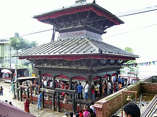
Manakamana is a former village development committee in Gorkha District in the Gandaki Zone of northern-central Nepal. At the time of the 1991 Nepal census it had a population of 5,083 and had 889 houses in the town.
Palumtar is a municipality in Gorkha District in the Gandaki Zone of northern-central Nepal. It was named after the former Village Development Committee which now is part of it. At the time of the 1991 Nepal census the VDC had a population of 6,982 and had 1358 houses in the town. The municipality has 23 461 inhabitants according to the census of 2011.
Pandrung is a village development committee in Gorkha District in the Gandaki Zone of northern-central Nepal. At the time of the 1991 Nepal census it had a population of 2,803 and had 538 houses in the town.
Machchhegaun is a town and municipality in Kavrepalanchok District in the Bagmati Zone of central Nepal. At the time of the 1991 Nepal census it had a population of 5,951 in 979 individual households.

Nijgadh, is a town and municipality in Nepal, located in Bara District of the Madhesh Province. The total area of the municipality is 289.4 sq. km. The municipality was formed on 8 May 2014 by merging Nijgadh VDC with Ratnapuri VDC and Bharatganj Singaul VDC.
Khalanga is a town and the district headquarters of the Darchula District in the Sudurpashchim Province of Nepal. It is part of the Mahakali Municipality in the Mahakali Zone. The town is located on the bank of Mahakali River and the border with Uttarakhand state, India. The town on the Indian side of the border also has similar name called Dharchula.
Sundar Haraicha is a municipality in Morang District of Koshi Province in Nepal. It is centered around Biratchowk town which is the gateway to Biratnagar. It borders Itahari Sub- Metropolitan city to the west, Dharan Sub- Metropolitan city to the Northwest and Belbari municipality to the east and is connected by Mahendra Highway. It is one of the fastest growing cities in eastern Nepal and the second largest city of Morang district after Biratnagar, with 121,305 inhabitants living in 26,677 households. It consists of the town centres of Biratchowk and Gothgaun which are parts of the Greater Birat Development Area which incorporates the cities of Biratnagar-Itahari-Gothgau-Biratchowk-Dharan primarily located on the Koshi Highway in Eastern Nepal, with an estimated total urban agglomerated population of 804,300 people living in 159,332 households.
Bhagwanpur is a rural municipality in Siraha District in Province No. 2 of south-eastern Nepal. At the time of the 2011 Nepal census it had a population of 20957 people living. It is located nearly 370 kilometers or 107 miles east of the capital, Kathmandu.


