Donaldson, Arkansas | |
---|---|
Coordinates: 34°14′06″N92°55′10″W / 34.23500°N 92.91944°W | |
Country | United States |
State | Arkansas |
County | Hot Spring |
Area | |
• Total | 0.59 sq mi (1.53 km2) |
• Land | 0.59 sq mi (1.53 km2) |
• Water | 0.00 sq mi (0.00 km2) |
Elevation | 230 ft (70 m) |
Population (2020) | |
• Total | 275 |
• Density | 465.31/sq mi (179.74/km2) |
Time zone | UTC-6 (Central (CST)) |
• Summer (DST) | UTC-5 (CDT) |
ZIP code | 71941 |
Area code | 501 |
FIPS code | 05-19450 |
GNIS feature ID | 2406386 [2] |
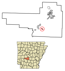
Donaldson is a town in Hot Spring County, Arkansas, United States. The population was 301 at the 2010 census. [3]
Donaldson is located in southern Hot Spring County at 34°14′14″N92°55′16″W / 34.23722°N 92.92111°W (34.237169, -92.921177), [4] in the valley of the Ouachita River, which passes 2 miles (3 km) west of the town. U.S. Route 67 runs through the northern side of the community, leading northeast 11 miles (18 km) to Malvern, the county seat, and southwest 14 miles (23 km) to Arkadelphia. Arkansas Highway 51 has its northern terminus in Donaldson and leads 17 miles (27 km) to Arkadelphia by a more southerly route.
According to the United States Census Bureau, Donaldson has a total area of 0.66 square miles (1.7 km2), all land. [3]
Census | Pop. | Note | %± |
---|---|---|---|
2000 | 326 | — | |
2010 | 301 | −7.7% | |
2020 | 275 | −8.6% | |
U.S. Decennial Census [5] 2014 Estimate [6] |
As of the census [7] of 2000, there were 326 people, 130 households, and 93 families residing in the town. The population density was 499.1 inhabitants per square mile (192.7/km2). There were 143 housing units at an average density of 218.9 per square mile (84.5/km2). The racial makeup of the town was 97.85% White, 0.61% Native American, and 1.53% from two or more races. 0.61% of the population were Hispanic or Latino of any race.
There were 130 households, out of which 31.5% had children under the age of 18 living with them, 56.9% were married couples living together, 11.5% had a female householder with no husband present, and 27.7% were non-families. 25.4% of all households were made up of individuals, and 16.9% had someone living alone who was 65 years of age or older. The average household size was 2.51 and the average family size was 3.01.
In the town, the population was spread out, with 26.7% under the age of 18, 8.6% from 18 to 24, 25.2% from 25 to 44, 24.5% from 45 to 64, and 15.0% who were 65 years of age or older. The median age was 36 years. For every 100 females, there were 97.6 males. For every 100 females age 18 and over, there were 100.8 males.
The median income for a household in the town was $22,813, and the median income for a family was $28,500. Males had a median income of $29,250 versus $20,500 for females. The per capita income for the town was $13,307. About 15.0% of families and 17.1% of the population were below the poverty line, including 25.3% of those under age 18 and 10.7% of those age 65 or over.
Public education for early childhood, elementary and secondary school students is available by the Ouachita School District, [8] which leads to graduation from Ouachita High School.
Saline County is located in the U.S. state of Arkansas. As of the 2020 census, the population was 123,416. Its county seat and largest city is Benton. Saline County was formed on November 2, 1835, and named for the salt water (brine) springs in the area, despite a differing pronunciation from saline. Until November 2014, it was an alcohol prohibition or dry county.
Perry County is a county located in the U.S. state of Arkansas. Its population was 10,019 at the 2020 United States Census. The county seat is Perryville. The county was formed on December 18, 1840, and named for Commodore Oliver Hazard Perry, naval hero in the War of 1812. It is an alcohol prohibition or dry county.
Ouachita County is a county located in the south central part of the U.S. state of Arkansas. As of the 2020 census, the population was 22,650.
Hot Spring County is located in the U.S. state of Arkansas. As of the 2020 census, the population was 33,040. The county seat is Malvern. Established on November 2, 1829, in the Arkansas Territory from a part of Clark County; it was named after the hot springs at Hot Springs, Arkansas, which were formerly in the county.
Garland County is located in the U.S. state of Arkansas. As of the 2020 census, the population was 100,180. The county seat is Hot Springs.
Clark County is a county located in the south-central part of the U.S. state of Arkansas. As of the 2020 census, the population was 21,446. The county seat is Arkadelphia. The Arkadelphia, AR Micropolitan Statistical Area includes all of Clark County.
Arkadelphia is a city in Clark County, Arkansas, United States. As of the 2020 census, the population was 10,380. The city is the county seat of Clark County. It is situated at the foothills of the Ouachita Mountains. Two universities, Henderson State University and Ouachita Baptist University, are located here. Arkadelphia was incorporated in 1857.
Caddo Valley is a town in Clark County, Arkansas, United States. The population was 635 at the 2010 census.
Gum Springs is a town in Clark County, Arkansas, United States. The population was 120 at the 2010 census, down from 194 in 2000.
Okolona is a town near the western edge of Clark County, Arkansas, United States. The population was 147 at the 2010 census.
Fountain Lake is a town in Garland County, Arkansas, United States. Bordering Hot Springs Village, the town is part of the Hot Springs Metropolitan Statistical Area. The population was 503 at the 2010 census.
Lake Hamilton is a census-designated place (CDP) in Garland County, Arkansas, United States. It is part of the Hot Springs Metropolitan Statistical Area. The population was 2,135 at the 2010 census. It is named after Lake Hamilton, one of the area's man-made lakes.
Lonsdale is a town in Garland County, Arkansas, United States. It is part of the Hot Springs Metropolitan Statistical Area. The population was 103 at the 2020 census.
Mountain Pine is a city in Garland County, Arkansas, United States. It is part of the Hot Springs Metropolitan Statistical Area. The population was 770 at the 2010 United States Census. It is located immediately southeast of Lake Ouachita below the Blakely Mountain Dam. The city consists of five defined neighborhoods, Pinewood (north), South Mountain Pine, a business district, Cozy Acres (southwest) and Mountain View/Timberland area.
Friendship is a town in Hot Spring County, Arkansas, United States. The population was 176 at the 2010 census, down from 206 at the 2000 census.
Black Springs is a town in Montgomery County, Arkansas, United States. The population was 96 at the 2020 census.
Mount Ida is a city in and county seat of Montgomery County, Arkansas, United States. Founded in 1842, the city saw a silver boom in the 1880s bring early prosperity and economic development to the area. Today, the economy is largely ranching, poultry farming, silviculture, and tourism around Lake Ouachita. It is known as the quartz crystal capital of the U.S. and is known worldwide for its quartz deposits. The population was 996 as of the 2020 census.
Oden is a town in Montgomery County, Arkansas, United States. As of the 2020 census, its population was 180, down from 232 in 2010.
Glenwood is a city in Pike and Montgomery counties in Arkansas, United States. As of the 2020 census, its population was 2,068. The community is located along the Caddo River in the Ouachita Mountains.
Calion is a second-class city in Union County, Arkansas, United States. The population was 494 at the 2010 census.