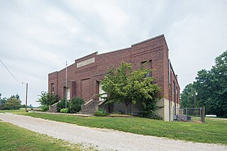
Greer Township is one of ten townships in Warrick County, Indiana, United States. As of the 2010 census, its population was 1,883 and it contained 769 housing units.

Hart Township is one of ten townships in Warrick County, Indiana, United States. As of the 2010 census, its population was 1,626 and it contained 691 housing units.

Selvin is an unincorporated community in Pigeon Township, Warrick County, in the U.S. state of Indiana.

Otwell is an unincorporated census-designated place in Jefferson Township, Pike County, in the U.S. state of Indiana.

Buckskin is a small unincorporated community in Barton Township, Gibson County, Indiana. Although unincorporated, Buckskin has the ZIP code 47647.

Johnson is an unincorporated town in Montgomery Township, Gibson County, Indiana, United States roughly 4 miles west of Owensville and 8 miles north of Poseyville. It should not be confused with Johnson County, Indiana which is in a different location and named for a different figure or nearby Johnson Township which is also named for a different figure, likely the same as the county.

East Mount Carmel is a small unincorporated community near the southwestern corner of White River Township in Gibson County, Indiana. The community is home to around 50 people.

Spearsville is an unincorporated community in Hamblen Township, Brown County, in the U.S. state of Indiana.

Giro is an unincorporated community located at the northernmost point of Gibson County in Washington Township, Gibson County, Indiana. The town is also known as Buena Vista.

King is an unincorporated community in Patoka Township, Gibson County, Indiana, United States. It is also referred to as Kings or as King's Station.

Mount Olympus is an unincorporated community in Washington Township, Gibson County, Indiana. It was formerly called Ennes. A post office called Ennes operated from 1879 until 1883.

Saint James is a small hamlet located roughly 1 mile south of Haubstadt, Indiana in Johnson Township, Gibson County, Indiana and 1/4 mile north of Vanderburgh County.

Skelton was an unincorporated community in Montgomery Township, Gibson County, Indiana. The town is now completely inside the grounds of the Gibson Generating Station. No part of the town exists as most of what was Skelton is in Gibson Lake.

Warrenton is an unincorporated community in Johnson Township, Gibson County, Indiana. Warrenton is home to The Log Inn, the oldest restaurant in Indiana.

Exchange is an unincorporated community in Green Township, Morgan County, in the U.S. state of Indiana.

Wheeling is an unincorporated community in Washington Township, Gibson County, Indiana, United States. The community contains a historic covered bridge over the Patoka River, the Wheeling Bridge, completed in 1877.
Dongola is an unincorporated community in Gibson County, Indiana, in the United States.
Mounts is an unincorporated community in Gibson County, Indiana, in the United States.
McGary is an unincorporated community in Gibson County, Indiana, in the United States.

Oatsville is an unincorporated community in Gibson and Pike counties, in the U.S. state of Indiana.


