Dowling, Michigan | |
|---|---|
 Dowling | |
| Coordinates: 42°31′21″N85°15′11″W / 42.52250°N 85.25306°W | |
| Country | United States |
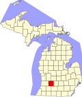
| State | Michigan |
| County | Barry |
| Township | Baltimore |
| Area | |
• Total | 6.29 sq mi (16.28 km2) |
| • Land | 6.08 sq mi (15.75 km2) |
| • Water | 0.20 sq mi (0.53 km2) |
| Elevation | 952 ft (290 m) |
| Population (2020) | |
• Total | 351 |
| • Density | 57.72/sq mi (22.29/km2) |
| Time zone | UTC-5 (Eastern (EST)) |
| • Summer (DST) | UTC-4 (EDT) |
| ZIP code | 49050 |
| Area code | 269 |
| FIPS code | 26-22900 |
| GNIS feature ID | 0624850 |
Dowling is a census-designated place (CDP) in Baltimore Township in Barry County, Michigan, United States. The population was 351 at the 2020 census. [2]