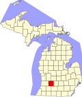
Yankee Springs Township, Michigan | |
---|---|
Coordinates: 42°37′52″N85°30′41″W / 42.63111°N 85.51139°W | |
Country | United States |
State | Michigan |
County | Barry |
Area | |
• Total | 35.9 sq mi (92.9 km2) |
• Land | 31.0 sq mi (80.4 km2) |
• Water | 4.8 sq mi (12.4 km2) |
Elevation | 758 ft (231 m) |
Population (2020) | |
• Total | 5,322 |
Time zone | UTC-5 (Eastern (EST)) |
• Summer (DST) | UTC-4 (EDT) |
ZIP code | 49333 |
Area code | 269 |
FIPS code | 26-89020 [1] |
GNIS feature ID | 1627297 [2] |
Website | www |
Yankee Springs Township is a civil township of Barry County in the U.S. state of Michigan. The population was 5,322 at the 2020 census. [3]
According to the United States Census Bureau, the township has a total area of 35.9 square miles (92.9 km2), of which 31.0 square miles (80.4 km2) is land and 4.8 square miles (12.4 km2), or 13.37%, is water, [4] consisting of several lakes in the western half of the township, the largest of which is Gun Lake. Yankee Springs Recreation Area occupies 5,200 acres (2,100 ha) along much of the shore of Gun Lake and to the north and east.
As of the census [1] of 2000, there were 4,219 people, 1,628 households, and 1,253 families residing in the township. The population density was 134.0 inhabitants per square mile (51.7/km2). There were 2,182 housing units at an average density of 69.3 per square mile (26.8/km2). The racial makeup of the township was 97.35% White, 0.26% African American, 0.36% Native American, 0.19% Asian, 0.02% Pacific Islander, 0.45% from other races, and 1.37% from two or more races. Hispanic or Latino of any race were 1.56% of the population.
There were 1,628 households, out of which 33.0% had children under the age of 18 living with them, 65.7% were married couples living together, 6.9% had a female householder with no husband present, and 23.0% were non-families. 18.1% of all households were made up of individuals, and 5.9% had someone living alone who was 65 years of age or older. The average household size was 2.59 and the average family size was 2.92.
In the township the population was spread out, with 26.1% under the age of 18, 6.7% from 18 to 24, 29.6% from 25 to 44, 25.5% from 45 to 64, and 12.1% who were 65 years of age or older. The median age was 37 years. For every 100 females, there were 100.0 males. For every 100 females age 18 and over, there were 98.5 males.
The median income for a household in the township was $52,661, and the median income for a family was $57,558. Males had a median income of $40,691 versus $31,250 for females. The per capita income for the township was $25,100. About 2.8% of families and 2.5% of the population were below the poverty line, including 2.0% of those under age 18 and 2.1% of those age 65 or over.
Assyria Township is a civil township of Barry County in the U.S. state of Michigan. As of the 2020 census, the township population was 1,992. The unincorporated community of Assyria Center is located on M-66 at the corner of Tasker Road.
Barry Township is a civil township of Barry County in the U.S. state of Michigan. As of the 2020 census, the township population was 3,417.
Castleton Township is a civil township of Barry County in the U.S. state of Michigan. The population was 3,329 at the 2020 census. Castleton Township was formed on February 16, 1842.
Hastings Charter Township is a charter township of Barry County in the U.S. state of Michigan. The population was 3,013 at the 2020 census. The township borders the city of Hastings on the north, east, and south.
Maple Grove Township is a civil township of Barry County in the U.S. state of Michigan. The population was 1,599 at the 2020 census. The unincorporated community of Maple Grove is located within the township.
Middleville is a village in Thornapple Township, Barry County, in the U.S. state of Michigan. Middleville is part of the Grand Rapids metropolitan area. The population was 4,295 at the 2020 census.
Rutland Charter Township is a charter township of Barry County in the U.S. state of Michigan. The population was 4,136 at the 2020 census.
Thornapple Township is a civil township of Barry County in the U.S. state of Michigan. The population was 9,331 at the 2020 census. It is the most populous township in Barry County.
Woodland Township is a civil township of Barry County in the U.S. state of Michigan. The population was 1,994 at the 2020 census. The village of Woodland is located within the township.
Watervliet Charter Township is a charter township of Berrien County in the U.S. state of Michigan. The population was 3,102 at the 2010 census.
Columbia Township is a civil township of Jackson County in the U.S. state of Michigan. As of the 2010 census, the population was 7,420.
Lake Township is a civil township of Lake County in the U.S. state of Michigan. The population was 849 at the 2000 census.
Fruitport Charter Township is a charter township of Muskegon County in the U.S. state of Michigan. The population was 14,575 at the 2020 census. The village of Fruitport is within the township.
Montague Township is a civil township of Muskegon County in the U.S. state of Michigan. The population was 1,555 at the 2020 census. It is adjacent to the city of Montague.
Sullivan Township is a civil township of Muskegon County in the U.S. state of Michigan. As of the 2020 census, the township population was 2,541.
White River Township is a civil township of Muskegon County in the U.S. state of Michigan. The population was 1,383 at the 2020 census.
Ferrysburg is a city in Ottawa County in the U.S. state of Michigan. The population was 2,892 at the 2010 census.
Spring Lake Township is a civil township of Ottawa County in the U.S. state of Michigan. The population was 13,140 according to the 2000 census and 14,300 according to the 2010 census. The village of Spring Lake is located within the township.
Markey Township is a civil township of Roscommon County in the U.S. state of Michigan. The population was 2,401 at the 2020 census. The township was created from Gerrish Township on April 21, 1887.
Richland Township is a civil township of Kalamazoo County in the U.S. state of Michigan. The population was 7,580 at the 2010 census, up from 6,491 at the 2000 census.