Duncan Down

Last updated

Duncan Down
Kent UK location map.svg
Red pog.svg
Duncan Down
Location within Kent
OS grid reference TR107667
District
Shire county
Region
Country England
Sovereign state United Kingdom
Post town Whitstable
Police Kent
Fire Kent
Ambulance South East Coast
UK Parliament
List of places
UK
England
Kent
51°19′48″N1°00′57″E / 51.3300°N 1.0157°E / 51.3300; 1.0157

Duncan Down is an open, public, area to the south west of Whitstable and is the largest village green in the United Kingdom. It is a 21 hectare (52 acre) area of grass and woodland incorporating four ponds and a brook. The area is maintained by the Friends of Duncan Down with assistance from Canterbury City Council and has received funding from nearby planning development. Originally intended for housing development in the inter-war years it is now protected by its village green status. [1]

Contents

History

At the beginning of the twentieth century a plan was produced that would have involved the development of a large part of the downs for housing. Two very small sections of this plan were built but the remaining sections were never implemented. Until World War II the downs were grassland but during the war the government directed that they should undergo cultivation and flax and other crops were planted. After the war the area remained under cultivation, mainly for hay until problems of vandalism made continued use unprofitable. Throughout the 1980s Canterbury City Council provided minimal management of the area manly consisting of grass cutting and rubbish removal. [2]

Since the 1960s five village greens have been registered. These, together, now comprise the area known by the name: Duncan Down. The first, VG124, an area of scrub and woodland to the northeast of the site was registered in 1969. The second area, originally cultivated farmland, which forms the major part of the site was registered in 1992. The third, fourth and fifth areas, VG240, VG256, VG 262 comprising woodland, were registered in 2007 and 2011 and 2012 respectively. [2]

View towards windmill.JPG
A view across part of the downs to the windmill and showing the mass of hawthorn in bloom

In 2020, a significant stone circle was installed on the site. [3] Intended as a site of reflection, the site has also attracted controversy as a local fertility shrine [4] On occasion, individuals leave ribbons and coloured ropes around the stones when making offerings for divine assistance with fertility and sexual prowess.

Ownership

The local council, Canterbury City Council is the main landowner. There are several plots of land under private ownership but the majority of the land has no registered owner.

Grassland

Approximately one quarter of the area of the downs is set aside as grassland which provides food for insects, birds, and the significant rabbit population. Although this grassland would ideally be controlled by animal grazing, the lack of ruminants on the site means that an annual hay harvest is undertaken.

Grass types present include perennial rye, sheep's fescue, sweet vernal, and timothy.

Flowering plants within the grassland areas include: birdsfoot trefoil, buttercup, clover, flax, ox-eye daisy, and vetch. The clover is of particular importance as bacteria within the root system fix nitrogen in the soil which is then used by other plants. Poppies appear occasionally but are rare as the soil is not disturbed.

Slowworms and lizards are found within the grassland existing on insects and slugs.

Scrubland

Hawthorn flowering in late spring on Duncan Down Hawthorn flowering on Duncan Down.JPG
Hawthorn flowering in late spring on Duncan Down

Scrubland forms around one fifth of the downs and is an important feature of the assisted evolution of the site. It is the natural result of leaving an area uncultivated and consists of a broad mixture of native tree species, mainly oak and ash. The scrub consists of hawthorn, dog rose, blackthorn (also known as sloe), and blackberry (bramble). As the scrubland matures areas of it are cut back leaving semi-mature trees standing. In some areas, clearings are made and various native species are planted. Bird ringing is undertaken at this location to assist in research into the behaviour, particularly migratory patterns, of the resident birds.

Woodland

Approximately half of the down is woodland. There are three named woods: Trench Wood, Gorrell Wood, and Benacre Wood. Trench and Gorrel woods have formed over the last 50–60 years from scrub land but Benacre Wood is a remnant of an ancient forest that once covered around 1214 hectare (3000 acres) of the locality. Trench Wood is so named because of the defensive trench workings that remain from World War II, Gorrell Wood is named for the stream which runs through it and Benacre Wood is the last surviving part of an ancient blean remaining near the town of Whitstable.

The oak is the predominant species of tree forming the woodland but yew and holly, both of which can survive below the canopy of oak leaves are in evidence. Various other trees including field maple and hazel can be found. As evidence of its age, Benacre wood is host to large quantities of bluebells in the spring. Other flowering plants present include primrose, snowdrop, and celandine. Non flowering plants include ivy. Various fungi are present including bracket fungi which are largely responsible for the natural recycling of dead wood.

In 2011 an area of hawthorn was removed from Trench Wood and a collection of native tree species was planted.

Stream and ponds

View of one of the expanded ponds with a newly planted weeping willow. Expanded Pond1.JPG
View of one of the expanded ponds with a newly planted weeping willow.

The Gorrell Stream runs through the downs providing a valuable source of water. During the summer there is only a very slow flow of water which may dry up completely during dry periods. During the winter the flow can become torrential which keeps the channel clear.

Four ponds have been created to provide a more reliable source of water for the local wildlife. Frogs, newts, and toads have all been identified in the ponds and the margins provide reed and rush cover for the young froglets which are otherwise taken by various predators including birds and grass snakes.

The banks of the stream are home to a number of old willows which provide a home for woodpeckers. Bats are also present in the older trees.

Green flag award

The downs have been awarded successive green flags since 2005 indicating a well maintained and cared for public green area. [5]

Wildlife

Various types of wildlife can be found the different types of habitat of the downs.

Ponds

The ponds support frogs, newts and toads. Insects present include dragonfly, mayfly, and waterboatmen (notonectidae).

Grassland

Slowworms, grass snakes, lizards, and some small rodents occupy the grassland.

Scrub and woodland

Various rodents including squirrels and mice, together with small mammals such as foxes, and rabbits are to be found in this habitat. Resident birds include blackbird, blue tit, chaffinch, great tit, wood pigeon, owls, and woodpecker. Bats are also known to be present on the site.

Maintenance

The maintenance of the down is undertaken by The Friends of Duncan Down and Canterbury City Council. Wardens approved by both parties under a memorandum of understanding carry out day-to-day maintenance and oversee the use of heavy machinery by outside contractors including the Council's contractor: Serco. In addition the 'Friends of Duncan Down' organise a wide variety of community based activities for the improvement of the area including monitoring of the site, planting of spring bulbs, path clearing, tree work, small works and the construction of seating benches and bridges.

Provision for activities

A small area at one corner of the downs has been set aside as a playing field and goals have been installed there. Local Girl Guides and Scouts and children from St Alphege Infants School use the site for educational purposes and the Friends provide expert guides for these activities.[ citation needed ]

Expansion

In September 2011 a proposal was put forward by a property company that they would donate a significant amount of land for the expansion of the downs if they were allowed to build a new housing development nearby. Following a meeting of the Planning Committee in 2016 outline planning permission was granted and this provided for a 40 acre expansion of the site of which some 5 acres will be used for amenity purposes, car parking and allotments but the remaining 35 acres is scheduled to be added to the site as village green with the whole site to be renamed as the Gorrell Valley Nature Reserve.[ citation needed ]

Related Research Articles

<span class="mw-page-title-main">Salisbury Plain</span> Chalk plateau in England

Salisbury Plain is a chalk plateau in southern England covering 300 square miles (780 km2). It is part of a system of chalk downlands throughout eastern and southern England formed by the rocks of the Chalk Group and largely lies within the county of Wiltshire, but stretches into Hampshire.

<span class="mw-page-title-main">Falmer</span> Village near Brighton, England

Falmer is a small village and civil parish in the Lewes District of East Sussex, England, lying between Brighton and Lewes, approximately five miles (8 km) north-east of the former. It is also the site of Brighton & Hove Albion's Falmer Stadium.

<span class="mw-page-title-main">Bookham Commons</span>

Bookham Commons are two commons, situated just to the north of the villages of Great Bookham and Little Bookham, in Surrey, England, 154.7 hectares in extent; the individual parts are named Great Bookham Common and Little Bookham Common. A group of dwellings known as the Isle of Wight is situated within the site, and a track, Common Road, leads to it from the northwest. Little Bookham Common lies south and west of this track, whereas Great Bookham Common lies to the east.

<span class="mw-page-title-main">East Chiltington</span> Village in East Sussex, England

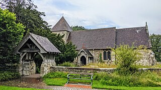
East Chiltington is a village and civil parish in the Lewes District of East Sussex, England. It is centred four miles (5.9 km) south-east of Burgess Hill and five miles (8 km) north-west of Lewes. It is a strip parish of 3.76 square miles (9.7 km2), stretching northward from the crest of the South Downs. The village church is 13th century in origin; the vicar also has charge of two churches in Plumpton. Near the church there is a pub called The Jolly Sportsman. The Sussex Greensand Way, a Roman road, runs from east to west through the centre of the parish.

<span class="mw-page-title-main">Newtimber</span> Human settlement in England

Newtimber is a small village and civil parish in the Mid Sussex District of West Sussex, England. It is located north-west of Brighton. The parish also includes the hamlet of Saddlescombe. The parish lies almost wholly with the South Downs National Park, with the exception of a small section of the parish north of the B2117 road. The planning authority for Newtimber is therefore the South Downs National Park Authority (SDNPA), the statutory planning authority for the National Park area. The downland scarp, which includes Newtimber Hill, Newtimber Holt, Saddlescombe chalk quarry and Summer Down, is mostly part of the Beeding Hill to Newtimber Hill, designated Site of Special Scientific Interest.

Ashford Green Corridor is a green space that runs through the town of Ashford in Kent, England. The Green Corridor is made up of parks, recreation grounds and other green spaces alongside the rivers that flow through Ashford. It is a Local Nature Reserve.

<span class="mw-page-title-main">Bratton Downs</span>

Bratton Downs is a 395.8 hectare biological and geological Site of Special Scientific Interest in Wiltshire, England, near the villages of Bratton and Edington, and about 3 miles (5 km) east of the town of Westbury. It was notified in 1971. The designated area consists mainly of chalk grassland, as well as some ancient woodland, and supports a diverse range of native flora and fauna. It overlays notable geological features—principally landforms created by glaciation in the Pleistocene.

<span class="mw-page-title-main">Ruttersleigh</span>

Ruttersleigh is a 97 hectares biological Site of Special Scientific Interest between Buckland St Mary and Staple Fitzpaine on the north-facing slope of the Blackdown Hills. in Somerset, notified in 1991.

<span class="mw-page-title-main">Scotstown Moor</span>

Scotstown Moor is in the north of Aberdeen, Scotland.

<span class="mw-page-title-main">Park Gate Down</span>

Park Gate Down or Parkgate Down is a 7-hectare (17-acre) biological Site of Special Scientific Interest south-east of Stelling Minnis in Kent. It is also a Special Area of Conservation and is managed by the Kent Wildlife Trust,

<span class="mw-page-title-main">Clayton to Offham Escarpment</span> Landform in Sussex, England

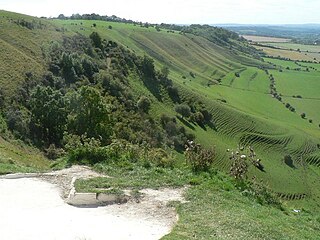
Clayton to Offham Escarpment is a 422.5-hectare (1,044-acre) linear biological Site of Special Scientific Interest (SSSI) which runs from Clayton in West Sussex to Lewes in East Sussex. Its ownership and management is divided between over fifteen landowners and farmers. Parts of Ditchling's Downs, e.g. TQ 323 133, and the scarp between Blackcap and Mount Harry, e.g. TQ 378 124, are owned by the National Trust. What remains of Ditchling Tenantry Down common at Ditchling Beacon is leased to the Sussex Wildlife Trust.

<span class="mw-page-title-main">Sound Heath</span> Area of common land in Sound, Cheshire, England, UK

Sound Heath, also known as Sound Common, is an area of common land in Sound, near Nantwich in Cheshire, England, which includes heathland, grassland, scrub, woodland and wetland habitats. The majority of the area is designated a Site of Special Scientific Interest and a Local Nature Reserve.

<span class="mw-page-title-main">Totteridge Green</span>

Totteridge Green is a five hectare Site of Borough Importance for Nature Conservation, Grade II, in Totteridge in the London Borough of Barnet. It is also registered common land.

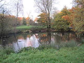
There are several nature reserves in the surroundings of Nailsea, North Somerset, England, which is located at 51°25′55″N2°45′49″W.

<span class="mw-page-title-main">Daneway Banks SSSI</span> Biological Site of Special Scientific Interest in Gloucestershire, England

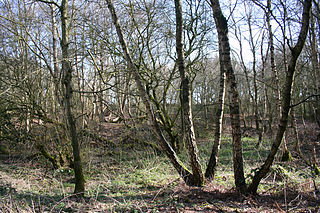
Daneway Banks is a 17-hectare (42-acre) biological Site of Special Scientific Interest in Gloucestershire, notified in 1954 and renotified in 1983. It lies half a mile west of Sapperton and is part of a group of wildlife sites in the Frome Valley that includes Siccaridge Wood and Sapperton Canal reserves. The site is in the Cotswold Area of Outstanding Natural Beauty.

<span class="mw-page-title-main">Bevendean Down</span> UK nature reserve

Bevendean Down is a 64.6-hectare (160-acre) Local Nature Reserve in the Bevendean district in Brighton, East Sussex and is within the boundaries of the South Downs National Park. It is owned by Brighton and Hove Council and managed by tenant farmers and others. It is mainly chalk grassland and there are also areas of woodland and scrub. This site is in five separate blocks.

<span class="mw-page-title-main">Beeding Hill to Newtimber Hill</span>

Beeding Hill to Newtimber Hill is a 321 ha (790-acre) biological and geological Downland Site of Special Scientific Interest (SSSI) north of Shoreham-by-Sea in West Sussex. It is a Nature Conservation Review site, Grade 2, and it includes Devil's Dyke Geological Conservation Review site.

<span class="mw-page-title-main">Bishop Monkton Ings</span> Site of Special Scientific Interest in North Yorkshire, England

Bishop Monkton Ings is a Site of Special Scientific Interest, or SSSI, situated east of Bishop Monkton village in North Yorkshire, England. It consists mostly of marshy, calcareous grassland, with some broadleaved woodland, and some fen alongside the two watercourses which run through the site. This varied wetland forms a habitat for a variety of plants, including the semi-parasitic marsh lousewort (Pedicularis palustris).

<span class="mw-page-title-main">Mar Field Fen</span> Site of Special Scientific Interest in North Yorkshire, England

Mar Field Fen is a Site of Special Scientific Interest, or SSSI, north of Masham, North Yorkshire, England, in a rural area known as Marfield. It is situated on land containing woodland carr, fen, spring-fed marshy grassland and drier calcareous grassland, between the River Ure to the east and Marfield Wetland nature reserve to the west. As "one of the best examples of fen habitat in the Vale of York," it is a protected habitat for a variety of plants, including the common butterwort, a carnivorous plant. There is no public access to this site.

<span class="mw-page-title-main">Ripon Parks</span> Site of Special Scientific Interest in North Yorkshire, England

Ripon Parks is a Site of Special Scientific Interest, or SSSI, situated north of Ripon, to the west of the River Ure and to the east of the village of North Stainley, in North Yorkshire, England. It was once part of the land held since the Middle Ages as a deer park by the archbishops of York and the canons of Ripon. The site was designated as an SSSI in 1983, because its varied habitats are valued for their breeding birds, amphibians and varied flora. The woods here are "of note" for the parasitic flowers of common toothwort and yellow star-of-Bethlehem. A small part of the site is accessible via public footpaths; there are no public facilities or dedicated car parks. The site incorporates the High Batts Nature Reserve, which is privately run for training, recording and educational purposes, and accessible to members only, except for its annual open day. Ripon Parks is now owned by the Ministry of Defence, and parts of the site are used as military training areas.

References

  1. "Duncan Downs". Canterbury City Council. Archived from the original on 11 October 2011. Retrieved 19 November 2011.
  2. 1 2 "Archived copy" (PDF). Archived from the original (PDF) on 11 October 2011. Retrieved 20 November 2011.{{cite web}}: CS1 maint: archived copy as title (link)
  3. Wright, Joe. "Whitstable's version of Stonehenge? New stone circle installed at Duncan Down village green". Kent Online.
  4. Harper, Brad. "Lingerie and condoms found at scene of 'sex orgy' at Gorrell Valley Nature Reserve in Whitstable". Kent Online.
  5. "Duncan Down, Green Flag Awards, Keep Britain Tidy, retrieved 2011-09-28". Archived from the original on 17 November 2011. Retrieved 19 November 2011.