
The Trojan Range is a mountain range rising to 2,760 metres (9,055 ft), extending northward from Mount Francais along the east side of Iliad Glacier, Anvers Island, in the Palmer Archipelago of the British Antarctic Territory. It was surveyed by the Falkland Islands Dependencies Survey (FIDS) in 1955 and named by the UK Antarctic Place-Names Committee (UK-APC) for the Trojans, one of the opposing sides in the Trojan War in Homer's Iliad.
Tabarin Peninsula is a peninsula 15 nautical miles (28 km) long and 5 to 12 nautical miles (22 km) wide, lying south of the trough between Hope Bay and Duse Bay and forming the east extremity of Trinity Peninsula in the Antarctic Peninsula. It was discovered and charted by the Swedish Antarctic Expedition, 1901–1904, led by Otto Nordenskjöld and Carl Anton Larsen. It was mapped in 1946 by the Falkland Islands Dependencies Survey (FIDS) and named after Operation Tabarin, the naval code name for the FIDS from 1943 to 1945.
Aphrodite Glacier is a glacier 15 nautical miles (28 km) long flowing north to the east coast of the Antarctic Peninsula 3 nautical miles (6 km) west of Victory Nunatak. The lower portion of the feature was first plotted by W.L.G. Joerg from aerial photographs taken by Sir Hubert Wilkins in December 1928 and by Lincoln Ellsworth in November 1935. The glacier was subsequently photographed by the Ronne Antarctic Research Expedition in December 1947 and surveyed by the Falkland Islands Dependencies Survey in December 1958 and November 1960. It was named by the UK Antarctic Place-Names Committee after Aphrodite, the goddess of love in Greek mythology.

Cadman Glacier is a glacier, 1.5 nautical miles (3 km) wide at its mouth and about 7 nautical miles (13 km) long, flowing northwestward into the head of the southern arm of Beascochea Bay south of Plas Point on the west side of the Antarctic Peninsula.
Mount Cardinall is a conical mountain, 675 metres (2,215 ft) high, lying close southwest of Mount Taylor and overlooking the northeast head of Duse Bay, at the northeast end of the Antarctic Peninsula. It was probably first seen by a party under J. Gunnar Andersson of the Swedish Antarctic Expedition, 1901–04. It was charted in 1945 by the Falkland Islands Dependencies Survey, who named it for Sir Allan Cardinall, then Governor of the Falkland Islands.

Whitecloud Glacier is a glacier which flows northward between Klokotnitsa Ridge on the east and Tsarevets Buttress on the west to discharge into Charcot Bay just west of Almond Point, Trinity Peninsula. Named by United Kingdom Antarctic Place-Names Committee (UK-APC) in 1960. The name is descriptive of cloud conditions that prevailed at the time of Falkland Islands Dependencies Survey (FIDS) survey of the area in 1948.
Damoy Point is a headland 900 metres (980 yd) west-northwest of Flag Point, the northern entrance point to the harbour of Port Lockroy, on the western side of Wiencke Island in the Palmer Archipelago of Antarctica. It was discovered and named by the French Antarctic Expedition, 1903–05, under Jean-Baptiste Charcot.
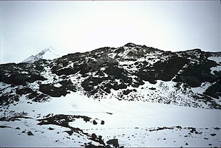
Frölich Peak is a peak 1,035 metres (3,400 ft) high, rising above Holst Point and dominating Chorul Peninsula at the head of Beascochea Bay on the west coast of Graham Land, Antarctica.
Depot Glacier is a well-defined valley glacier, flanked by lateral moraines, which terminates in a high vertical ice cliff at the head of Hope Bay, in the northeast end of the Antarctic Peninsula. It was discovered by the Swedish Antarctic Expedition, 1901–04, under Otto Nordenskiöld, and so named by him because, as seen from Antarctic Sound, it appeared to be a possible site for a depot.
Fivemile Rock is a small nunatak, 375 metres (1,230 ft) high, rising just northwest of Mineral Hill on Tabarin Peninsula, Antarctica. It was mapped in 1946 and again in 1956 by the Falkland Islands Dependencies Survey, and so named because the feature is located 5 nautical miles (9 km) from their station at Hope Bay on the route from there to Duse Bay.
Mondor Glacier is a glacier 3.5 nautical miles (6 km) long flowing southwest from the head of Depot Glacier into Duse Bay, Trinity Peninsula, Antarctica. This glacier and Depot Glacier together fill the depression between Hope Bay and Duse Bay which marks the northern limit of Tabarin Peninsula. The glacier was mapped in 1946 and 1956 by the Falkland Islands Dependencies Survey (FIDS), who named the feature in association with Tabarin Peninsula. "Operation Tabarin" was derived from the "Bal Tabarin" in Paris. In Recueil General des Oeuvres et Fantaisies de Tabarin, Tabarin was the buffoon who attracted the crowd to the booth where Mondor sold his quack medicines.

Gourdon Glacier is a glacier 4 nautical miles (7 km) long on the east side of James Ross Island, flowing southeast into Markham Bay between Saint Rita Point and Rabot Point. It has a conspicuous rock wall at its head. The glacier was first surveyed by the Swedish Antarctic Expedition under Otto Nordenskiöld, 1901–04, who named it for Ernest Gourdon, geologist and glaciologist of the French Antarctic Expedition, 1903–05.
Herbert Plateau is a portion of the central plateau of Graham Land, Antarctica, lying between Blériot Glacier and Drygalski Glacier. It borders Foster Plateau on the south and Detroit Plateau on the north. The feature was photographed by the Falkland Islands and Dependencies Aerial Survey Expedition in 1956–57 and mapped from these photos by the Falkland Islands Dependencies Survey (FIDS). It was named by the UK Antarctic Place-Names Committee in 1960 for Walter W. Herbert, a FIDS assistant surveyor at the Hope Bay station in 1956 and 1957.

Hyatt Cove is a cove at the west side of Sonia Point in Flandres Bay, on the northeast coast of Kiev Peninsula on Danco Coast of Graham Land, Antarctica. It was discovered and roughly mapped by the Belgian Antarctic Expedition, 1897–99. It was mapped in greater detail in the 1950s by Argentine, British and Chilean expeditions, and was named by the UK Antarctic Place-Names Committee (UK-APC) in 1986 after Raymond H. Hyatt of the Cartographic Section at the Foreign and Commonwealth Office, 1949–85, and head of section from 1970, with responsibility for preparing UK-APC maps.
Terrapin Hill is a rounded, reddish-colored hill, 545 m high, standing at the south end of The Naze, a peninsula of northern James Ross Island, close south of Trinity Peninsula. This area was first explored by the Swedish Antarctic Expedition, 1901–04, under Nordenskjold. Terrapin Hill was first charted by the Falkland Islands Dependencies Survey (FIDS), 1945, who in 1948 applied this name which is descriptive of its shape.
Kenney Glacier is a glacier 1 nmi long flowing northwest from The Pyramid and The Saddlestone into Depot Glacier, near the head of Hope Bay, Trinity Peninsula, Antarctica. It was mapped in 1945 and 1948 by the Falkland Islands Dependencies Survey (FIDS), was resurveyed by the FIDS in 1955, and was named for Richard Kenney, assistant surveyor at Hope Bay in 1954 and 1955, who made a detailed local survey of the area between Hope Bay and Duse Bay.
Mount Reece is a sharp, ice-free peak in the Antarctic Peninsula, 1,085 m, standing 4 nautical miles (7 km) west of Pitt Point and 3 km southeast of Skakavitsa Peak. It is the second highest point of Kondofrey Heights forming the south wall of Victory Glacier on the south side of Trinity Peninsula. Charted in 1945 by the Falkland Islands Dependencies Survey (FIDS) and named for Alan Reece, leader of the FIDS Deception Island base in 1945, and meteorologist and geologist at the Hope Bay base in 1946. Reece, a member of the Norwegian-British-Swedish Antarctic Expedition (NBSAE), 1949–52, was killed in an airplane accident in the Canadian Arctic in 1960.
View Point is 150m long eastern tip of a promontory, on Antarctica, forming the west side of the entrance to Duse Bay on the south coast of Trinity Peninsula, on the northern portion of the Antarctic Peninsula. Situated 6.79 km east of Skomlya Hill and 6.45 km southeast of Boil Point. Discovered by a party under J. Gunnar Andersson of the Swedish Antarctic Expedition, 1901-04. So named by the Falkland Islands Dependencies Survey (FIDS) following their survey of the area in 1945 because from this promontory, good panoramic photographs were obtained.
Last Hill is a small hill, 350 metres (1,150 ft) high, with a rock ridge at its crest and a cliff at its north side, standing 4 nautical miles (7 km) south-southwest of Hope Bay and 2 nautical miles (4 km) east of the northeast shore of Duse Bay on Tabarin Peninsula, Antarctica. It was probably seen by the Swedish Antarctic Expedition, 1901–04, under Otto Nordenskjöld, but was first charted in 1946 by the Falkland Islands Dependencies Survey, who so named it because it marks the last climb on the sledge route between Hope Bay and Duse Bay.
Leay Glacier is a glacier flowing northwest into Girard Bay to the west of Hotine Glacier, on Kiev Peninsula, on the west coast of Graham Land, Antarctica. It was first charted by the French Antarctic Expedition, 1908–10, under Jean-Baptiste Charcot, and was named by the UK Antarctic Place-Names Committee for Petra Searle of the Directorate of Overseas Surveys, who has contributed to the work of mapping the Antarctic Peninsula area.


