
Kolaghat is a census town in Kolaghat CD Block, Tamluk subdivision of the Purba Medinipur district in the state of West Bengal, India.
Putsuri is a village in Manteswar CD block in Kalna subdivision of Purba Bardhaman district in West Bengal, India.

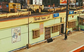
Bagnan is a census town in Bagnan I CD Block of Uluberia subdivision in Howrah district in the state of West Bengal, India.
Guma is a census town(CT) in the Habra II CD block of Barasat sadar subdivision in North 24 Parganas district in the Indian state of West Bengal.

Bhagabanpur I is a community development block that forms an administrative division in Egra subdivision of Purba Medinipur district in the Indian state of West Bengal.

Kotulpur is a community development block that forms an administrative division in the Bishnupur subdivision of the Bankura district in the Indian state of West Bengal.

Bagnan I is a community development block that forms an administrative division in Uluberia subdivision of Howrah district in the Indian state of West Bengal.

Jangipara is a community development block that forms an administrative division in Srirampore subdivision of Hooghly district in the Indian state of West Bengal.

Rajbalhat is a census town in Jangipara CD Block of Srirampore subdivision in Hooghly district in the Indian state of West Bengal. Rajbalhat can be reached conveniently by Bus from Kolkata, Haripal or Tarakeswar.

Patrasayer is a community development block that forms an administrative division in the Bishnupur subdivision of the Bankura district in the Indian state of West Bengal.

Joypur is a community development block that forms an administrative division in the Bishnupur subdivision of the Bankura district in the Indian state of West Bengal.

Bharatpur II is a community development block that forms an administrative division in the Kandi subdivision of Murshidabad district in the Indian state of West Bengal.
Bhagabanpur is a village, in Bhagabanpur I CD block in Egra subdivision of Purba Medinipur district in the state of West Bengal, India.

Goghat II is a community development block that forms an administrative division in Arambag subdivision of Hooghly district in the Indian state of West Bengal.
Jirat is a census town located in Hooghly District in the Indian State of West Bengal. It is the administrative headquarter of Balagarh Block. It is birthplace of the Dr. Gangaprasad Mukherjee, Writer Charuchandra Banerjee, Tollywood actor Anil Chatterjee, sonnet writer Debendranath Senthe and poet Mohitlal Majumdar etc.
Purandarpur is a village in Suri II CD block in Suri Sadar subdivision of Birbhum district in the state of West Bengal, India.
Banior is a village and gram panchayat in Nalhati I Block in Rampurhat subdivision of Birbhum District in the Indian state of West Bengal. The other regional name of Banior is Banur।
Majigram is a village in Mongalkote CD block in Katwa subdivision of Purba Bardhaman district in West Bengal, India.
Ajodhya is a village in the Bishnupur CD block in the Bishnupur subdivision of the Bankura district in the state of West Bengal, India.
Hadal Narayanpur are two adjacent villages considered as one in the Patrasayer CD block in the Bishnupur subdivision of the Bankura district in the state of West Bengal, India.


