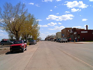
Carstairs is a town in central Alberta, Canada. It is located on Highway 2A, 241 kilometres (150 mi) south of the provincial capital, Edmonton, and 48 kilometres (30 mi) north of Calgary, the nearest major city. The closest neighbouring communities are the towns of Didsbury and Crossfield. Carstairs is located entirely within the rural Mountain View County.

Bentley, originally called Oxford, is a town in central, Alberta, Canada within Lacombe County. It is located on Highway 12, approximately 28 km (17 mi) northwest of Red Deer.

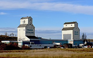
Crossfield is a town in southern Alberta, Canada within Rocky View County. It is located on Highway 2A 43 km (27 mi) north of the City of Calgary.
Cremona is a village in Southern Alberta, Canada. It is located north of Cochrane and west of Carstairs, along the Cowboy Trail. It is likely named for Cremona, Italy.
Dunmore is a hamlet in Alberta, Canada within Cypress County, located 2.6 kilometres (1.6 mi) southeast of Medicine Hat's city limits on Highway 1 and the Canadian Pacific Railway mainline. A portion of the hamlet is recognized as a designated place by Statistics Canada.
Benchlands is a hamlet in Alberta within the Municipal District of Bighorn No. 8. The Ghost River is located on the hamlet's south side, while Highway 40 borders the north side.
Bottrel is a hamlet in southern Alberta under the jurisdiction of Rocky View County.
Cochrane Lake is a hamlet in southern Alberta under the jurisdiction of Rocky View County. Statistics Canada also recognizes a smaller portion of the hamlet as a designated place under the name of Cochrane Lake Subdivision.
De Winton is a hamlet in southern Alberta, Canada within the Municipal District (M.D.) of Foothills No. 31. It is located just south of the City of Calgary and west of Highway 2A.

MacEwan Glen is a suburban neighbourhood in northwest Calgary, Alberta, Canada. The primarily low-density residential community is located directly north of Nose Hill Park and is bounded by Country Hills Boulevard to the north, 14 Street W to the east, Shaganappi Trail to the west, and Nose Hill to the south.
Byemoor is a hamlet in Alberta, Canada within the County of Stettler No. 6. It is located at the intersection of Highway 853 and Highway 589, approximately 70 kilometres (43 mi) southeast of Stettler and 80 kilometres (50 mi) northeast of Drumheller. It has an elevation of 845 metres (2,772 ft).

Kincora is a residential neighbourhood in the northwest quadrant of Calgary, Alberta, Canada. Located near the north edge of the city, it is bounded by the Sherwood community across Shaganappi Trail to the west, the Sage Hill community across 128 Avenue N.W. to the north, the Evanston community across Symons Valley Road to the east, and the Hidden Valley community across Stoney Trail to the south. It is one of five communities located within the Symons Valley area.
Sherwood is a residential neighbourhood in the northwest quadrant of Calgary, Alberta, Canada. Located near the north edge of the city, it is bounded by Sarcee Trail to the west, the Nolan Hill community across 128 Avenue N.W. to the north, the Kincora community across Shaganappi Trail to the east, and the Hamptons community across Stoney Trail to the south. It is one of five communities located within the Symons Valley area.
Ghost Lake is a summer village in Alberta, Canada. It is located between the Bow Valley Trail and the northern shore of the Ghost Lake Reservoir in the Municipal District of Bighorn No. 8, west of Cochrane.
Carvel is a hamlet in Alberta, Canada within Parkland County. It is located on Highway 770, approximately 35 kilometres (22 mi) west of Edmonton. The hamlet's name is derived from the novel Richard Carvel by the American writer Winston Churchill.
Stirlingville is an unincorporated community in central Alberta, Canada within Mountain View County. It is located on Highway 581, approximately 27 km (17 mi) east of the Town of Carstairs.
Burnstick Lake is a summer village in Alberta, Canada. It is located on the northern shore of Burnstick Lake, in Clearwater County, south of Caroline.

Cherhill is a hamlet in Alberta, Canada within Lac Ste. Anne County. It is located along Highway 43, approximately 35 kilometres (22 mi) east of Mayerthorpe and 82 kilometres (51 mi) northwest of Edmonton.
Alhambra is a hamlet in Alberta, Canada within Clearwater County. It is located close to the David Thompson Highway, east of Rocky Mountain House.
Buck Lake is a hamlet in central Alberta, Canada within the County of Wetaskiwin No. 10. It is located on Highway 13, approximately 109 kilometres (68 mi) southwest of Edmonton. It is located on the shore of Buck Lake (Alberta).


