The northern region of Europe has several definitions. A restrictive definition may describe Northern Europe as being roughly north of the southern coast of the Baltic Sea, which is about 54°N, or may be based on other geographical factors such as climate and ecology.

The Volcano Islands or Iwo Islands are a group of three Japanese-governed islands in Micronesia. They lie south of the Ogasawara Islands and belong to the municipality of Ogasawara, Tokyo, Tokyo Metropolis, Japan. The islands are all active volcanoes lying atop an island arc that stretches south to the Marianas. They have an area of 32.55 square kilometres (12.57 sq mi), and a population of 380. The island of Iwo Jima in the Volcano Islands lies about 1,240 kilometres (770 mi) southeast of Miyazaki.

Macaronesia is a collection of four volcanic archipelagos in the North Atlantic, off the coasts of Africa and Europe. Each archipelago is made up of a number of Atlantic oceanic islands, which are formed by seamounts on the ocean floor whose peaks have risen above the ocean's surface. Some of the Macaronesian islands belong to Portugal, some belong to Spain, and the rest belong to Cape Verde. Politically, the islands belonging to Portugal and Spain are part of the European Union. Geologically, Macaronesia is part of the African tectonic plate. Some of its islands – the Azores – are situated along the edge of that plate at the point where it abuts the Eurasian and North American plates.

Malesia is a biogeographical region straddling the Equator and the boundaries of the Indomalayan and Australasian realms, and also a phytogeographical floristic region in the Paleotropical Kingdom. It has been given different definitions. The World Geographical Scheme for Recording Plant Distributions split off Papuasia in its 2001 version.

The Nanpō Islands is a collective term for the groups of islands that are located to the south of the Japanese archipelago in Micronesia. They extend from the Izu Peninsula west of Tokyo Bay southward for about 1,200 km (750 mi), to within 500 km (310 mi) of the Mariana Islands. The Nanpō Islands are all administered by Tokyo Metropolis.

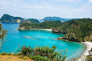
The Ogasawara subtropical moist forests is a terrestrial ecoregion which encompasses the Ogasawara Archipelago of Japan. The Ogasawara Archipelago lies in the Pacific Ocean south of Honshu, Japan's largest island, and north of the Marianas Islands. The ecoregion includes the Bonin Islands and Volcano Islands chains. The islands are volcanic in origin, and have never been linked to a continent. They are home to distinct plants and animals including many endemic species.

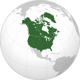
Northern America is the northernmost subregion of North America. The boundaries may be drawn slightly differently. In one definition, it lies directly north of Middle America. Northern America's land frontier with the rest of North America then coincides with the Mexico–United States border. Geopolitically, according to the United Nations' scheme of geographical regions and subregions, Northern America consists of Bermuda, Canada, Greenland, Saint Pierre and Miquelon and the United States.
Alsophila buennemeijeri, synonym Cyathea buennemeijeri, is a species of tree fern endemic to the Natuna Islands in Indonesia. In the World Geographical Scheme for Recording Plant Distributions, these islands are treated as part of Kalimantan. A. buennemeijeri grows in open scrub at an altitude of about 600 m. This rare species is known only from the summits of two low hills. The trunk is erect and may be 5 m tall or more. Fronds are bi- or tripinnate and 2–3 m long. The stipe is dark and covered with spines at the base, as well as numerous scattered dark scales with pale, fragile edges. Sori occur near the midvein of fertile pinnules and are covered by thin, fragile indusia that resemble cups in shape.
The World Geographical Scheme for Recording Plant Distributions (WGSRPD) is a biogeographical system developed by the international Biodiversity Information Standards (TDWG) organization, formerly the International Working Group on Taxonomic Databases. The WGSRPD standards, like other standards for data fields in botanical databases, were developed to promote "the wider and more effective dissemination of information about the world's heritage of biological organisms for the benefit of the world at large". The system provides clear definitions and codes for recording plant distributions at four scales or levels, from "botanical continents" down to parts of large countries. Current users of the system include the International Union for Conservation of Nature (IUCN), the Germplasm Resources Information Network (GRIN), and the World Checklist of Selected Plant Families (WCSP).

Clinostigma is a genus of flowering plant in the Arecaceae (palm) family, native to various islands in the western Pacific. It contains the following species:

Ochrosia is a genus of flowering plants, first described in 1789. It is in the family Apocynaceae, native to Southeast Asia, Australia, and various islands of the Indian and Pacific Oceans.
- Ochrosia ackeringae(Teijsm. & Binn.) Miq. – Indonesia, Philippines, Papuasia, Christmas Island
- Ochrosia acuminataTrimen ex Valeton - Sulawesi
- Ochrosia alyxioidesGuillaumin - Vanuatu
- Ochrosia apoensisElmer - Luzon, Mindanao
- Ochrosia balansae(Guillaumin) Baill. ex Guillaumin - New Caledonia
- Ochrosia basistaminaHendrian - Sulawesi
- Ochrosia bodenheimarumGuillaumin - Vallée de la Toutouta in New Caledonia
- Ochrosia borbonicaJ.F.Gmel. – Mauritius + Réunion; naturalized in Guangdong
- Ochrosia brevitubaBoiteau - New Caledonia
- Ochrosia brownii(Fosberg & Sachet) Lorence & Butaud - Nuku Hiva in Marquesas
- Ochrosia citrodoraK.Schum. & Lauterb. - New Guinea
- Ochrosia coccinea(Teijsm. & Binn.) Miq. - Maluku, Sulawesi, New Guinea, Solomon Islands; naturalized in Guangdong
- Ochrosia comptaK.Schum., Hōlei – Hawaii
- Ochrosia ellipticaLabill. – Lord Howe Island, Queensland, New Caledonia, Vanuatu, Nauru; naturalized in Guangdong + Taiwan
- Ochrosia fatuhivensisFosberg & Sachet – Fatu Hiva in Marquesas but extinct
- Ochrosia ficifolia(S.Moore) Markgr. - New Guinea
- Ochrosia glomerata(Blume) F.Muell. - Borneo, Sulawesi, Philippines, Maluku, New Guinea, Solomon Islands
- Ochrosia grandifloraBoit. – New Caledonia
- Ochrosia haleakalaeH.St.John, Hōlei – Maui + island of Hawaiʻi in Hawaiian Islands
- Ochrosia hexandraKoidz. - Kazan-retto
- Ochrosia inventorumL.Allorge – New Caledonia
- Ochrosia iwasakiana(Koidz.) Koidz. ex Masam.
- Ochrosia kauaiensisH.St.John, Hōlei – Kauaʻi in Hawaiian Islands
- †Ochrosia kilaueaensisH.St.John, Hōlei – island of Hawaiʻi in Hawaiian Islands, but extinct
- Ochrosia kilneriF.Muell. - Queensland
- Ochrosia lifuanaGuillaumin - Loyalty Islands + Isle of Pines in New Caledonia
- Ochrosia mariannensisA.DC. - Mariana Islands
- Ochrosia mianaBaill. ex Guillaumin – New Caledonia
- Ochrosia minima(Markgr.) Fosberg & Boiteau – Queensland, Papua New Guinea
- Ochrosia moorei(F.Muell.) F.Muell. ex Benth. – Queensland, New South Wales
- Ochrosia mulsantiiMontrouz. – New Caledonia
- Ochrosia nakaiana(Koidz.) Koidz. ex H.Hara - Ogasawara-shoto
- Ochrosia newellianaF.M.Bailey – Queensland
- Ochrosia novocaledonicaDäniker – New Caledonia
- Ochrosia oppositifolia(Lam.) K.Schum. - Seychelles, Chagos Islands, Sri Lanka, Maldive Islands, Andaman & Nicobar Islands, Thailand, Vietnam, W Malaysia, Indonesia, Papuasia, Samoa, Tonga, Tuvalu, Vanuatu, Wallis & Futuna, French Polynesia, Line Islands, Micronesia
- Ochrosia poweriF.M.Bailey - Queensland, New South Wales
- Ochrosia sciadophyllaMarkgr - Bismarck Archipelago, Solomon Islands
- Ochrosia sevenetiiBoiteau - New Guinea
- Ochrosia silvaticaDäniker – New Caledonia
- Ochrosia solomonensis(Merr. & L.M.Perry) Fosberg & Boiteau - Solomon Islands
- Ochrosia syncarpaMarkgr. - Bali, Lombok, Timor, Flores
- Ochrosia tahitensisLaness. ex Pichon – Tahiti
- Ochrosia tenimberensisMarkgr. - Tanimbar Islands
- Ochrosia nukuhivensisFosberg & Sachet = Rauvolfia nukuhivensis(Fosberg & Sachet) Lorence & Butaud
- Ochrosia sandwicensisA.DC. = Rauvolfia sandwicensisA.DC.
- Ochrosia tuberculata(Vahl) Pichon = Rauvolfia sandwicensisA.DC.

Ogasawara Subprefecture is a subprefecture of Tokyo Metropolis, Japan. The subprefecture covers the Ogasawara Archipelago and is coterminous with the village of Ogasawara. The prefectural government maintains a main office on Chichijima and a branch office on Hahajima.

Allium thunbergii, Thunberg's chive or Thunberg garlic, is an East Asian species of wild onion native to Japan, Korea, and China. It grows at elevations up to 3000 m. The Flora of China recognizes A. tunbergii and A. stenodon as separate species, but more recent sources combine the two.

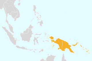
Papuasia is a Level 2 botanical region defined in the World Geographical Scheme for Recording Plant Distributions (WGSRPD). It lies in the southwestern Pacific Ocean, in the Melanesia ecoregion of Oceania and Tropical Asia.

The Cape Provinces of South Africa is a biogeographical area used in the World Geographical Scheme for Recording Plant Distributions (WGSRPD). It is part of the WGSRPD region 27 Southern Africa. The area has the code "CPP". It includes the South African provinces of the Eastern Cape, the Northern Cape and the Western Cape, together making up most of the former Cape Province.

The Northern Provinces of South Africa is a biogeographical area used in the World Geographical Scheme for Recording Plant Distributions (WGSRPD). It is part of the WGSRPD region 27 Southern Africa. The area has the code "TVL". It includes the South African provinces of Gauteng, Mpumalanga, Limpopo and North West, together making up an area slightly larger than the former Transvaal Province.
The Central American Pacific Islands is a biogeographical area used in the World Geographical Scheme for Recording Plant Distributions. It has the Level 3 code "CPI". It consists of a number of islands off the western coast of Central America in the Pacific Ocean: Clipperton Island, Cocos Island and Malpelo Island.
Richard Kenneth "Dick" Brummitt was a British botanist.

The Bonin Islands are an archipelago of over 30 subtropical and tropical islands, some 1,000 kilometres directly south of Tokyo, Japan and 1,000 miles northwest of Guam.


