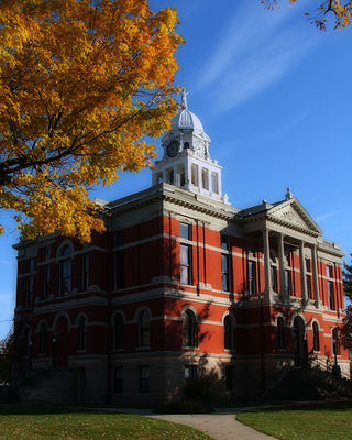
Eaton County is a county in the U.S. state of Michigan. As of the 2020 United States Census, the population was 109,175. The county seat is Charlotte. The county was organized in 1837 and was named for John Eaton, who was Secretary of War under U.S. President Andrew Jackson, making it one of Michigan's Cabinet counties. Eaton County is included in the Lansing-East Lansing, Metropolitan Statistical area in Central Michigan.
Carmel Township is a civil township of Eaton County in the U.S. state of Michigan. The population was 2,855 as of the 2010 census.

Eaton Rapids is a city in Eaton County in the U.S. state of Michigan. The population was 5,214 at the 2010 census.
Oneida Charter Township is a charter township of Eaton County in the U.S. state of Michigan. The population was 3,865 at the 2010 United States Census.
Vermontville Township is a civil township of Eaton County in the U.S. state of Michigan. The population was 2,100 at the 2000 census.
Windsor Charter Township is a charter township of Eaton County in the U.S. state of Michigan. It was organized as Windsor Township on March 16, 1842. The population was 6,838 at the 2010 census, down from 7,340 at the 2000 census.

Rives Township is a civil township of Jackson County in the U.S. state of Michigan. The population was 4,683 at the 2010 census.

Tompkins Township is a civil township of Jackson County in the U.S. state of Michigan. The population was 2,671 at the 2010 census.

Spencer Township is a civil township of Kent County in the U.S. state of Michigan. The population was 3,960 at the 2010 census.
Weare Township is a civil township of Oceana County in the U.S. state of Michigan. The population was 1,261 at the 2000 census.

Clam Lake Township is a civil township of Wexford County in the U.S. state of Michigan. The population was 2,467 at the 2010 census.
Watab Township is an urban township in Benton County, Minnesota, United States, located north of the mouth of Watab Creek on the opposite side of the Mississippi River in Sartell. The population was 3,093 as of the 2010 census.
Springfield Township is a township in Cottonwood County, Minnesota, United States. The population was 120 at the 2010 census.
Grand Rapids Township was a township in Itasca County, Minnesota, United States. The population was 11,747 at the 2000 census. By the time of the 2010 census, the area of the former township had been divided between the cities of Grand Rapids, La Prairie, and Coleraine.
Scandia Valley Township is a township in Morrison County, Minnesota, United States. The population was 1,074 at the 2000 census. According to the U. S. Census Bureau it was merged with Rail Prairie Township on 31 December 2002. The larger township reported a population of 1,191 inhabitants in the 2010 census.

Mazeppa Township is a township in Wabasha County, Minnesota, United States. The population was 743 at the 2000 census. Mazeppa Township was organized in 1858 and named in honor of Ivan Mazepa, a 17th-century Cossack chief popularized by Lord Byron's poem "Mazeppa".

Elmhurst Township is a township in Lackawanna County, Pennsylvania, United States. The population was 836 at the 2020 census.

Porter Township is a township in Schuylkill County, Pennsylvania, United States. The population was 2,157 at the 2020 census.

Jackson Township is a township in Tioga County, Pennsylvania, United States. The population was 1,880 at the 2020 census.
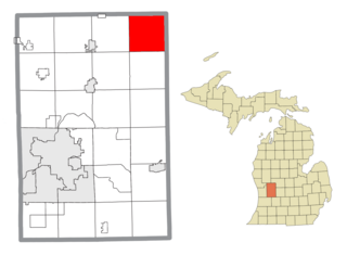
Brookfield Township is a civil township of Eaton County in the U.S. state of Michigan. As of the 2010 census, the township population was 1,537.


