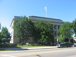
Preble County is a county located in the U.S. state of Ohio. As of the 2020 census, the population was 40,999, down 3.0% from the 2010 census population of 42,270. Its county seat is Eaton. The county was formed on February 15, 1808, from portions of Butler and Montgomery Counties. It is named for Edward Preble, a naval officer who fought in the American Revolutionary War and against the Barbary Pirates.

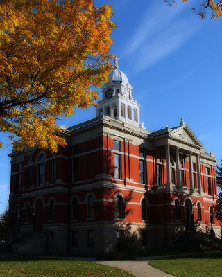
Eaton County is a county in the U.S. state of Michigan. As of the 2020 United States Census, the population was 109,175. The county seat is Charlotte. The county was organized in 1837 and was named for John Eaton, who was Secretary of War under U.S. President Andrew Jackson, making it one of Michigan's Cabinet counties. Eaton County is included in the Lansing-East Lansing, Metropolitan Statistical area in Central Michigan.
Kinderhook Township is a civil township of Branch County in the U.S. state of Michigan. As of the 2010 census, the township population was 1,497.
Carmel Township is a civil township of Eaton County in the U.S. state of Michigan. The population was 2,855 as of the 2010 census.
Chester Township is a civil township of Eaton County in the U.S. state of Michigan. The population was 1,778 at the 2000 United States Census.
Delta Charter Township, officially known as the Charter Township of Delta and commonly known as simply Delta Township, is a charter township of Eaton County in the U.S. state of Michigan. As of the 2010 census, it had a population of 32,408 making it the most populous municipality in Eaton County. The township operates its own fire department, but contracts with the Eaton County Sheriff Department for police protection. The township is a major community in metropolitan Lansing.
Eaton Township is a civil township of Eaton County in the U.S. state of Michigan. The population was 4,278 at the 2000 United States Census.

Mulliken is a village in Eaton County in the U.S. state of Michigan. The population was 553 at the 2010 census. The village is within Roxand Township.
Sunfield Township is a civil township of Eaton County in the U.S. state of Michigan. The population was 1,997 at the 2010 census, down from 2,177 at the 2000 census.
Vermontville Township is a civil township of Eaton County in the U.S. state of Michigan. The population was 2,100 at the 2000 census.
Walton Township is a civil township of Eaton County in the U.S. state of Michigan. The population was 2,011 at the 2000 census.

Rives Township is a civil township of Jackson County in the U.S. state of Michigan. The population was 4,683 at the 2010 census.
Ravenna Township is a civil township of Muskegon County in the U.S. state of Michigan. As of the 2010 census, the township population was 2,905. The Village of Ravenna is located within the township.

Woodhull Township is a civil township of Shiawassee County in the U.S. state of Michigan. The population was 3,810 at the 2010 census.
Sharon Township is a township in Le Sueur County, Minnesota, United States. The population was 658 at the 2000 census.

Elmira Township is a civil township of Otsego County in the U.S. state of Michigan. The population was 1,687 at the 2010 census.

Barry Township is a township in Schuylkill County, Pennsylvania. Formed in 1822, it is named for American Revolutionary War Commander John Barry and was formed from parts of Norwegian and Schuylkill Townships.

Foster Township is a township in Schuylkill County, Pennsylvania, United States. The population was 242 at the 2020 census.

Loveland Park is a census-designated place (CDP) located in Symmes Township, Hamilton County and Deerfield Township, Warren County, in the southwestern part of the U.S. state of Ohio. The CDP is named after the city of Loveland. The population was 1,523 at the 2010 census.
Brookfield Township is a civil township of Eaton County in the U.S. state of Michigan. As of the 2010 census, the township population was 1,537.


