Edaga Arbi Glacials

Last updated
Edaga Arbi Glacials
Stratigraphic range: Late Carboniferous
Edaga Arbi glacials.jpg
Roadcut between Werqamba and Hawzien, northeast of Dogu’a Tembien
Type Geological formation
Underlies Adigrat Sandstone, coeval with Enticho Sandstone
Overlies Precambrian basement
Thickness200 m (660 ft)
Lithology
Primary Tillite, Mudstone
Other Dropstones, Sandstone
Location
Coordinates 14°12′13″N39°15′18″E / 14.2037°N 39.255°E / 14.2037; 39.255
Approximate paleocoordinates 0°N0°E / 0°N 0°E / 0; 0
Region Tigray
CountryFlag of Ethiopia.svg  Ethiopia Flag of Eritrea.svg  Eritrea
Extentcentral-south Eritrea, northeast Tigray
Type section
Named forTown of Idaga Arbi
Named byD.B. Dow
Ethiopia relief location map.jpg
Blue pog.svg
Edaga Arbi Glacials (Ethiopia)

The Edaga Arbi Glacials are a Palaeozoic geological formation in Tigray (northern Ethiopia) and in Eritrea. The matrix is composed of grey, black and purple clays (locally silt), that contains rock fragments up to 6 metres across. Pollen dating yields a Late Carboniferous (~323 million years or Ma) to Early Permian (~295 Ma) age. [1]

Contents

Name and definition

The name was coined by geologist D.B.Dow and colleagues [2] They referred to the wide outcrops surrounding the town of Idaga Arbi. So far the nomenclature has not been proposed for recognition to the International Commission on Stratigraphy.

Stratigraphic context

The Edaga Arbi Glacials fill the bottom of north-south oriented valleys, that were carved by glaciers, into the Precambrian basement and in Early Palaeozoic sediments. These valleys were often several kilometres wide and tens of meters deep. [1] Indeed, northern Ethiopia was glaciated in the Early Palaeozoic (Late Ordovician; ~445 Ma), and in the Late Palaeozoic (Carboniferous-Permian; ~300 Ma). This has led to the presence of glacial sediments as well as erosional landforms in eastern Tigray. Over the last 30 million years the Ethiopian Highlands have been uplifted and the Edaga Arbi Glacials have been exposed as a result of the erosion of overlying rocks. This is one of the few places in the world where the Palaeozoic glacial deposits are well exposed and can be easily accessed. [3]

Environment

These glaciogenic sediments were deposited directly by the glacier as moraines. They have been consolidated, what allows to name them as tillites. As usual, these moraines and tillites are composed of large rock fragments in a fine earth mass. [3] Mudstones are predominant. Often, they hold dropstones, what indicates that the sediment was often deposited in fjords or pro-glacial lakes. The tillites have often been deformed by (underwater) slumping. [4]

Lithology

The Edaga Arbi Glacials may reach a thickness of 200 metres. Similar to most other tillites, they hold many different types of sediment. Generally, the sediments are rich in mud (clay and silt), in contrast to the Enticho Sandstone fluvioglacial deposits. Basal till that was deposited directly under the ice holds many rock fragments. In other places, the settling in water of suspended fine-grained sediment resulted in massive stratified mudstones. Still elsewhere, the underwater movement of sand by gravity resulted in sandstone lenses. As they were formed under water, the mudstone and the sandstone contain (sometimes very large) dropstones, deposited from melting ice rafts. [4]

Life

Pollen and spores have been found in the Edaga Arbi Glacials. Their age confirms that the Edaga Arbi Glacials date back to the Late Palaeozoic ice age. [5]

Geographical extent

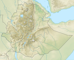
The deposits are exposed locally as south as Samre and Abergelle, and then further north at the margins of the Dogu’a Tembien massif. [3] They are widespread around Idaga Arbi and further north into Eritrea.

Exposed glacial geomorphology

The glacial erosion in northern Ethiopia reshaped the topography. Later on this topography was covered by more recent sediments. In places where these sediments were again eroded, the ancient landforms have become visible. They are sometimes millimeters and sometimes kilometres wide. These ancient landforms are mainly visible on the exposed older Precambrian basement bedrock surface. [3] For instance, the larger valleys correspond to the path that the glaciers followed. More in detail, the polished bedrock surfaces display striations and other small depressions and fractures. The fine particles within glaciers polished the bedrock, while striations are scratch-marks created when larger rock fragments were dragged over the pre-existing rock surface by glaciers. The shape of the striations evidences that the ice flow direction was towards the north. Glacial grooves within the Edaga Arbi Glacials were probably created by flowing meltwater under glaciers. [6]

Related Research Articles

<span class="mw-page-title-main">Till</span> Unsorted glacial sediment

Till or glacial till is unsorted glacial sediment.

<span class="mw-page-title-main">Tigray Region</span> Regional state in northern Ethiopia

The Tigray Region, officially the Tigray National Regional State, is the northernmost regional state in Ethiopia. The Tigray Region is the homeland of the Tigrayan (Tegaru), Saho and Irob people. Its capital and largest city is Mekelle. Tigray is the fifth-largest by area, the fifth-most populous, and the fifth-most densely populated of the 11 regional states.

<span class="mw-page-title-main">Glacial landform</span> Landform created by the action of glaciers

Glacial landforms are landforms created by the action of glaciers. Most of today's glacial landforms were created by the movement of large ice sheets during the Quaternary glaciations. Some areas, like Fennoscandia and the southern Andes, have extensive occurrences of glacial landforms; other areas, such as the Sahara, display rare and very old fossil glacial landforms.

The Permo-Carboniferous is the time period including the latter parts of the Carboniferous and early part of the Permian period. Permo-Carboniferous rocks are in places not differentiated because of the presence of transitional fossils, and also where no conspicuous stratigraphic break is present.

<span class="mw-page-title-main">Glacial striation</span> Bedrock abrasions from glacier movement

Glacial striations or striae are scratches or gouges cut into bedrock by glacial abrasion. These scratches and gouges were first recognized as the result of a moving glacier in the late 18th century when Swiss alpinists first associated them with moving glaciers. They also noted that if they were visible today that the glaciers must also be receding.

<span class="mw-page-title-main">Boulder clay</span> Geological deposit of clay

Boulder clay is an unsorted agglomeration of clastic sediment that is unstratified and structureless and contains gravel of various sizes, shapes, and compositions distributed at random in a fine-grained matrix. The fine-grained matrix consists of stiff, hard, pulverized clay or rock flour. Boulder clay is also known as either known as drift clay; till; unstratified drift, geschiebelehm (German); argile á blocaux (French); and keileem (Dutch).

<span class="mw-page-title-main">Plucking (glaciation)</span> Glacial erosion of bedrock

Plucking, also referred to as quarrying, is a glacial phenomenon that is responsible for the weathering and erosion of pieces of bedrock, especially large "joint blocks". This occurs in a type of glacier called a "valley glacier". As a glacier moves down a valley, friction causes the basal ice of the glacier to melt and infiltrate joints (cracks) in the bedrock. The freezing and thawing action of the ice enlarges, widens, or causes further cracks in the bedrock as it changes volume across the ice/water phase transition, gradually loosening the rock between the joints. This produces large pieces of rock called joint blocks. Eventually these joint blocks come loose and become trapped in the glacier.

<span class="mw-page-title-main">Late Paleozoic icehouse</span> Ice age

The late Paleozoic icehouse, also known as the Late Paleozoic Ice Age (LPIA) and formerly known as the Karoo ice age, was an ice age that began in the Late Devonian and ended in the Late Permian, occurring from 360 to 255 million years ago (Mya), and large land-based ice-sheets were then present on Earth's surface. It was the second major icehouse period of the Phanerozoic. It is named after the tillite found in the Karoo Basin of western South Africa, where evidence for the ice age was first clearly identified in the 19th century.

<span class="mw-page-title-main">Abrasion (geology)</span> Process of erosion

Abrasion is a process of erosion which occurs when material being transported wears away at a surface over time. It is the process of friction caused by scuffing, scratching, wearing down, marring, and rubbing away of materials. The intensity of abrasion depends on the hardness, concentration, velocity and mass of the moving particles. Abrasion generally occurs in four ways: glaciation slowly grinds rocks picked up by ice against rock surfaces; solid objects transported in river channels make abrasive surface contact with the bed and walls; objects transported in waves breaking on coastlines; and by wind transporting sand or small stones against surface rocks.

<span class="mw-page-title-main">Geology of England</span> Overview of the geology of England

The geology of England is mainly sedimentary. The youngest rocks are in the south east around London, progressing in age in a north westerly direction. The Tees–Exe line marks the division between younger, softer and low-lying rocks in the south east and the generally older and harder rocks of the north and west which give rise to higher relief in those regions. The geology of England is recognisable in the landscape of its counties, the building materials of its towns and its regional extractive industries.

<span class="mw-page-title-main">Geology of Yorkshire</span>

The Geology of Yorkshire in northern England shows a very close relationship between the major topographical areas and the geological period in which their rocks were formed. The rocks of the Pennine chain of hills in the west are of Carboniferous origin whilst those of the central vale are Permo-Triassic. The North York Moors in the north-east of the county are Jurassic in age while the Yorkshire Wolds to the south east are Cretaceous chalk uplands. The plain of Holderness and the Humberhead levels both owe their present form to the Quaternary ice ages. The strata become gradually younger from west to east.

<span class="mw-page-title-main">Geology of Ethiopia</span>

The geology of Ethiopia includes rocks of the Neoproterozoic East African Orogeny, Jurassic marine sediments and Quaternary rift-related volcanism. Events that greatly shaped Ethiopian geology is the assembly and break-up of Gondwana and the present-day rifting of Africa.

<span class="mw-page-title-main">Enticho Sandstone</span> Geological formation in Ethiopia

The Enticho Sandstone is a geological formation in north Ethiopia. It forms the lowermost sedimentary rock formation in the region and lies directly on the basement rocks. Enticho Sandstone consists of arenite that is rich in quartz. The formation has a maximum thickness of 200 metres. Locally, its upper part is coeval with the Edaga Arbi Glacials. The Enticho Sandstone has been deposited during the Ordovician, as evidenced by impressions of organisms.

<span class="mw-page-title-main">Adigrat Sandstone</span> Sandstone formation between Ethiopia and Eritrea border

The Adigrat Sandstone formation in north Ethiopia, in a wide array of reddish colours, comprises sandstones with coarse to fine grains, and locally conglomerates, silt- and claystones. Given the many lateritic palaeosols and locally fossil wood fragments, the formation is interpreted as a deposit in estuarine, lacustrine-deltaic or continental environments. The upper limit of Adigrat Sandstone is of Middle-Late Jurassic age whereas the lower boundary is Triassic. There are numerous rock-hewn churches in this formation.

The geology of national parks in Britain strongly influences the landscape character of each of the fifteen such areas which have been designated. There are ten national parks in England, three in Wales and two in Scotland. Ten of these were established in England and Wales in the 1950s under the provisions of the National Parks and Access to the Countryside Act 1949. With one exception, all of these first ten, together with the two Scottish parks were centred on upland or coastal areas formed from Palaeozoic rocks. The exception is the North York Moors National Park which is formed from sedimentary rocks of Jurassic age.

<span class="mw-page-title-main">May Qoqah</span> River in the Tembien highlands of Ethiopia

May Qoqah is a river of the Nile basin. Rising on the Ts’ats’en plateau of Dogu’a Tembien in northern Ethiopia, it flows northward to empty finally in Giba and Tekezé River.

<span class="mw-page-title-main">May Selelo</span> River in the Tembien highlands of Ethiopia

May Selelo is a river of the Nile basin. Rising in the mountains of Dogu’a Tembien in northern Ethiopia, it flows southward to empty in Giba and Tekezé River.

<span class="mw-page-title-main">Zikuli River</span> River in the Tembien highlands of Ethiopia

Zikuli, also called Gereb Awhi or Mennewe River, is a river of the Nile basin. Rising in the mountains of Dogu’a Tembien in northern Ethiopia, it flows southward to empty finally in Giba and Tekezé River.

<span class="mw-page-title-main">Tanqwa</span> River in the Tigray highlands of Ethiopia

Tanqwa is a river of northern Ethiopia. Rising in the mountains of Dogu’a Tembien, it flows westward to Giba River which empties finally in the Tekezé River.

References

  1. 1 2 Nyssen, Jan; Jacob, Miro; Frankl, Amaury, eds. (2019). Geo-trekking in Ethiopia's Tropical Mountains. p. 38. ISBN   978-3-030-04954-6.
  2. Palaeozoic glacial rocks recently discovered in northern Ethiopia
  3. 1 2 3 4 Bussert, R. (2019). Evidence of the 'Snowball Earth' and Other Ancient Glaciations from the Border Areas of the Dogu'a Tembien District. GeoGuide. Cham, Switzerland: SpringerNature. pp. 91–105. doi:10.1007/978-3-030-04955-3_6. ISBN   978-3-030-04954-6. S2CID   199106886.
  4. 1 2 Bussert, R. (2014). "Depositional environments during the Late Palaeozoic ice age (LPIA) in northern Ethiopia, NE Africa". J Afr Earth Sci. 99: 386–407. Bibcode:2014JAfES..99..386B. doi:10.1016/j.jafrearsci.2014.04.005.
  5. Bussert, R.; Schrank, E. (2007). "Palynological evidence for a latest Carboniferous-Early Permian glaciation in Northern Ethiopia". Journal of African Earth Sciences. 49 (4–5): 201–210. Bibcode:2007JAfES..49..201B. doi:10.1016/j.jafrearsci.2007.09.003.
  6. Bussert, R (2010). "Exhumed erosional landforms of the Late Palaeozoic glaciation in northern Ethiopia: Indicators of ice-flow direction, palaeolandscape and regional ice dynamics". Gondwana Res. 18 (2–3): 356–369. Bibcode:2010GondR..18..356B. doi:10.1016/j.gr.2009.10.009.