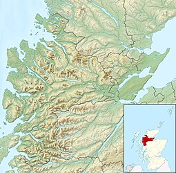
Sutherland is a historic county, registration county and lieutenancy area in the Highlands of Scotland. Its county town is Dornoch. Sutherland borders Caithness and Moray Firth to the east, Ross-shire and Cromartyshire to the south and the Atlantic to the north and west. Like its southern neighbour Ross-shire, Sutherland has some of the most dramatic scenery in Europe, especially on its western fringe where the mountains meet the sea. These include high sea cliffs and very old mountains composed of Precambrian and Cambrian rocks.

The Slate Islands are an island group in the Inner Hebrides, lying immediately off the west coast of Scotland, north of Jura and southwest of Oban. The main islands are Seil, Easdale, Luing, Shuna, Torsa and Belnahua. Scarba and Kerrera, which lie nearby are not usually included.

Erraid is a tidal island approximately one mile square located in the Inner Hebrides of Scotland. It lies west of Mull and southeast of Iona. The island receives about 1,000 millimetres (40 in) of rain and 1,350 hours of sunshine annually, making it one of the driest and sunniest places on the western seaboard of Scotland. It is attended by numerous uninhabited small islets, the largest being Eilean Dubh, Eilean nam Muc, Eilean Chalmain, Eilean Ghomain and Eilean na Seamair.

This particular Eilean Dubh is sometimes known as Glen Caladh Island and lies just off the Cowal peninsula in the Kyles of Bute. The island is around 0.3 kilometres at its longest length and rises to a height of 19 metres above sea level. It is almost entirely covered by woodland.
Eilean Dubh Mòr is an uninhabited island in the Inner Hebrides of Scotland. It lies at the mouth of the Firth of Lorn, between the islands of Lunga and Garbh Eileach. The area of the island has been measured variously—at 50 hectares by Livingstone and 65 hectares by Haswell-Smith, the latter including the nearby islet of Eilean Dubh Beag, which is joined to Eilean Dubh Mòr at low tide.
Ross-shire is a historic county in the Scottish Highlands. The county borders Sutherland to the north and Inverness-shire to the south, as well as having a complex border with Cromartyshire – a county consisting of numerous enclaves or exclaves scattered throughout Ross-shire's territory. Ross-shire includes most of Ross along with Lewis in the Outer Hebrides. Dingwall is the traditional county town. The area of Ross-shire is based on that of the historic province of Ross, but with the exclusion of the many enclaves that form Cromartyshire.
Lunga is one of the Slate Islands in the Firth of Lorn in Argyll and Bute, Scotland. The "Grey Dog" tidal race, which runs in the sea channel to the south, reaches 8 knots (15 km/h) in full flood. The name "Lunga" is derived from the Old Norse for "isle of the longships', but almost all other place names are Gaelic in origin.
Gunna is an island in the Inner Hebrides of Scotland.
Stuley is an island lying to the east of South Uist in the Outer Hebrides, Scotland. It lies off the section of coastline between Loch Eynort and Loch Boisdale. It is 45 hectares (0.17 sq mi) and 40 metres (131 ft) at its highest point.

Eilean Mòr is the largest of the Crowlin Islands in the Inner Sound off the Isle of Skye, Scotland.

Bernera Island or simply Bernera is a tidal island off Lismore, in Argyll, Scotland.

Fraoch-eilean is a small island with an uncertain population north of Benbecula in the Outer Hebrides of Scotland. It is about 55 hectares in extent and the highest point is 11 metres (36 ft). Its name derives from the Gaelic for "heather island".

Eilean Horrisdale is an uninhabited island in Loch Gairloch in Wester Ross, Scotland.
Eilean Hoan is an island in Loch Eriboll in Sutherland on the north coast of Scotland. It is about 28 hectares in extent and the highest point is 25 metres (82 ft) above sea level. Its name is of Gaelic and Old Norse derivation and means "haven island".
Eilean Mòr is an uninhabited island in Loch Dunvegan in north west Skye, Scotland. At low water the island is connected to Eilean Dubh.

The Black Water is a river in the Highlands of Scotland. It begins at the confluence of the Glascarnoch River with the Abhainn Srath a' Bhàthaich, near where it is crossed by the Black Bridge, carrying the A835 road. It flows in a south-easterly direction past the village of Garve, then passing through Loch Garve and Loch na Cròic, and around Eilean nan Daraich. It flows over Rogie Falls, then past Contin, around Contin Island, before flowing into the River Conon near Moy Bridge.

Eilean Meadhonach is the second largest of the Crowlin Islands, located in the Inner Sound off the island of Skye, Scotland.

Loch Sween is a sea loch located near Lochgilphead, Argyll and Bute, Scotland. Castle Sween is located on the southern shore towards the seaward end of the loch. The village of Tayvallich, a favoured haven for water craft as it sits at the head of sheltered Loch a' Bhealaich, lies on the northern shore.
This page is based on this
Wikipedia article Text is available under the
CC BY-SA 4.0 license; additional terms may apply.
Images, videos and audio are available under their respective licenses.